Bellevue, Nebraska
Bellevue, Nebraska | |
|---|---|
City | |
 Aerial view of Offutt Air Force Base with Bellevue in foreground | |
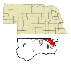 Location of Bellevue within Nebraska and Sarpy County | |
| Coordinates: 41°9′31″N 95°56′3″W / 41.15861°N 95.93417°WCoordinates: 41°9′31″N 95°56′3″W / 41.15861°N 95.93417°W | |
| Country | United States |
| State | Nebraska |
| County | Sarpy |
| Area | |
| • Total | 16.73 sq mi (43.33 km2) |
| • Land | 16.57 sq mi (42.92 km2) |
| • Water | 0.16 sq mi (0.41 km2) |
| Elevation | 1,033 ft (315 m) |
| Population | |
| • Total | 64,176 |
| • Estimate (2019)[4] | 53,544 |
| • Density | 3,873.02/sq mi (1,494.57/km2) |
| Time zone | UTC−6 (Central (CST)) |
| • Summer (DST) | UTC−5 (CDT) |
| Area code(s) | 402/531 |
| FIPS code | 31-03950 |
| GNIS feature ID | 0827304[3] |
| Website | http://www.bellevue.net/ |

Bellevue (French for "beautiful view"; previously named Belleview[5]) is a suburban city in Sarpy County, Nebraska, United States. It is part of the Omaha-Council Bluffs metropolitan area, and had a population of 50,137 at the 2010 census.
Originally settled by European Americans in the 1830s, Bellevue was incorporated in 1855 and is the oldest continuous town in Nebraska. It has been credited by the Nebraska State Legislature as being the state's second-oldest settlement; previously it served as the seat of government in Nebraska.[6]
Geography[]
Bellevue is located at an elevation of 1159 ft (353 m). According to the United States Census Bureau, the city has a total area of 16.02 square miles (41.49 km2), of which 15.85 square miles (41.05 km2) is land and 0.17 square miles (0.44 km2) is water.[7] It is bounded on the east by the Missouri River.
Demographics[]
| Historical population | |||
|---|---|---|---|
| Census | Pop. | %± | |
| 1880 | 211 | — | |
| 1890 | 754 | 257.3% | |
| 1900 | 527 | −30.1% | |
| 1910 | 596 | 13.1% | |
| 1920 | 695 | 16.6% | |
| 1930 | 1,017 | 46.3% | |
| 1940 | 1,184 | 16.4% | |
| 1950 | 3,858 | 225.8% | |
| 1960 | 8,831 | 128.9% | |
| 1970 | 21,953 | 148.6% | |
| 1980 | 21,813 | −0.6% | |
| 1990 | 39,240 | 79.9% | |
| 2000 | 44,382 | 13.1% | |
| 2010 | 50,137 | 13.0% | |
| 2019 (est.) | 53,544 | [4] | 6.8% |
| U.S. Decennial Census[8] 2018 Estimate[9] | |||
2010 census[]
At the 2010 census there were 50,137 people, 19,142 households, and 13,371 families living in the city. The population density was 3,163.2 inhabitants per square mile (1,221.3/km2). There were 20,591 housing units at an average density of 1,299.1 per square mile (501.6/km2). The racial makeup of the city was 81.5% White, 6.0% African American, 0.7% Native American, 2.3% Asian, 0.2% Pacific Islander, 5.4% from other races, and 3.9% from two or more races. Hispanic or Latino of any race were 11.9%.[2]
Of the 19,142 households 36.1% had children under the age of 18 living with them, 51.9% were married couples living together, 13.0% had a female householder with no husband present, 5.0% had a male householder with no wife present, and 30.1% were non-families. 24.3% of households were one person and 7.9% were one person aged 65 or older. The average household size was 2.62 and the average family size was 3.11.
The median age was 34.8 years. 26.4% of residents were under the age of 18; 9.8% were between the ages of 18 and 24; 26.7% were from 25 to 44; 25.6% were from 45 to 64; and 11.5% were 65 or older. The gender makeup of the city was 49.2% male and 50.8% female.
2000 census[]
At the 2000 census, there were 44,382 people, 16,937 households, and 11,940 families living in the city. The population density was 3,346.4 people per square mile (1,292.3/km2). There were 17,439 housing units at an average density of 1,314.9 per square mile (507.8/km2). The racial makeup of the city was 85.83% White, 6.13% African American, 0.50% Native American, 2.11% Asian, 0.11% Pacific Islander, 2.78% from other races, and 2.54% from two or more races. Hispanic or Latino of any race were 5.88% of the population.
Of the 16,937 households 35.5% had children under the age of 18 living with them, 55.4% were married couples living together, 11.3% had a female householder with no husband present, and 29.5% were non-families. 23.2% of households were one person and 6.6% were one person aged 65 or older. The average household size was 2.61 and the average family size was 3.09.
The age distribution was 27.4% under the age of 18, 10.2% from 18 to 24, 31.0% from 25 to 44, 21.8% from 45 to 64, and 9.6% 65 or older. The median age was 34 years. For every 100 females, there were 98.3 males. For every 100 females age 18 and over, there were 95.6 males.
The median household income was $47,201 and the median family income was $54,422. Males had a median income of $33,819 versus $25,783 for females. The per capita income for the city was $20,903. About 4.1% of families and 5.9% of the population were below the poverty line, including 7.9% of those under age 18 and 3.8% of those age 65 or over.
Notable people[]
- Buddy Carlyle, Major League Baseball pitcher and coach
- Henry T. Clarke Sr., merchant and legislator, father of Henry Clarke
- Henry Clarke, legislator and baseball player
- Tyler Cloyd, baseball pitcher
- Abbie Cornett, Nebraska state legislator
- William Forsee, Presidential elector
- Bob Gibson, baseball player and hall of famer
- Leisha Hailey, actress, musician
- Robert Hays, actor known for his film role as pilot Ted Striker in the movie Airplane!
- Manny Lawson, football player
- Thakoon Panichgul, Thai-American Fashion Designer
- Don Preister, Nebraska State Senator
- Terry D. Scott, tenth Master Chief Petty Officer of the Navy (MCPON)
- Molly Schuyler, competitive eating champion
- Yvonne Turner, WNBA Basketball Player
- Regis F. A. Urschler, USAF Brigadier General and P-51 air show pilot
See also[]
- Bellevue Public Schools
- Great Plains Art Museum
- Moses Merill Mission
- Offutt Air Force Base
- United States Strategic Command
- Sarpy County Historical Museum
- Nebraska Medicine- Bellevue
References[]
- ^ "2019 U.S. Gazetteer Files". United States Census Bureau. Retrieved July 26, 2020.
- ^ Jump up to: a b "U.S. Census website". United States Census Bureau. Retrieved 2012-06-24.
- ^ "US Board on Geographic Names". United States Geological Survey. 2007-10-25. Retrieved 2008-01-31.
- ^ Jump up to: a b "Population and Housing Unit Estimates". United States Census Bureau. May 24, 2020. Retrieved May 27, 2020.
- ^ "Selected Poetry". D.E. Reed & Co. Nebraska Palladium. January 24, 1855.
- ^ (1912) Bulletin. Issues 2. Nebraska State Legislature. p. 7.
- ^ "US Gazetteer files 2010". United States Census Bureau. Archived from the original on 2012-01-25. Retrieved 2012-06-24.
- ^ "U.S. Decennial Census". Census.gov. Retrieved April 19, 2013.
- ^ "Population Estimates". United States Census Bureau. Retrieved June 8, 2018.
External links[]
| Wikimedia Commons has media related to Bellevue, Nebraska. |
| Wikivoyage has a travel guide for Bellevue, Nebraska. |
| show Municipalities and communities of Sarpy County, Nebraska, United States |
|---|

| show Metropolitan area of Omaha–Council Bluffs |
|---|

| show Authority control |
|---|
- Bellevue, Nebraska
- Cities in Nebraska
- Cities in Sarpy County, Nebraska
- Nebraska populated places on the Missouri River
- 1855 establishments in Nebraska Territory