Ithaca, Nebraska
Ithaca, Nebraska | |
|---|---|
 Historic grain elevator in Ithaca. Built ca. 1890, it is listed in the National Register of Historic Places. | |
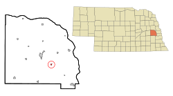 Location of Ithaca, Nebraska | |
 Ithaca Location within Nebraska | |
| Coordinates: 41°9′37″N 96°32′23″W / 41.16028°N 96.53972°WCoordinates: 41°9′37″N 96°32′23″W / 41.16028°N 96.53972°W | |
| Country | United States |
| State | Nebraska |
| County | Saunders |
| Township | Wahoo |
| Area | |
| • Total | 0.23 sq mi (0.60 km2) |
| • Land | 0.23 sq mi (0.60 km2) |
| • Water | 0.00 sq mi (0.00 km2) |
| Elevation | 1,175 ft (358 m) |
| Population | |
| • Total | 148 |
| • Estimate (2019)[5] | 148 |
| • Density | 635.19/sq mi (245.15/km2) |
| Time zone | UTC-6 (Central (CST)) |
| • Summer (DST) | UTC-5 (CDT) |
| ZIP code | 68033 |
| Area code(s) | 402 |
| FIPS code | 31-24285[3] |
| GNIS feature ID | 0830312[4] |


Ithaca is a village in Saunders County, Nebraska, United States. The population was 148 at the 2010 census.
History[]
Ithaca was founded in 1866.[6] It was named after Ithaca, New York, the native home of a pioneer settler.[7]
Geography[]
Ithaca is located at 41°9′37″N 96°32′23″W / 41.16028°N 96.53972°W (41.160392, -96.539861).[8]
According to the United States Census Bureau, the village has a total area of 0.23 square miles (0.60 km2), all land.[9]
Demographics[]
| Historical population | |||
|---|---|---|---|
| Census | Pop. | %± | |
| 1910 | 171 | — | |
| 1920 | 156 | −8.8% | |
| 1930 | 137 | −12.2% | |
| 1940 | 139 | 1.5% | |
| 1950 | 140 | 0.7% | |
| 1960 | 126 | −10.0% | |
| 1970 | 121 | −4.0% | |
| 1980 | 156 | 28.9% | |
| 1990 | 133 | −14.7% | |
| 2000 | 168 | 26.3% | |
| 2010 | 148 | −11.9% | |
| 2019 (est.) | 148 | [5] | 0.0% |
| U.S. Decennial Census[10] | |||
2010 census[]
As of the census[2] of 2010, there were 148 people, 57 households, and 40 families living in the village. The population density was 643.5 inhabitants per square mile (248.5/km2). There were 58 housing units at an average density of 252.2 per square mile (97.4/km2). The racial makeup of the village was 93.9% White, 4.1% Native American, and 2.0% from other races. Hispanic or Latino of any race were 8.1% of the population.
There were 57 households, of which 38.6% had children under the age of 18 living with them, 61.4% were married couples living together, 5.3% had a female householder with no husband present, 3.5% had a male householder with no wife present, and 29.8% were non-families. 26.3% of all households were made up of individuals, and 10.5% had someone living alone who was 65 years of age or older. The average household size was 2.60 and the average family size was 3.13.
The median age in the village was 36.7 years. 28.4% of residents were under the age of 18; 6.7% were between the ages of 18 and 24; 25% were from 25 to 44; 27.1% were from 45 to 64; and 12.8% were 65 years of age or older. The gender makeup of the village was 48.0% male and 52.0% female.
2000 census[]
As of the census[3] of 2000, there were 168 people, 57 households, and 42 families living in the village. The population density was 730.2 people per square mile (282.0/km2). There were 58 housing units at an average density of 252.1 per square mile (97.4/km2). The racial makeup of the village was 96.43% White, 1.79% Native American, and 1.79% from two or more races.
There were 57 households, out of which 38.6% had children under the age of 18 living with them, 66.7% were married couples living together, and 26.3% were non-families. 21.1% of all households were made up of individuals, and 8.8% had someone living alone who was 65 years of age or older. The average household size was 2.95 and the average family size was 3.50.
In the village, the population was spread out, with 33.3% under the age of 18, 8.3% from 18 to 24, 28.0% from 25 to 44, 17.3% from 45 to 64, and 13.1% who were 65 years of age or older. The median age was 35 years. For every 100 females, there were 93.1 males. For every 100 females age 18 and over, there were 111.3 males.
As of 2000 the median income for a household in the village was $36,875, and the median income for a family was $31,667. Males had a median income of $35,313 versus $24,167 for females. The per capita income for the village was $15,321. About 2.8% of families and 2.8% of the population were below the poverty line, including 2.2% of those under the age of eighteen and 3.1% of those 65 or over.
Notable people[]
- Harold D. Hansen (1904-1987) - Brigadier general, U.S. Marine Corps
References[]
- ^ "2019 U.S. Gazetteer Files". United States Census Bureau. Retrieved July 26, 2020.
- ^ Jump up to: a b "U.S. Census website". United States Census Bureau. Retrieved 2012-06-24.
- ^ Jump up to: a b "U.S. Census website". United States Census Bureau. Retrieved 2008-01-31.
- ^ "US Board on Geographic Names". United States Geological Survey. 2007-10-25. Retrieved 2008-01-31.
- ^ Jump up to: a b "Population and Housing Unit Estimates". United States Census Bureau. May 24, 2020. Retrieved May 27, 2020.
- ^ "Ithaca, Saunders County". Center for Advanced Land Management Information Technologies. University of Nebraska. Retrieved 23 August 2014.
- ^ Perky, Charles (1915). Past and Present of Saunders County, Nebraska: A Record of Settlement, Organization, Progress and Achievement. S.J. Clarke publishing Company. p. 128.
- ^ "US Gazetteer files: 2010, 2000, and 1990". United States Census Bureau. 2011-02-12. Retrieved 2011-04-23.
- ^ "US Gazetteer files 2010". United States Census Bureau. Archived from the original on 2012-07-02. Retrieved 2012-06-24.
- ^ "Census of Population and Housing". Census.gov. Retrieved June 4, 2015.
| show Municipalities and communities of Saunders County, Nebraska, United States |
|---|
| show Metropolitan area of Omaha–Council Bluffs |
|---|

| show Authority control |
|---|
- Villages in Saunders County, Nebraska
- Villages in Nebraska