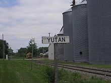
Yutan, Nebraska
Yutan, Nebraska | |
|---|---|
 Rusty Rooster Bar in downtown Yutan | |
 Location of Yutan, Nebraska | |
 Yutan Location within Nebraska | |
| Coordinates: 41°14′40″N 96°23′54″W / 41.24444°N 96.39833°WCoordinates: 41°14′40″N 96°23′54″W / 41.24444°N 96.39833°W | |
| Country | United States |
| State | Nebraska |
| County | Saunders |
| Township | Union |
| Area | |
| • Total | 0.57 sq mi (1.49 km2) |
| • Land | 0.57 sq mi (1.49 km2) |
| • Water | 0.00 sq mi (0.00 km2) |
| Elevation | 1,168 ft (356 m) |
| Population | |
| • Total | 1,174 |
| • Estimate (2019)[3] | 1,310 |
| • Density | 2,282.23/sq mi (881.40/km2) |
| Time zone | UTC-6 (Central (CST)) |
| • Summer (DST) | UTC-5 (CDT) |
| ZIP code | 68073 |
| Area code(s) | 402 |
| FIPS code | 31-54115 |
| GNIS feature ID | 0834920[4] |
| Website | www |


Yutan is a city in Saunders County, Nebraska, United States. The population was 1,174 at the 2010 census.
History[]
Yutan was originally called Clear Creek, and under the latter name was platted in 1876 when the Omaha and Republican Valley Railroad was extended to that point. It was renamed in 1884 after Ietan, an Otoe Indian chief.[5][6][7]
Geography[]
Yutan is located at 41°14′40″N 96°23′54″W / 41.244523°N 96.398349°W (41.244523, -96.398349).[8]
According to the United States Census Bureau, the city has a total area of 0.53 square miles (1.37 km2), all land.[9]
Demographics[]
| Historical population | |||
|---|---|---|---|
| Census | Pop. | %± | |
| 1890 | 168 | — | |
| 1900 | 263 | 56.5% | |
| 1910 | 353 | 34.2% | |
| 1920 | 300 | −15.0% | |
| 1930 | 313 | 4.3% | |
| 1940 | 268 | −14.4% | |
| 1950 | 287 | 7.1% | |
| 1960 | 335 | 16.7% | |
| 1970 | 507 | 51.3% | |
| 1980 | 631 | 24.5% | |
| 1990 | 626 | −0.8% | |
| 2000 | 1,216 | 94.2% | |
| 2010 | 1,174 | −3.5% | |
| 2019 (est.) | 1,310 | [3] | 11.6% |
| U.S. Decennial Census[10] | |||
2010 census[]
As of the census[2] of 2010, there were 1,174 people, 432 households, and 324 families living in the city. The population density was 2,215.1 inhabitants per square mile (855.3/km2). There were 449 housing units at an average density of 847.2 per square mile (327.1/km2). The racial makeup of the city was 98.0% White, 0.9% African American, 0.1% Native American, 0.1% Asian, 0.4% from other races, and 0.5% from two or more races. Hispanic or Latino of any race were 1.9% of the population.
There were 432 households, of which 41.7% had children under the age of 18 living with them, 56.5% were married couples living together, 12.0% had a female householder with no husband present, 6.5% had a male householder with no wife present, and 25.0% were non-families. 20.4% of all households were made up of individuals, and 8.4% had someone living alone who was 65 years of age or older. The average household size was 2.72 and the average family size was 3.12.
The median age in the city was 35.4 years. 30.9% of residents were under the age of 18; 7.3% were between the ages of 18 and 24; 25% were from 25 to 44; 26.8% were from 45 to 64; and 10% were 65 years of age or older. The gender makeup of the city was 50.1% male and 49.9% female.
2000 census[]
As of the census of 2000, there were 1,216 people, 406 households, and 319 families living in the city. The population density was 2,561.3 people per square mile (998.9/km2). There were 423 housing units at an average density of 891.0 per square mile (347.5/km2). The racial makeup of the city was 96.71% White, 0.16% African American, 0.82% Native American, 0.49% Asian, 0.25% from other races, and 1.56% from two or more races. Hispanic or Latino of any race were 1.15% of the population.
There were 406 households, out of which 45.1% had children under the age of 18 living with them, 63.1% were married couples living together, 11.8% had a female householder with no husband present, and 21.4% were non-families. 17.7% of all households were made up of individuals, and 7.1% had someone living alone who was 65 years of age or older. The average household size was 3.00 and the average family size was 3.43.
In the city, the population was spread out, with 35.0% under the age of 18, 8.1% from 18 to 24, 31.8% from 25 to 44, 17.8% from 45 to 64, and 7.3% who were 65 years of age or older. The median age was 32 years. For every 100 females, there were 103.0 males. For every 100 females age 18 and over, there were 92.7 males.
As of 2000 the median income for a household in the city was $44,844, and the median income for a family was $52,273. Males had a median income of $36,310 versus $25,850 for females. The per capita income for the city was $16,675. About 1.9% of families and 2.6% of the population were below the poverty line, including 3.5% of those under age 18 and 9.3% of those age 65 or over.
Education[]
Yutan's schools are administered by . Yutan Elementary School and are located in the city.
References[]
- ^ "2019 U.S. Gazetteer Files". United States Census Bureau. Retrieved July 26, 2020.
- ^ a b "U.S. Census website". United States Census Bureau. Retrieved 2012-06-24.
- ^ a b "Population and Housing Unit Estimates". United States Census Bureau. May 24, 2020. Retrieved May 27, 2020.
- ^ "US Board on Geographic Names". United States Geological Survey. 2007-10-25. Retrieved 2008-01-31.
- ^ "Yutan, Saunders County". Center for Advanced Land Management Information Technologies. University of Nebraska. Retrieved 23 August 2014.
- ^ Fitzpatrick, Lillian L. (1960). Nebraska Place-Names. University of Nebraska Press. p. 128. ISBN 0-8032-5060-6. A 1925 edition is available for download at University of Nebraska—Lincoln Digital Commons.
- ^ "Profile for Yutan, NE". ePodunk. Retrieved 23 August 2014.
- ^ "US Gazetteer files: 2010, 2000, and 1990". United States Census Bureau. 2011-02-12. Retrieved 2011-04-23.
- ^ "US Gazetteer files 2010". United States Census Bureau. Archived from the original on February 20, 2011. Retrieved 2012-06-24.
- ^ United States Census Bureau. "Census of Population and Housing". Retrieved October 19, 2013.
External links[]
Municipalities and communities of Saunders County, Nebraska, United States | ||
|---|---|---|
| Cities | ||
| Villages | ||
| Townships | ||
| CDP | ||
| Unincorporated communities | ||
| ||
Metropolitan area of Omaha–Council Bluffs | ||||||
|---|---|---|---|---|---|---|
| Primary cities |
|  | ||||
| Cities over 10,000 (per 2010 Census) |
| |||||
| Cities of 5,000 to 10,000 (per 2010 Census) |
| |||||
| Cities of 1,000 to 5,000 (per 2010 Census) |
| |||||
| Census-designated places |
| |||||
| Cities and villages of fewer than 1,000 (per 2010 Census) |
| |||||
| Counties |
| |||||
- Cities in Saunders County, Nebraska
- Cities in Nebraska