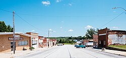
Persia, Iowa
Persia, Iowa | |
|---|---|
 | |
 Location of Persia, Iowa | |
| Coordinates: 41°34′44″N 95°34′14″W / 41.57889°N 95.57056°WCoordinates: 41°34′44″N 95°34′14″W / 41.57889°N 95.57056°W | |
| Country | |
| State | |
| County | Harrison |
| Area | |
| • Total | 0.47 sq mi (1.22 km2) |
| • Land | 0.47 sq mi (1.22 km2) |
| • Water | 0.00 sq mi (0.00 km2) |
| Elevation | 1,175 ft (358 m) |
| Population | |
| • Total | 319 |
| • Estimate (2019)[3] | 287 |
| • Density | 610.64/sq mi (235.59/km2) |
| Time zone | UTC-6 (Central (CST)) |
| • Summer (DST) | UTC-5 (CDT) |
| ZIP code | 51563 |
| Area code(s) | 712 |
| FIPS code | 19-62445 |
| GNIS feature ID | 0460096 |

Persia is a city in Harrison County, Iowa, United States. The population was 319 in the 2010 census, a decline from 363 in the 2000 census.[4]
Geography[]
Persia is located at 41°34′44″N 95°34′14″W / 41.57889°N 95.57056°W (41.578993, -95.570417).[5]
According to the United States Census Bureau, the city has a total area of 0.47 square miles (1.22 km2), all of it land.[6]
Demographics[]
| Historical population | |||
|---|---|---|---|
| Census | Pop. | %± | |
| 1900 | 361 | — | |
| 1910 | 358 | −0.8% | |
| 1920 | 380 | 6.1% | |
| 1930 | 396 | 4.2% | |
| 1940 | 395 | −0.3% | |
| 1950 | 373 | −5.6% | |
| 1960 | 322 | −13.7% | |
| 1970 | 316 | −1.9% | |
| 1980 | 355 | 12.3% | |
| 1990 | 312 | −12.1% | |
| 2000 | 363 | 16.3% | |
| 2010 | 319 | −12.1% | |
| 2019 (est.) | 287 | [3] | −10.0% |
| U.S. Decennial Census[7] | |||
2010 census[]
As of the census[2] of 2010, there were 319 people, 127 households, and 88 families living in the city. The population density was 678.7 inhabitants per square mile (262.0/km2). There were 137 housing units at an average density of 291.5 per square mile (112.5/km2). The racial makeup of the city was 97.8% White, 0.3% African American, and 1.9% Native American. Hispanic or Latino of any race were 0.3% of the population.
There were 127 households, of which 35.4% had children under the age of 18 living with them, 54.3% were married couples living together, 11.8% had a female householder with no husband present, 3.1% had a male householder with no wife present, and 30.7% were non-families. 26.0% of all households were made up of individuals, and 10.3% had someone living alone who was 65 years of age or older. The average household size was 2.51 and the average family size was 3.03.
The median age in the city was 36.1 years. 27.6% of residents were under the age of 18; 7.6% were between the ages of 18 and 24; 26.9% were from 25 to 44; 22.5% were from 45 to 64; and 15.4% were 65 years of age or older. The gender makeup of the city was 48.6% male and 51.4% female.
2000 census[]
As of the census[8] of 2000, there were 363 people, 141 households, and 104 families living in the city. The population density was 794.9 people per square mile (304.7/km2). There were 145 housing units at an average density of 317.5 per square mile (121.7/km2). The racial makeup of the city was 99.45% White, 0.28% African American, and 0.28% from two or more races. Hispanic or Latino of any race were 0.55% of the population.
There were 141 households, out of which 31.9% had children under the age of 18 living with them, 61.0% were married couples living together, 6.4% had a female householder with no husband present, and 26.2% were non-families. 23.4% of all households were made up of individuals, and 15.6% had someone living alone who was 65 years of age or older. The average household size was 2.57 and the average family size was 2.97.
Age spread: 26.2% under the age of 18, 8.8% from 18 to 24, 27.5% from 25 to 44, 19.6% from 45 to 64, and 17.9% who were 65 years of age or older. The median age was 36 years. For every 100 females, there were 92.1 males. For every 100 females age 18 and over, there were 91.4 males.
The median income for a household in the city was $36,563, and the median income for a family was $40,000. Males had a median income of $26,000 versus $22,500 for females. The per capita income for the city was $14,859. About 8.3% of families and 10.0% of the population were below the poverty line, including 13.6% of those under age 18 and 13.1% of those age 65 or over.
In the media[]
In September 2012, BBC Persian channel broadcast a short coverage of the city of Persia.[9] This coverage was about the city itself and why it is named Persia. The mayor and some locals were interviewed as a part of this coverage.
Persia is referenced, along with the nearby Nishnabotna River and Interstate 680, on the C.W. McCall song "Four Wheel Drive" from his 1975 album Wolf Creek Pass.
Education[]
Tri-Center Community School District operates schools serving Persia.[10] Its high school is Tri-Center High School.
References[]
- ^ "2019 U.S. Gazetteer Files". United States Census Bureau. Retrieved July 17, 2020.
- ^ Jump up to: a b "U.S. Census website". United States Census Bureau. Retrieved 2012-05-11.
- ^ Jump up to: a b "Population and Housing Unit Estimates". United States Census Bureau. May 24, 2020. Retrieved May 27, 2020.
- ^ "Data from the 2010 Census". State Data Center of Iowa. Archived from the original on July 18, 2011. Retrieved April 7, 2011.
- ^ "US Gazetteer files: 2010, 2000, and 1990". United States Census Bureau. 2011-02-12. Retrieved 2011-04-23.
- ^ "US Gazetteer files 2010". United States Census Bureau. Archived from the original on 2012-01-25. Retrieved 2012-05-11.
- ^ "Census of Population and Housing". Census.gov. Retrieved June 4, 2015.
- ^ "U.S. Census website". United States Census Bureau. Retrieved 2008-01-31.
- ^ "پرشیا :شهری کوچک در قلب آمریکا". 9 September 2012.
- ^ "TRI-CENTER" (PDF). Iowa Department of Education. Retrieved 2020-09-01.
External links[]
| Wikimedia Commons has media related to Persia, Iowa. |
- PDF Map of Persia Iowa[permanent dead link]
- Interesting story of a Persian visiting Persia Iowa
- City-Data Comprehensive Statistical Data and more about Persia
| show Metropolitan area of Omaha–Council Bluffs |
|---|

| show Municipalities and communities of Harrison County, Iowa, United States |
|---|
- Cities in Harrison County, Iowa
- Cities in Iowa