Cuming County, Nebraska
Cuming County | |
|---|---|
U.S. county | |
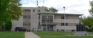 Cuming County Courthouse in West Point | |
 Location within the U.S. state of Nebraska | |
 Nebraska's location within the U.S. | |
| Coordinates: 41°55′N 96°47′W / 41.92°N 96.79°W | |
| Country | |
| State | |
| Founded | 1855 (authorized) 1857 (organized) |
| Named for | Thomas B. Cuming |
| Seat | West Point |
| Largest city | West Point |
| Area | |
| • Total | 575 sq mi (1,490 km2) |
| • Land | 571 sq mi (1,480 km2) |
| • Water | 4.0 sq mi (10 km2) 0.7%% |
| Population | |
| • Estimate (2018) | 8,940 |
| • Density | 15.8/sq mi (6.1/km2) |
| Time zone | UTC−6 (Central) |
| • Summer (DST) | UTC−5 (CDT) |
| Congressional district | 1st |
| Website | www |

Cuming County is a county in the U.S. state of Nebraska. As of the 2010 United States Census, the population was 9,139.[1] Its county seat is West Point.[2]
In the Nebraska license plate system, Cuming County is represented by the prefix 24 since it had the 24th largest number of vehicles registered in the state when the license plate system was established in 1922.
History[]
Cuming County was formed in 1855 and organized in 1857.[3][4] It was named for Thomas B. Cuming, the first secretary (and twice Acting Governor) of the newly created Nebraska Territory (1854–1858).[5]
The courthouse dates from the 1950s.[6]
On August 26, 2019, the DHHS announced that West Point's water was unsafe to drink after a year of complaints from citizens of the town. The maximum safe level of manganese for infants had been exceeded by over 700 micrograms per mL.[7]
Geography[]
According to the US Census Bureau, the county has an area of 575 square miles (1,490 km2), of which 571 square miles (1,480 km2) is land and 4.0 square miles (10 km2) (0.7%) is water.[8]
Major highways[]
Adjacent counties[]
- Thurston County – northeast
- Burt County – east
- Dodge County – south
- Colfax County – southwest
- Stanton County – west
- Wayne County – northwest
Demographics[]
| Historical population | |||
|---|---|---|---|
| Census | Pop. | %± | |
| 1860 | 67 | — | |
| 1870 | 2,964 | 4,323.9% | |
| 1880 | 5,569 | 87.9% | |
| 1890 | 12,265 | 120.2% | |
| 1900 | 14,584 | 18.9% | |
| 1910 | 13,782 | −5.5% | |
| 1920 | 13,769 | −0.1% | |
| 1930 | 14,327 | 4.1% | |
| 1940 | 13,562 | −5.3% | |
| 1950 | 12,994 | −4.2% | |
| 1960 | 12,435 | −4.3% | |
| 1970 | 12,034 | −3.2% | |
| 1980 | 11,664 | −3.1% | |
| 1990 | 10,117 | −13.3% | |
| 2000 | 10,203 | 0.9% | |
| 2010 | 9,139 | −10.4% | |
| 2018 (est.) | 8,940 | [9] | −2.2% |
| US Decennial Census[10] 1790-1960[11] 1900-1990[12] 1990-2000[13] 2010-2013[1] | |||
As of the 2000 United States Census,[14] there were 10,203 people, 3,945 households, and 2,757 families in the county. The population density was 18 people per square mile (7/km2). There were 4,283 housing units at an average density of 8 per square mile (3/km2). The racial makeup of the county was 95.88% White, 0.13% Black or African American, 0.28% Native American, 0.20% Asian, 0.03% Pacific Islander, 2.63% from other races, and 0.85% from two or more races. 5.48% of the population were Hispanic or Latino of any race. 67.4% were of German and 5.6% American ancestry.
There were 3,945 households, out of which 32.60% had children under the age of 18 living with them, 61.70% were married couples living together, 5.30% had a female householder with no husband present, and 30.10% were non-families. 27.10% of all households were made up of individuals, and 14.90% had someone living alone who was 65 years of age or older. The average household size was 2.53 and the average family size was 3.08.
The county population contained 27.20% under the age of 18, 6.50% from 18 to 24, 25.20% from 25 to 44, 20.90% from 45 to 64, and 20.20% who were 65 years of age or older. The median age was 39 years. For every 100 females there were 102.10 males. For every 100 females age 18 and over, there were 99.20 males.
The median income for a household in the county was $33,186, and the median income for a family was $38,369. Males had a median income of $26,577 versus $19,246 for females. The per capita income for the county was $16,443. About 7.00% of families and 9.00% of the population were below the poverty line, including 9.80% of those under age 18 and 7.80% of those age 65 or over.
Communities[]
Cities[]
- West Point (county seat)
- Wisner
Villages[]
Unincorporated communities[]
Townships[]
|
|
Politics[]
Cuming County voters are reliably Republican. In no national election since 1936 has the county selected the Democratic Party candidate (as of 2020).
| Presidential election results | |||
|---|---|---|---|
| Year | Republican | Democratic | Third Parties |
| 2020 | 78.7% 3,507 | 19.5% 870 | 1.8% 82 |
| 2016 | 76.6% 3,122 | 17.7% 719 | 5.7% 233 |
| 2012 | 72.3% 2,876 | 25.9% 1,031 | 1.7% 69 |
| 2008 | 66.9% 2,732 | 31.2% 1,274 | 2.0% 81 |
| 2004 | 76.6% 3,330 | 22.2% 966 | 1.2% 53 |
| 2000 | 76.7% 3,232 | 20.3% 857 | 3.0% 126 |
| 1996 | 61.6% 2,520 | 25.3% 1,033 | 13.2% 538 |
| 1992 | 57.1% 2,713 | 17.6% 836 | 25.3% 1,202 |
| 1988 | 71.8% 3,208 | 27.7% 1,239 | 0.5% 24 |
| 1984 | 82.9% 3,931 | 16.4% 779 | 0.6% 30 |
| 1980 | 78.1% 4,006 | 15.7% 803 | 6.3% 322 |
| 1976 | 69.2% 3,303 | 28.8% 1,374 | 2.0% 97 |
| 1972 | 78.9% 3,810 | 21.1% 1,019 | 0.0% 0 |
| 1968 | 72.6% 3,254 | 20.9% 935 | 6.6% 296 |
| 1964 | 57.5% 3,064 | 42.5% 2,265 | 0.0% 0 |
| 1960 | 67.5% 3,894 | 32.6% 1,879 | 0.0% 0 |
| 1956 | 76.4% 4,223 | 23.6% 1,302 | 0.0% 0 |
| 1952 | 80.6% 4,557 | 19.4% 1,095 | 0.0% 0 |
| 1948 | 63.9% 2,930 | 36.1% 1,657 | 0.0% 0 |
| 1944 | 74.1% 4,008 | 25.9% 1,401 | 0.0% 0 |
| 1940 | 73.3% 4,383 | 26.7% 1,595 | 0.0% 0 |
| 1936 | 39.0% 2,275 | 53.3% 3,114 | 7.7% 451 |
| 1932 | 21.1% 1,191 | 77.9% 4,391 | 1.0% 57 |
| 1928 | 48.0% 2,418 | 51.5% 2,597 | 0.6% 28 |
| 1924 | 36.7% 1,642 | 21.9% 981 | 41.4% 1,850 |
| 1920 | 78.6% 3,177 | 18.9% 764 | 2.5% 99 |
| 1916 | 51.0% 1,551 | 46.9% 1,424 | 2.1% 64 |
| 1912 | 27.5% 759 | 53.8% 1,484 | 18.7% 514 |
| 1908 | 42.2% 1,284 | 56.6% 1,722 | 1.1% 34 |
| 1904 | 52.7% 1,490 | 44.0% 1,244 | 3.3% 94 |
| 1900 | 43.8% 1,385 | 55.0% 1,736 | 1.2% 38 |
| Source:[15] | |||
See also[]
- National Register of Historic Places listings in Cuming County, Nebraska
References[]
- ^ Jump up to: a b "State & County QuickFacts". US Census Bureau. Archived from the original on July 9, 2011. Retrieved September 18, 2013.
- ^ "Find a County". National Association of Counties. Archived from the original on 31 May 2011. Retrieved 7 June 2011.
- ^ Fitzpatrick, Lilian Linder (1925). Nebraska Place-Names. Lincoln: University of Nebraska Studies in Language, Literature, and Criticism. p. 44. Retrieved December 18, 2014.
- ^ "Cuming County Nebraska Historic Buildings Survey" (PDF). Nebraska State Historical Society. July 2000. Retrieved December 18, 2014.
- ^ Gannett, Henry (1905). The Origin of Certain Place Names in the United States. Govt. Print. Off. p. 97.
- ^ Topp, LaRayne M. (2013). Cuming County. Arcadia Pub. p. 18. ISBN 9780738590707.
- ^ Omaha.com. "Bottled or filtered water recommended after high manganese levels found in West Point water". Retrieved 29 August 2019.
- ^ "2010 Census Gazetteer Files". US Census Bureau. August 22, 2012. Archived from the original on November 13, 2013. Retrieved December 6, 2014.
- ^ "Population and Housing Unit Estimates". Retrieved December 26, 2019.
- ^ "US Decennial Census". US Census Bureau. Retrieved December 6, 2014.
- ^ "Historical Census Browser". University of Virginia Library. Retrieved December 6, 2014.
- ^ "Population of Counties by Decennial Census: 1900 to 1990". US Census Bureau. Retrieved December 6, 2014.
- ^ "Census 2000 PHC-T-4. Ranking Tables for Counties: 1990 and 2000" (PDF). US Census Bureau. Retrieved December 6, 2014.
- ^ "U.S. Census website". US Census Bureau. Retrieved 31 January 2008.
- ^ Election Results
| show Places adjacent to Cuming County, Nebraska |
|---|
| show Municipalities and communities of Cuming County, Nebraska, United States |
|---|

Coordinates: 41°55′N 96°47′W / 41.92°N 96.79°W
| show Authority control |
|---|
- Nebraska counties
- Cuming County, Nebraska
- 1857 establishments in Nebraska Territory
- Populated places established in 1857