B47 (New York City bus)
This article needs additional citations for verification. (October 2016) |
b47
| |||
|---|---|---|---|
| Ralph Avenue Line | |||
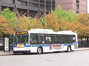 A B47 bus at Woodhull Hospital heading to Kings Plaza. | |||
| Overview | |||
| System | MTA New York City Bus | ||
| Operator | New York City Transit Authority | ||
| Garage | Grand Avenue Depot | ||
| Vehicle | Orion VII NG HEV New Flyer Xcelsior XD40 New Flyer Xcelsior XDE40 | ||
| Began service | 1943 (streetcar line) 1951 (bus) | ||
| Route | |||
| Locale | Brooklyn | ||
| Communities served | Bedford–Stuyvesant, Crown Heights, Brownsville, Remsen Village, East Flatbush, Flatlands, Mill Basin, Marine Park | ||
| Start | Bedford–Stuyvesant – Woodhull Medical Center | ||
| Via | Ralph Avenue | ||
| End | Mill Basin / Marine Park – Kings Plaza | ||
| Length | 6.2 miles (10.0 km)[1] (entire route) | ||
| Service | |||
| Operates | All times | ||
| Annual patronage | 1,890,678 (2020) | ||
| Timetable | B47 | ||
| |||
The B47 is a surface transit line on Ralph Avenue in Brooklyn, New York City. Once a streetcar line,[2] it is now part of the B47 bus route, operated by the New York City Transit Authority, Prior to 1995, it was the B78 route; the northern part of the route from St. Johns Place to Woodhull Hospital was part of the B40 line. The B47 was created as a result of a merger of the B40 and B78 on September 8, 2002.
Route description[]
The southbound B47 begins at the Woodhull Medical Center in East Williamsburg, near the intersection of Marcus Garvey Boulevard and Ellery Street. It travels southeast along Broadway, then turns right on Ralph Avenue, heading south on Ralph Avenue. Since Ralph Avenue is split into two sections in Crown Heights, the B47 makes a series of zigzag turns in the neighborhood, first turning right at East New York Avenue, then left at East 98th Street, right at Rutland Road, left at Rockaway Parkway, right at Clarkson Avenue, and left at Remsen Avenue. The B47 bears to the right where Ralph Avenue resumes. The bus then continues south along Ralph Avenue before bearing left at Mill Avenue. It next turns right at Avenue U where it continues until its terminus at East 54th Street, in front of the Kings Plaza Shopping Center in Mill Basin.[3]
The northbound B47 begins at East 54th Street, then continues northeast on Avenue U, turns left onto Mill Avenue, and bears right on Ralph Avenue. The B47 bears left at Remsen Avenue when the southern section of Ralph Avenue ends. The B47 turns right onto Clarkson Avenue, left onto East 98th Street, and right on East New York Avenue. The bus turns left at Ralph Avenue, where it continues until reaching the northern end of Ralph Avenue at Broadway. The B47 turns left then continues northwest along Broadway until reaching Woodhull Hospital, where it terminates.[3]
History[]
The Ralph Avenue Line was one of a number of branch lines of the Brooklyn, Queens County and Suburban Railroad's Broadway Line.[4]
Service on the line used to originate at the Williamsburg Bridge Trolley Terminal on the Lower East Side of Manhattan, but was cut back to Washington Plaza in Brooklyn in 1949.[5]
The Ralph Avenue corridor featured two streetcars, the Ralph Avenue Line and the Ralph and Rockaway Avenues Line, both of which originated at the Williamsburg Bridge Trolley Terminal. The former ran via 98th Street, Ralph Avenue, and Broadway,[6] while the latter ran via Rockaway Avenue, Ralph Avenue, and Broadway.[7] Ralph Avenue service was discontinued on November 1, 1943, and Ralph and Rockaway Avenues Line service was discontinued on May 27, 1951.[8][9]: 125
The B40 bus replaced the northern portion of the Ralph Avenue Line, and it traveled on Broadway, Ralph Avenue, and Liberty Avenue between the Williamsburg Bridge Plaza Bus Terminal in Williamsburg and the Liberty Avenue subway station in East New York. The B78 replaced the southern portion of the Ralph Avenue Line, and traveled from the Sutter Avenue–Rutland Road subway station in Brownsville to the Kings Plaza Shopping Center. The two routes did not intersect. The B40 and B78 routes were discontinued September 8, 2002, and the Ralph Avenue portion of the B40 merged with the B78 at that time to form the current B47.[10]
References[]
- ^ Google (May 10, 2017). "B47" (Map). Google Maps. Google. Retrieved May 10, 2017.
- ^ Brooklyn Daily Eagle Almanac ...: A Book of Information, General of the World, and Special of New York City and Long Island ... Brooklyn Daily Eagle. 1895. p. 247.
- ^ a b "Brooklyn Bus Map" (PDF). Metropolitan Transportation Authority. October 2020. Retrieved December 1, 2020.
- ^ Cudahy, Brian J. (August 25, 2009). How We Got to Coney Island: The Development of Mass Transportation in Brooklyn and Kings County. Fordham University Press. ISBN 9780823222117.
- ^ Transportation, New York (N Y. ) Board of (1949). Proceedings. p. 269.
- ^ Korman, Joseph (March 14, 2012). "BMT Trolley and Trackless Route Map Line - 11 - Ralph Ave". www.thejoekorner.com. Retrieved November 9, 2017.
- ^ Korman, Joseph (March 14, 2012). "BMT Trolley and Trackless Route Map Line - 10 - Ralph-Rockaway Avenues". www.thejoekorner.com. Retrieved November 9, 2017.
- ^ Korman, Joseph (October 31, 2016). "Brooklyn Trolleys". www.thejoekorner.com. Retrieved November 9, 2017.
- ^ Brooklyn Streetcars. Arcadia Publishing. 2008. ISBN 9780738557618.
- ^ "New York City Transit Bus Changes". mta.info. September 2002. Archived from the original on October 21, 2002. Retrieved May 15, 2017.CS1 maint: bot: original URL status unknown (link)
External links[]
 Media related to B47 (New York City bus) at Wikimedia Commons
| Current local routes |  | |
|---|---|---|
| Current express routes |
| |
| Former routes | ||
- MTA Regional Bus routes
- Bus routes in Brooklyn
- Streetcar lines in Brooklyn