B68 (New York City bus)
This article needs additional citations for verification. (October 2016) |
b68
| |||
|---|---|---|---|
| Coney Island Avenue Line | |||
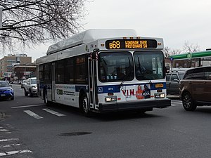 A Windsor Terrace-bound B68 bus in Kensington. | |||
| Overview | |||
| System | MTA New York City Bus | ||
| Operator | New York City Transit Authority | ||
| Garage | Jackie Gleason Depot | ||
| Vehicle | New Flyer C40LF CNG New Flyer Xcelsior XN40 | ||
| Began service | 1862 | ||
| Route | |||
| Locale | Brooklyn | ||
| Communities served | Windsor Terrace, Kensington, Midwood, Homecrest, Sheepshead Bay, Brighton Beach, Coney Island | ||
| Start | Park Slope – Bartel Pritchard Square / 15th Street – Prospect Park station | ||
| Via | Prospect Park Southwest, Coney Island Avenue, Brighton Beach Avenue[1] | ||
| End | Coney Island – Stillwell Avenue and Mermaid Bus Loop / Stillwell Avenue station | ||
| Length | 7.6 miles (12.2 km) | ||
| Service | |||
| Operates | All times[1] | ||
| Annual patronage | 1,578,702 (2020)[2] | ||
| Transfers | Yes | ||
| Timetable | B68 | ||
| |||
The B68 is a bus route that constitutes a public transit line operating in Brooklyn, New York City. The B68 is operated by the MTA New York City Transit Authority. Its precursor was a streetcar line that began operation in June 1862, and was known as the Coney Island Avenue Line. The route became a bus line in 1955.
Route description[]
The B68's northern terminus is at Prospect Park Southwest and Pritchard Square near the 15th Street–Prospect Park station in Park Slope. Service heads south via Prospect Park Southwest and Coney Island Avenue until Brighton Beach Avenue. Service then heads west via that street until West Brighton Avenue, before turning right onto West 5th Street. Buses then make lefts at Neptune Avenue and Stilwell Avenue before terminating at the Mermaid Bus Loop at Coney Island–Stillwell Avenue station.[1]
History[]
As a horsecar line[]
The original line ran from the Boulevard entrance of Prospect Park (Park Circle) to Coney Island and was operated by the Coney Island and Brooklyn Railroad (CI&B). It was the first railroad of any kind to reach Coney Island. The CI&B connected to other lines to bring people from Brooklyn (then a city) and from New York City (then meaning Manhattan) to its service to Coney Island. It began operating service along the Smith Street Line to Fulton Ferry in June 1862,[3] so that the line was commonly called the "Smith Street Line". It was also known as the "Slocum Road" after its president, Henry Warner Slocum, a Civil War general and New York congressman. Slocum's name is also associated with the steamboat General Slocum, involved in a disastrous fire on the East River. Most of the route operated alongside the Coney Island Plank Road, now Coney Island Avenue.
As a trolley line[]
In 1890, in order to compete better with the steam railroads that had been opened to Coney Island beginning in 1864, the CI&B became the first horsecar line in Kings County to electrify, using trolley wire.
The CI&B acquired the () in the early 1890s, and leased the Brooklyn City and Newtown Rail Road (DeKalb Avenue Line) in 1897.
The , a Brooklyn Rapid Transit Company subsidiary, bought a majority of CI&B stock in 1913 or 1914;[4] it remained part of the BRT (Brooklyn-Manhattan Transit Corporation after 1923) system until the BMT was purchased by the City of New York in 1940.
As a bus line[]
In 1955, this was the third-to-last Brooklyn streetcar line to be converted to bus operation and the fourth to last in the State of New York. Service was renumbered as the B68 bus. In July 2001, service was extended from West 5th Street to the Coney Island subway station.[5]
References[]
- ^ a b c MTA Regional Bus Operations. "B68 bus schedule" (PDF).
- ^ "Facts and Figures". mta.info. August 28, 2011. Retrieved January 3, 2020.
- ^ "Brooklyn News". The New York Times. June 23, 1862. Archived from the original on July 17, 2012.
- ^ "1914 Moody's Manual: Brooklyn Rapid Transit Company" (PDF). Archived from the original (PDF) on September 27, 2007. (696 KiB)
- ^ http://www.nyc.gov/html/dot/downloads/pdf/ci_pubtrans.pdf p.17
| Current local routes |  | |
|---|---|---|
| Current express routes |
| |
| Former routes | ||
Companies and predecessors of the Brooklyn–Manhattan Transit Corporation | |||||
|---|---|---|---|---|---|
| Elevated railroads and subways |
|   | |||
| Streetcars and cable cars |
| ||||
| Buses | |||||
| Streetcar lists | |||||
| Other |
| ||||
- Streetcar lines in Brooklyn
- MTA Regional Bus routes
- Bus routes in Brooklyn
- Predecessors of the Brooklyn–Manhattan Transit Corporation
- Defunct New York (state) railroads