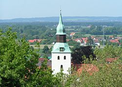
Bad Essen
Bad Essen | |
|---|---|
 Bad Essen | |
 Coat of arms | |
show Location of Bad Essen within Osnabrück district | |
 Bad Essen | |
| Coordinates: 52°19′17″N 8°20′24″E / 52.32139°N 8.34000°ECoordinates: 52°19′17″N 8°20′24″E / 52.32139°N 8.34000°E | |
| Country | Germany |
| State | Lower Saxony |
| District | Osnabrück |
| Government | |
| • Mayor | Timo Natemeyer (Ind.) |
| Area | |
| • Total | 103.31 km2 (39.89 sq mi) |
| Elevation | 113 m (371 ft) |
| Population (2020-12-31)[1] | |
| • Total | 15,828 |
| • Density | 150/km2 (400/sq mi) |
| Time zone | UTC+01:00 (CET) |
| • Summer (DST) | UTC+02:00 (CEST) |
| Postal codes | 49152 |
| Dialling codes | 05472 |
| Vehicle registration | OS |
| Website | www.badessen.de |


Bad Essen is a small municipality and health resort in the district of Osnabrück, in Lower Saxony. Bad Essen with its historical centre is located on the German Timber-Frame Road.
Geography[]
The town of Bad Essen is on the North German Plains, because of the transition of the low mountain range to the plains. The Wiehengebirge Range covers approximately the southern third of the town and reaches an altitude of 211m above sea level. The highest point of the Wiehengebirge Range is on the black Brink in Lintorf. The northern part of the town is flat, with an average altitude of 50m above sea level. The Hunte flows through the eastern part of Bad Essen northwards and crosses the Midland Canal in Wittlage.
References[]
External links[]

| show Towns and municipalities in Osnabrück (district) |
|---|
| show Authority control |
|---|
This Osnabrück district location article is a stub. You can help Wikipedia by . |
- Municipalities in Lower Saxony
- Bad Essen
- Wiehen Hills
- Osnabrück (district)
- Spa towns in Germany
- Weser-Ems region geography stubs