Bailey, North Carolina
Bailey, North Carolina | |
|---|---|
 | |
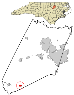 Location in Nash County and the state of North Carolina. | |
| Coordinates: 35°46′49″N 78°6′56″W / 35.78028°N 78.11556°WCoordinates: 35°46′49″N 78°6′56″W / 35.78028°N 78.11556°W | |
| Country | United States |
| State | North Carolina |
| County | Nash |
| Area | |
| • Total | 0.70 sq mi (1.82 km2) |
| • Land | 0.70 sq mi (1.82 km2) |
| • Water | 0.00 sq mi (0.00 km2) |
| Elevation | 223 ft (68 m) |
| Population (2010) | |
| • Total | 569 |
| • Estimate (2019)[2] | 562 |
| • Density | 800.57/sq mi (309.13/km2) |
| Time zone | UTC-5 (Eastern (EST)) |
| • Summer (DST) | UTC-4 (EDT) |
| ZIP code | 27807 |
| Area code(s) | 252 |
| FIPS code | 37-03020[3] |
| GNIS feature ID | 1018899[4] |

Bailey is a town in Nash County, North Carolina, United States. It is part of the Rocky Mount, North Carolina Metropolitan Statistical Area. The population was 566 at the 2020 census.
History[]
The Morgan School was listed on the National Register of Historic Places in 2006.[5]
Geography[]
Bailey is located at 35°46′49″N 78°06′56″W / 35.780279°N 78.115622°W.[6]
According to the United States Census Bureau, the town has a total area of 0.7 square miles (1.8 km2), all land.
Demographics[]
| Historical population | |||
|---|---|---|---|
| Census | Pop. | %± | |
| 1910 | 195 | — | |
| 1920 | 518 | 165.6% | |
| 1930 | 631 | 21.8% | |
| 1940 | 645 | 2.2% | |
| 1950 | 743 | 15.2% | |
| 1960 | 795 | 7.0% | |
| 1970 | 724 | −8.9% | |
| 1980 | 685 | −5.4% | |
| 1990 | 553 | −19.3% | |
| 2000 | 670 | 21.2% | |
| 2010 | 569 | −15.1% | |
| 2019 (est.) | 562 | [2] | −1.2% |
| U.S. Decennial Census[7] | |||
At the 2000 census there were 670 people, 274 households, and 184 families in the town. The population density was 955.8 people per square mile (369.6/km2). There were 302 housing units at an average density of 430.8 per square mile (166.6/km2). The racial makeup of the town was 67.91% White, 22.84% African American, 7.46% from other races, and 1.79% from two or more races. Hispanic or Latino of any race were 10.75%.[3]
Of the 274 households 26.3% had children under the age of 18 living with them, 52.6% were married couples living together, 10.9% had a female householder with no husband present, and 32.5% were non-families. 29.2% of households were one person and 13.5% were one person aged 65 or older. The average household size was 2.45 and the average family size was 2.98.
The age distribution was 23.6% under the age of 18, 9.3% from 18 to 24, 26.9% from 25 to 44, 22.2% from 45 to 64, and 18.1% 65 or older. The median age was 38 years. For every 100 females, there were 97.1 males. For every 100 females age 18 and over, there were 88.2 males.
The median household income was $36,328 and the median family income was $43,750. Males had a median income of $33,929 versus $25,179 for females. The per capita income for the town was $21,910. About 6.7% of families and 11.2% of the population were below the poverty line, including 21.4% of those under age 18 and 7.9% of those age 65 or over.
Notable people[]
- Thomas Bradshaw, a Black man hunted down and murdered by a mob in 1927[8]
- Jack Finch, conservationist of eastern bluebirds
- Julius Peppers, former defensive end for the NFL's Carolina Panthers
- Tarheel Slim, singer
References[]
- ^ "2019 U.S. Gazetteer Files". United States Census Bureau. Retrieved July 27, 2020.
- ^ a b "Population and Housing Unit Estimates". United States Census Bureau. May 24, 2020. Retrieved May 27, 2020.
- ^ a b "U.S. Census website". United States Census Bureau. Retrieved 2008-01-31.
- ^ "US Board on Geographic Names". United States Geological Survey. 2007-10-25. Retrieved 2008-01-31.
- ^ "National Register Information System". National Register of Historic Places. National Park Service. July 9, 2010.
- ^ "US Gazetteer files: 2010, 2000, and 1990". United States Census Bureau. 2011-02-12. Retrieved 2011-04-23.
- ^ "Census of Population and Housing". Census.gov. Retrieved June 4, 2015.
- ^ Harrison, Conor M. (2014). Power For All? Electricity and Uneven Development in North Carolina (PDF) (Thesis). University of North Carolina. p. 120.
Municipalities and communities of Nash County, North Carolina, United States | ||
|---|---|---|
| City |  | |
| Towns | ||
| Unincorporated communities | ||
| Footnotes | ‡This populated place also has portions in an adjacent county or counties | |
| ||
- Towns in North Carolina
- Towns in Nash County, North Carolina
- Rocky Mount metropolitan area