Banggai Islands Regency
Banggai Islands Regency
Kabupaten Banggai Kepulauan | |
|---|---|
 Coat of arms | |
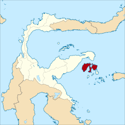 Location within Central Sulawesi | |
| Coordinates: 1°24′31″S 123°12′23″E / 1.408619°S 123.206363°ECoordinates: 1°24′31″S 123°12′23″E / 1.408619°S 123.206363°E | |
| Country | Indonesia |
| Region | Sulawesi |
| Province | Central Sulawesi |
| Capital | |
| Government | |
| • In Order Regent | Rais D. Adam |
| Area | |
| • Total | 2,488.79 km2 (960.93 sq mi) |
| Population (2020 Census)[1] | |
| • Total | 120,142 |
| • Density | 48/km2 (130/sq mi) |
| Time zone | UTC+8 (ICST) |
| Area code | (+62) 462 |
| Website | banggaikep |


The Banggai Archipelago (Indonesian: Kepulauan Banggai) is a group of islands, which are located at the far eastern end of Central Sulawesi, Indonesia. It makes up a newly established regency (kabupaten) of Central Sulawesi Province of Indonesia, created by splitting the existing Banggai Regency into a new Banggai Regency situated on the mainland of Sulawesi (capital, Luwuk) and a Banggai Islands Regency then comprising the entire archipelago (with its capital at Banggai town). In December 2014 a further splitting of the Regency was the removal of seven districts (including Banggai Island itself, together with smaller islands to its southwest and southeast) to form a new Banggai Laut Regency.
The reduced Banggai Islands Regency thus comprises the main island of Peleng together with various small offshore islands. It covers an area of 2,488.79 km2 and has a population of 109,384 at the 2010 census[2] and 120,142 at the 2020 Census.[3] The archipelago is surrounded by the Banda Sea's Gulf of Tolo (Teluk Tolo), and the Molucca Sea. The (Selat Peleng) separate it from mainland Sulawesi.
Administrative Districts[]
The Banggai Islands Regency is divided into twelve districts (kecamatan), tabulated below with their areas and their populations at the 2010 Census [4] and the 2020 Census.[5] The table also includes the location of the district headquarters, the numbers of administrative villages (rural desa and urban kelurahan) and offshore islands in each district, and its postal codes.
| District Name |
Area in km2 |
Population Census 2010 |
Population Census 2020 |
Admin centre |
Number of villages |
Number of islands |
Post codes |
|---|---|---|---|---|---|---|---|
| Totikum | 155.45 | 9,869 | 10,473 | Sambiut | 11 | 4 | 94884 |
| Totikum Selatan (South Totikum) |
95.19 | 8,036 | 8,499 | Kalumbatan | 8 | - | 94887 |
| Tinangkung | 312.60 | 13,201 | 17,194 | Salakan | 11 | 52 | 94885 |
| Tinangkung Selatan (South Tinangkum) | 187.89 | 7,204 | 7,989 | Mansamat | 9 | - | 94885 (a) |
| Tinangkung Utara (North Tinangkung) | 136.65 | 7,670 | 8,694 | Batulombo | 6 | - | 94886 |
| Liang | 176.19 | 3,076 | 8,531 | Liang | 16 | 65 | 94883 |
| Peling Tengah (Central Peling) | 140.00 | 9,244 | 10,397 | Patukuki | 11 | - | 94888 |
| Bulagi | 275.66 | 9,529 | 9,493 | Bulagi Satu | 16 | 2 | 94882 (b) |
| Bulagi Selatan (South Bulagi) | 319.00 | 9,716 | 9,713 | Lolantang | 20 | 8 | 94882 |
| Bulagi Utara (North Bulagi) |
318.00 | 8,890 | 9,640 | Sambulangan | 12 | - | 94889 |
| Buko | 184.84 | 9,376 | 9,880 | Tabata | 13 | 21 | 94881 |
| Buko Selatan (South Buko) | 187.32 | 7,881 | 8,649 | Lumbi-lumbia | 11 | - | 94880 |
| Totals | 2,488.79 | 109,384 | 120,142 | 144 | 224 |
Transportation[]
Merpati Nusantara Airlines served the islands from Palu (the capital of Central Sulawesi Province).[citation needed] There is also a bus service via Luwuk and thence by boat or ship to Banggai.
Endangered Banggai cardinalfish[]
The Banggai Islands are home to the Banggai cardinalfish, a small endemic tropical cardinal fish with a big mouth which can be found at least in 10 locations.[6]
Climate[]
Salakan has a tropical rainforest climate (Af) with moderate rainfall from August to January and heavy rainfall from February to July.
| hideClimate data for Salakan | |||||||||||||
|---|---|---|---|---|---|---|---|---|---|---|---|---|---|
| Month | Jan | Feb | Mar | Apr | May | Jun | Jul | Aug | Sep | Oct | Nov | Dec | Year |
| Average high °C (°F) | 30.8 (87.4) |
30.8 (87.4) |
31.0 (87.8) |
31.3 (88.3) |
31.0 (87.8) |
30.5 (86.9) |
30.1 (86.2) |
30.7 (87.3) |
31.4 (88.5) |
31.9 (89.4) |
32.2 (90.0) |
31.3 (88.3) |
31.1 (87.9) |
| Daily mean °C (°F) | 26.9 (80.4) |
26.9 (80.4) |
27.0 (80.6) |
27.3 (81.1) |
27.2 (81.0) |
26.9 (80.4) |
26.4 (79.5) |
26.6 (79.9) |
26.8 (80.2) |
27.1 (80.8) |
27.8 (82.0) |
27.2 (81.0) |
27.0 (80.6) |
| Average low °C (°F) | 23.0 (73.4) |
23.0 (73.4) |
23.1 (73.6) |
23.3 (73.9) |
23.5 (74.3) |
23.3 (73.9) |
22.7 (72.9) |
22.5 (72.5) |
22.3 (72.1) |
22.4 (72.3) |
23.4 (74.1) |
23.2 (73.8) |
23.0 (73.4) |
| Average rainfall mm (inches) | 114 (4.5) |
135 (5.3) |
172 (6.8) |
203 (8.0) |
219 (8.6) |
266 (10.5) |
192 (7.6) |
117 (4.6) |
79 (3.1) |
71 (2.8) |
88 (3.5) |
94 (3.7) |
1,750 (69) |
| Source: Climate-Data.org[7] | |||||||||||||
References[]
- ^ Badan Pusat Statistik, Jakarta, 2021.
- ^ Biro Pusat Statistik, Jakarta, 2011.
- ^ Badan Pusat Statistik, Jakarta, 2021.
- ^ Biro Pusat Statistik, Jakarta, 2011.
- ^ Badan Pusat Statistik, Jakarta, 2021.
- ^ "Banggai Kepulauan". March 24, 2013.
- ^ "Climate: Salakan". Climate-Data.org. Retrieved 19 November 2020.
| show Regencies and cities of Central Sulawesi |
|---|
| show Authority control |
|---|
This Central Sulawesi location article is a stub. You can help Wikipedia by . |
- Banggai Islands Regency
- Sulawesi geography stubs