Tolitoli Regency
Tolitoli Regency
Kabupaten Tolitoli | |
|---|---|
 Coat of arms | |
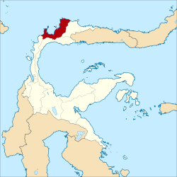 Location within Central Sulawesi | |
| Coordinates: 1°02′19″N 120°49′04″E / 1.03861°N 120.81778°E | |
| Country | Indonesia |
| Province | Central Sulawesi |
| Capital | |
| Government | |
| • Regent | Mohammad Saleh Bantilan |
| • Vice Regent | Abdul Rahman |
| Area | |
| • Total | 4,079.77 km2 (1,575.21 sq mi) |
| Population (2020 Census)[1] | |
| • Total | 225,154 |
| • Density | 55/km2 (140/sq mi) |
| Time zone | UTC+8 (ICST) |
| Area code | (+62) 453 |
| Website | tolitolikab |


Tolitoli Regency is a regency of Central Sulawesi Province of Indonesia. It covers an area of 4,079.77 km2 and had a population of 211,296 at the 2010 Census[2] and 225,154 at the 2020 Census.[3] The principal town lies at , a port on the coast of Baolan District.
Administrative Districts[]
The Tolitoli Regency was divided at 2020 into ten districts (kecamatan), which are tabulated below with their areas and their populations at the 2010 Census[4] and the 2020 Census.[5] The table also includes the location of the district administrative centres, and the number of administrative villages (rural desa and urban kelurahan) in each district.
| Name | Area in km2 |
Pop'n Census 2010 |
Pop'n Census 2020 |
Admin centre |
No. of villages |
|---|---|---|---|---|---|
| (South Dampal) |
392.67 | 21,394 | 21,620 | Bangkir | 13 |
| (North Dampal) |
182.88 | 14,390 | 13,900 | Ogotua | 12 |
| 542.50 | 21,358 | 22,650 | Tinabogan | 16 | |
| 412.13 | 11,682 | 12,270 | Bib | 11 | |
| 441.30 | 10,458 | 10,750 | Kayulompa | 10 | |
| 258.03 | 63,072 | 67,600 | Baru | 10 | |
| 626.00 | 11,875 | 12,850 | Sibea | 10 | |
| 597.76 | 31,701 | 35,720 | Lalos | 14 | |
| (North Toli-Toli) |
405.50 | 16,940 | 18,180 | Laulalang | 10 |
| 221.00 | 8,426 | 9,630 | Galumpang | 4 | |
| Totals | 4,079.77 | 211,296 | 225,154 | Tolitoli | 110 |
Climate[]
Tolitoli has a tropical rainforest climate (Af) with moderate rainfall in March and April and heavy rainfall in the remaining months.
| hideClimate data for Tolitoli | |||||||||||||
|---|---|---|---|---|---|---|---|---|---|---|---|---|---|
| Month | Jan | Feb | Mar | Apr | May | Jun | Jul | Aug | Sep | Oct | Nov | Dec | Year |
| Average high °C (°F) | 30.5 (86.9) |
30.6 (87.1) |
30.9 (87.6) |
31.2 (88.2) |
31.4 (88.5) |
30.8 (87.4) |
30.4 (86.7) |
31.3 (88.3) |
31.5 (88.7) |
32.2 (90.0) |
31.6 (88.9) |
31.1 (88.0) |
31.1 (88.0) |
| Daily mean °C (°F) | 26.6 (79.9) |
26.7 (80.1) |
26.9 (80.4) |
27.0 (80.6) |
27.4 (81.3) |
26.8 (80.2) |
26.4 (79.5) |
27.0 (80.6) |
26.9 (80.4) |
27.5 (81.5) |
27.2 (81.0) |
27.1 (80.8) |
27.0 (80.5) |
| Average low °C (°F) | 22.7 (72.9) |
22.8 (73.0) |
22.9 (73.2) |
22.9 (73.2) |
23.4 (74.1) |
22.9 (73.2) |
22.4 (72.3) |
22.7 (72.9) |
22.4 (72.3) |
22.8 (73.0) |
22.9 (73.2) |
23.1 (73.6) |
22.8 (73.1) |
| Average rainfall mm (inches) | 256 (10.1) |
169 (6.7) |
108 (4.3) |
117 (4.6) |
174 (6.9) |
194 (7.6) |
274 (10.8) |
166 (6.5) |
154 (6.1) |
164 (6.5) |
194 (7.6) |
177 (7.0) |
2,147 (84.7) |
| Source: Climate-Data.org[6] | |||||||||||||
References[]
External links[]
- (in Indonesian) Local Government of Tolitoli Regency
| show Regencies and cities of Central Sulawesi |
|---|
| show Authority control |
|---|
Coordinates: 1°02′19″N 120°49′04″E / 1.03861°N 120.81778°E
This Central Sulawesi location article is a stub. You can help Wikipedia by . |
- Regencies of Central Sulawesi
- Sulawesi geography stubs