Bansud
Bansud | |
|---|---|
| Municipality of Bansud | |
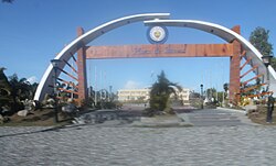 Municipal grounds | |
 Seal | |
 Map of Oriental Mindoro with Bansud highlighted | |
OpenStreetMap  | |
 Bansud Location within the Philippines | |
| Coordinates: 12°50′00″N 121°22′00″E / 12.83333°N 121.36667°ECoordinates: 12°50′00″N 121°22′00″E / 12.83333°N 121.36667°E | |
| Country | Philippines |
| Region | Mimaropa |
| Province | Oriental Mindoro |
| District | 2nd district |
| Barangays | 13 (see Barangays) |
| Government | |
| • Type | Sangguniang Bayan |
| • Mayor | Ronaldo M. Morada |
| • Vice Mayor | Rico B. Tolentino |
| • Representative | Alfonso V. Umali Jr. |
| • Electorate | 25,190 voters (2019) |
| Area | |
| • Total | 343.47 km2 (132.61 sq mi) |
| Elevation | 21 m (69 ft) |
| Highest elevation | 123 m (404 ft) |
| Lowest elevation | 0 m (0 ft) |
| Population (2020 census) [3] | |
| • Total | 42,671 |
| • Density | 120/km2 (320/sq mi) |
| • Households | 9,144 |
| Economy | |
| • Income class | 2nd municipal income class |
| • Poverty incidence | 26.61% (2015)[4] |
| • Revenue | ₱200,593,061.87 (2020) |
| • Assets | ₱281,781,087.75 (2020) |
| • Expenditure | ₱152,977,196.89 (2020) |
| • Liabilities | ₱65,031,713.00 (2020) |
| Service provider | |
| • Electricity | Oriental Mindoro Electric Cooperative (ORMECO) |
| Time zone | UTC+8 (PST) |
| ZIP code | 5210 |
| PSGC | |
| IDD : area code | +63 (0)43 |
| Native languages | Romblomanon Tagalog |
| Website | www |

Bansud, officially the Municipality of Bansud (Tagalog: Bayan ng Bansud), is a 2nd class municipality in the province of Oriental Mindoro, Philippines. According to the 2020 census, it has a population of 42,671 people. [3]
Etymology[]
The name of the town is said to be derived from a legend. The legend says that long ago the Mangyans, the aborigines of the Mindoro settled in the lands near the mouth of Bansud River, which they called “Basud” which means Delta. The delta provided fertile soil for the people; hence they lived there peacefully and productively until the time that settlers from the province of Marinduque and Visayan Islands moved in. In many years that followed, the word “Basud” was eventually changed to Bansud.
Geography[]
Bansud is 90 kilometres (56 mi) from Calapan.
Barangays[]
Bansud is politically subdivided into 13 barangays.
- Alcadesma
- Bato
- Conrazon
- Malo
- Manihala
- Pag-asa
- Poblacion
- Proper Bansud
- Rosacara
- Salcedo
- Sumagui
- Proper Tiguisan
- Villa Pag-Asa
Climate[]
| Climate data for Bansud, Oriental Mindoro | |||||||||||||
|---|---|---|---|---|---|---|---|---|---|---|---|---|---|
| Month | Jan | Feb | Mar | Apr | May | Jun | Jul | Aug | Sep | Oct | Nov | Dec | Year |
| Average high °C (°F) | 26 (79) |
28 (82) |
29 (84) |
31 (88) |
31 (88) |
30 (86) |
29 (84) |
29 (84) |
29 (84) |
29 (84) |
28 (82) |
27 (81) |
29 (84) |
| Average low °C (°F) | 22 (72) |
22 (72) |
22 (72) |
23 (73) |
25 (77) |
25 (77) |
25 (77) |
25 (77) |
25 (77) |
24 (75) |
23 (73) |
23 (73) |
24 (75) |
| Average precipitation mm (inches) | 115 (4.5) |
66 (2.6) |
55 (2.2) |
39 (1.5) |
164 (6.5) |
282 (11.1) |
326 (12.8) |
317 (12.5) |
318 (12.5) |
192 (7.6) |
119 (4.7) |
173 (6.8) |
2,166 (85.3) |
| Average rainy days | 13.6 | 9.4 | 10.4 | 10.5 | 21.1 | 26.0 | 29.0 | 27.6 | 27.5 | 23.1 | 16.7 | 16.1 | 231 |
| Source: Meteoblue [5] | |||||||||||||
Demographics[]
| Year | Pop. | ±% p.a. |
|---|---|---|
| 1960 | 10,935 | — |
| 1970 | 17,492 | +4.80% |
| 1975 | 20,095 | +2.82% |
| 1980 | 22,614 | +2.39% |
| 1990 | 26,225 | +1.49% |
| 1995 | 31,901 | +3.74% |
| 2000 | 35,032 | +2.03% |
| 2007 | 35,664 | +0.25% |
| 2010 | 38,341 | +2.67% |
| 2015 | 40,992 | +1.28% |
| 2020 | 42,671 | +0.79% |
| Source: Philippine Statistics Authority [6] [7] [8][9] | ||
Economy[]
| Poverty Incidence of Bansud | |
| Source: Philippine Statistics Authority[10][11][12][13][14][15] | |
References[]
- ^ Municipality of Bansud | (DILG)
- ^ "2015 Census of Population, Report No. 3 – Population, Land Area, and Population Density" (PDF). Philippine Statistics Authority. Quezon City, Philippines. August 2016. ISSN 0117-1453. Archived (PDF) from the original on May 25, 2021. Retrieved July 16, 2021.
- ^ a b Census of Population (2020). "MIMAROPA". Total Population by Province, City, Municipality and Barangay. PSA. Retrieved 8 July 2021.
- ^ https://psa.gov.ph/sites/default/files/City%20and%20Municipal-level%20Small%20Area%20Poverty%20Estimates_%202009%2C%202012%20and%202015_0.xlsx; publication date: 10 July 2019; publisher: Philippine Statistics Authority.
- ^ "Bansud: Average Temperatures and Rainfall". Meteoblue. Retrieved 27 April 2020.
- ^ Census of Population (2015). "Region IV-B (Mimaropa)". Total Population by Province, City, Municipality and Barangay. PSA. Retrieved 20 June 2016.
- ^ Census of Population and Housing (2010). "Region IV-B (Mimaropa)". Total Population by Province, City, Municipality and Barangay. NSO. Retrieved 29 June 2016.
- ^ Censuses of Population (1903–2007). "Region IV-B (Mimaropa)". Table 1. Population Enumerated in Various Censuses by Province/Highly Urbanized City: 1903 to 2007. NSO.
- ^ "Province of Oriental Mindoro". Municipality Population Data. Local Water Utilities Administration Research Division. Retrieved 17 December 2016.
- ^ "Poverty incidence (PI):". Philippine Statistics Authority. Retrieved 28 December 2020.
- ^ https://psa.gov.ph/sites/default/files/NSCB_LocalPovertyPhilippines_0.pdf; publication date: 29 November 2005; publisher: Philippine Statistics Authority.
- ^ https://psa.gov.ph/sites/default/files/2003%20SAE%20of%20poverty%20%28Full%20Report%29_1.pdf; publication date: 23 March 2009; publisher: Philippine Statistics Authority.
- ^ https://psa.gov.ph/sites/default/files/2006%20and%202009%20City%20and%20Municipal%20Level%20Poverty%20Estimates_0_1.pdf; publication date: 3 August 2012; publisher: Philippine Statistics Authority.
- ^ https://psa.gov.ph/sites/default/files/2012%20Municipal%20and%20City%20Level%20Poverty%20Estima7tes%20Publication%20%281%29.pdf; publication date: 31 May 2016; publisher: Philippine Statistics Authority.
- ^ https://psa.gov.ph/sites/default/files/City%20and%20Municipal-level%20Small%20Area%20Poverty%20Estimates_%202009%2C%202012%20and%202015_0.xlsx; publication date: 10 July 2019; publisher: Philippine Statistics Authority.
External links[]
- Bansud Profile at PhilAtlas.com
- Philippine Standard Geographic Code
- Philippine Census Information
- Local Governance Performance Management System
Places adjacent to Bansud | ||||||||||||||||
|---|---|---|---|---|---|---|---|---|---|---|---|---|---|---|---|---|
| ||||||||||||||||
Calapan (capital) | |
| Municipalities | |
| Component city | |
- Municipalities of Oriental Mindoro