Oriental Mindoro
Oriental Mindoro | |
|---|---|
| Province of Oriental Mindoro | |
 Flag  Seal | |
| Anthem: Martsa ng Silangang Mindoro (Oriental Mindoro March) | |
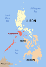
 Location in the Philippines | |
show OpenStreetMap | |
| Coordinates: 13°00′N 121°25′E / 13°N 121.42°ECoordinates: 13°00′N 121°25′E / 13°N 121.42°E | |
| Country | Philippines |
| Region | Mimaropa |
| Founded | November 15, 1950[1] |
| Capital | Calapan |
| Government | |
| • Type | Sangguniang Panlalawigan |
| • Governor | Humerlito "Bonz" A. Dolor (PDP–Laban) |
| • Vice Governor | Antonio “CA Jojo” S. Perez Jr. (PDP–Laban) |
| Area | |
| • Total | 4,238.38 km2 (1,636.45 sq mi) |
| Area rank | 28th out of 81 |
| Highest elevation | 2,616 m (8,583 ft) |
| Population (2020 census) [3] | |
| • Total | 908,339 |
| • Rank | 32nd out of 81 |
| • Density | 210/km2 (560/sq mi) |
| • Density rank | 47th out of 81 |
| Divisions | |
| • Independent cities | 0 |
| • Component cities | show
1 |
| • Municipalities | show
14 |
| • Barangays | 426 |
| • Districts | 1st and 2nd districts of Oriental Mindoro |
| Time zone | UTC+8 (PHT) |
| ZIP code | 5200–5214 |
| IDD : area code | +63 (0)43 |
| ISO 3166 code | PH-MDR |
| Spoken languages |
|
| Website | www |


Oriental Mindoro (Tagalog: Silangang Mindoro: Ilocano: Amianan nga Mindoro; Hiligaynon: Sidlanganong Mindoro; Spanish: Mindoro Oriental) is a province in the Philippines located on the island of Mindoro under Mimaropa region in Luzon, about 140 kilometres (87 mi) southwest of Manila. The province is bordered by the Verde Island Passage and the rest of Batangas to the north, by Marinduque, Maestre de Campo (or known as Sibale but official name is Concepcion) Island, Tablas Strait and the rest of Romblon to the east, by Semirara and the rest of Caluya Islands, Antique to the south, and by Occidental Mindoro to the west. Calapan, the only city in the island, is the provincial capital.
Oriental Mindoro is touted as the country's emerging eco-tourism destination. In 2005, the Philippines was found to be the center of marine fish biodiversity and the home of the most diverse marine ecosystem in the world,[4] by American biologists Kent Carpenter and Victor Springer. Most of the endemic species in the Philippines are found in the Verde Island Passage between Mindoro island and the main island of Luzon. The passage houses 2,983 individual species of algae, corals, crustaceans, mollusks, fishes, marine reptiles, and marine mammals, based on a study conducted by Carpenter and Springer in 2005.
UNESCO declared Puerto Galera a biosphere reserve[5] under its Man and the Biosphere Programme in the 1970s. The Verde Island Passage is at the apex of the so-called Coral Triangle – the Philippines, Indonesia, and Malaysia – which has the distinction of being the "center of the center of the world's marine biodiversity" and the "center of the center of marine shorefish biodiversity".
History[]
This section needs expansion. You can help by . (June 2016) |
World War II[]
A Japanese force landed on northeastern Mindoro in the Philippine Islands on 27 February 1942.
Almost three years later, after the invasion of Mindoro by Allied forces, they proceeded to land to Bongabong and heading to and capturing Calapan, the capital of the united Mindoro Province at the time on 24 January 1945.
Creation[]
After World War II, reconstruction and rehabilitation of infrastructure and economy took place on the island, which then constituted a single province. This was partitioned on 13 June 1950 into Oriental Mindoro and Occidental Mindoro by virtue of Republic Act No. 505.[6]
In the decades after the War, Mindoro attracted settlers from overpopulated provinces in the Philippines. Apart from the hope to become landowners or to have better tenancy conditions, the Hukbalahap Rebellion in Central Luzon was an important factor for migration. Under the settlement program of the National Resettlement and Rehabilitation Administration (NARRA) founded in 1954, families from Central Luzon were settled in the Bongabong-Pinamalayan area. This project ended in 1956 after 606 families (3,636 people) were settled on 8,600 hectares (21,000 acres) of public land. Since then, new settlers continue to migrate to Mindoro until today.
Armed conflict[]
The island currently sees an ongoing conflict between the Armed Forces of the Philippines and insurgents. On March 6, 2010, eleven soldiers were killed and seven were hurt in a gun battle with the New People's Army in Mansalay, Oriental Mindoro.[7]
Geography[]

Oriental Mindoro covers a total area of 4,238.38 square kilometres (1,636.45 sq mi)[8] occupying the eastern section of Mindoro island in Mimaropa region. The province is bordered by the Verde Island Passage to the north, by Marinduque, Maestre de Campo, Tablas Strait and the rest of Romblon to the east, by Semirara and the rest of Caluya Islands, Antique to the south, and by Occidental Mindoro to the west.
The western portion of the province is mountainous or rugged, while the east has hills and flood plains. Mount Halcon, standing 2,582 metres (8,471 ft) above sea level, is the 18th highest mountain in the country and is the province's and island's highest peak. Lake Naujan, the fifth largest lake in the country with an area of approximately 8,125 hectares (20,080 acres) of open water, is located at the northeastern part of the island and the province.
Administrative divisions[]
Oriental Mindoro comprises 14 municipalities, with one city, Calapan serving as the provincial capital.
- † Provincial capital and component city
- Municipality
| ||||||||||||||||||||||||||||||||||||||||||||||||||||||||||||||||||||||||||||||||||||||||||||||||||||||||||||||||||||||||||||||||||||||||||||||||||||||||||||||||||||||||||||||||||||||||||||||||||||||||||||||||||||||||||||||||||||||||||||||||
Climate[]
Oriental Mindoro has no distinct wet or dry season. Average temperature ranges from 28 to 32 °C (82 to 90 °F). The province experiences maximum rainfall during the months of June to September. Relative humidity is registered at 87%.[11]
Demographics[]
| Year | Pop. | ±% p.a. |
|---|---|---|
| 1903 | 26,359 | — |
| 1918 | 43,738 | +3.43% |
| 1939 | 92,530 | +3.63% |
| 1948 | 124,556 | +3.36% |
| 1960 | 228,998 | +5.20% |
| 1970 | 328,364 | +3.67% |
| 1975 | 388,744 | +3.44% |
| 1980 | 446,938 | +2.83% |
| 1990 | 550,049 | +2.10% |
| 1995 | 608,616 | +1.91% |
| 2000 | 681,818 | +2.46% |
| 2007 | 735,769 | +1.06% |
| 2010 | 785,602 | +2.41% |
| 2015 | 844,059 | +1.38% |
| 2020 | 908,339 | +1.45% |
| Source: Philippine Statistics Authority [9] [10] [12][13] | ||
The population of Oriental Mindoro in the 2020 census was 908,339 people, [3] with a density of 210 inhabitants per square kilometre or 540 inhabitants per square mile.
The province is largely rural, with 70% of the population engaged in agriculture and fishing and with only 30% living in urban centers. Tagalog is widely spoken in the province. Other languages spoken are Ilocano and Visayan. Dialects of the Mangyan language are Arayan, Alagnan, Buhid, Hanunoo, and Tadyawan.[14] Because of the RORO trips coming from Caticlan, a few people from the southern part can understand Hiligaynon.
Religion[]
A very large portion of the population are of Roman Catholic conviction (81%).[15] Other Christian and Islamic belief constitute most of the remaining religious affiliation in the province. Other populations practice Anitism, animism, or atheism.
Indigenous people[]
The indigenous people of Oriental Mindoro are the Mangyans (Manguianes in Spanish, Mañguianes in Old Tagalog), consisting of seven distinct tribes. They occupy the interior, specially the highlands. Mangyans have inhabited the island since pre-history. They are believed to have originally traveled from Indonesia and settled down for good in the island.
Economy[]
Oriental Mindoro's rich and arable land is suitable for agriculture. It produces large quantities of rice, corn, coconut, vegetables and fruits like calamansi, banana, rambutan, marang or uloy, lanzones and durian. For that, Oriental Mindoro is also known as the Rice Granary and Fruit Basket of Southern Tagalog. It still is the Banana King and Calamansi King of the region. Its total agricultural area is 169,603.34 hectares (419,099.0 acres). Based on agricultural statistics, 85,244 hectares (210,640 acres) are devoted to palay production while 21,671 hectares (53,550 acres)s to coconut plantation. For 2019, the province has been one of the top producers of rice becoming a source of rice for the National Food Authority's rice procurement target.[23]
Tourist attractions[]
This section is written like a travel guide rather than an encyclopedic description of the subject. (May 2016) |

Access from Luzon via the Batangas ports mostly goes through the Verde Island Passage to reach Puerto Galera, the key entry point to Oriental Mindoro. In November 2004, Puerto Galera was voted a member of the UNESCO-affiliated ‘The Club of the Most Beautiful Bays in the World. Puerto Galera features a natural harbor which also protects ships, yachts and bancas from strong typhoons sweeping in from the Pacific.
Puerto Galera, known for white sand beaches and the accompanying honky tonk bar scene on some key beaches, is known for its dive sites with a biodiversity of marine life in and around the coral reefs. Underwater rock formations and coral gardens are home to a variety of marine life, which include numerous species of nudibranch, mantis shrimp, sea anemone, moray and sea fan sea horses. The seas off the coast are host to passing dolphin pods and even the rarer whale shark, and are part of the migratory small whale route from the Visayas.
Towering 8,488 feet (2,587 m) above sea level, Mount Halcon in Baco, is a popular mountain climbing destination. Local and migratory birds allow birdwatching activities. The province is home to endemic wildlife like the tamaraw, a straight-horned water buffalo.
Other tourist destinations include:
Hidden Paradise[]
The attraction consists of a natural spring with a swimming pool and picnic cottages. It is located in Baco, and can be reached in 45 minutes by taking a jeepney bound for the Calapan market.
Alibatan Island[]
The island measures 5 ha and is noted for its white sand. The place serves as the breeding place of seagulls and turtles. Corals and oysters can be found all around the area. The island is also called "Target Island" because Americans used the island for bombing practice in 1946. It is located in Baco, and can be reached in an hour through a motorized banca from the market square.
Buyayao Island[]
It is a rocky island, except for the area facing Buyayao Peninsula. Big snakes called "sobre kama" are found in the mountains. The water around the island is suitable for deep-sea fishing. It is located off the coast of Mansalay, and can be reached in 30 minutes by motorized banca from Mansalay market.
Suqui Beach[]
This is a public beach with cottages and other facilities. It is a favorite place for the local people, especially during the summer. It is located in Suqui, Calapan, and can be reached in 15 minutes by taking a tricycle from the town proper.
Banilad Beach[]
The place is a good spot for picnicking and swimming, especially during the summer. It is located in Pili, Pinamalayan, and can be reached by taking a jeepney to the port of Barangay Wawa, then an hour's ride by motorized banca to the beach.
Bongol Beach[]
It is a secluded beach, with a 2-kilometre (1.2 mi) white sand beach. It is located in Bongol, Pinamalayan, and can be reached in two hours by boarding a Bongol-bound jeepney from the town proper of Pinamalayan and then a tricycle to the beach area.
Tamaraw Falls[]
The 423-foot (129 m) waterfalls, situated alongside the road, is actually a series of asymmetrical falls, leading to the grand one, dropping to a frothy waterbed below. The cascading waterfalls are a great attraction to passers-by. Tamaraw Falls is located in Barangay Villaflor, Puerto Galera. It can be reached in two hours by taking a jeepney bound for Barangay Villaflor from Puerto Galera, or Calapan.
La Laguna Beach[]
An ideal place for swimming, snorkeling, and scuba diving. There are a number of resorts that offer accommodation and other travel and aqua sports facilities to both domestic and international tourists. It is located in La Laguna, Puerto Galera, and can be reached in 30 minutes from the town proper of Puerto Galera by taking a jeepney bound for La Laguna.
Sabang Beach[]
This area is ideal for swimming, snorkeling, and scuba diving. A cluster of nightspots abound in this area, which make it popular for evening socials. Cottages with entertainment facilities stand close to each other. Low-budget accommodations are available. It is located east of Puerto Galera, and can be reached in 15 minutes from the Puerto Galera pier by taking a jeepney or an outrigger banca.
Small La Laguna[]
Contrary to its name, Small La Laguna is bigger than La Laguna, and has more facilities. It has coral reefs, and its water is ideal for snorkeling and scuba diving. There are diving equipment for rent at nearby dive shops. It is located beside Sabang Beach, and can be reached in 20 minutes from the pier by taking a jeepney bound for Sabang.
Talipanan Beach[]
This area is not as busy as the other beaches in Puerto Galera. Thus, it is an ideal site for private swimming. It is located in Puerto Galera, and can be reached in 40 minutes by taking a jeepney or an outrigger boat from the town pier.
White Sand Beach[]
The white sandy strips of this beach offer excellent opportunities for swimming. Resorts in this area provide entertainment facilities for tourists' greater amusement and leisure. It is located in Barangay San Isidro, Puerto Galera, and is accessible in 30 minutes from the town proper by a jeepney or a boat.
Punta Guarda Beach[]
This beach is far from the busy areas of Puerto Galera; thus, it is ideal for those who seek privacy and retreat. It is located in Puerto Galera, Oriental Mindoro, and can be reached by taking a 10-minute jeepney ride from the town proper, to about one kilometer on the beach mark. The remaining distance is covered on foot.
Melco Beach[]
It is a beige-colored sandy beach with cottages for rent. It is located in Roxas, Oriental Mindoro, and can be reached in 10 minutes by a banca from the pier.
Education[]
This section reads like a directory. (September 2018) |
Higher education institutions in the province:[24]
- Abada College
- ACMCL College
- AMA CLC College of Calapan (ACLC College)
- Baco Community College
- Clarendon College
- CLCC Institute of Computer, Arts & Technology
- Dalubhasaan ng Lungsod ng Calapan (City College of Calapan)
- Divine Word College of Calapan
- Eastern Mindoro College
- Eastern Mindoro Institute of Technology and Sciences
- Erhard Science and Technological Institute - Oriental Mindoro Inc.
- Filipino Academy of Scientific Trades
- Grace Mission College
- Innovative College Of Science in Information Technology
- IATEC Computer College
- Institute of Business Science and Medical Arts
- John Paul College
- Luna Goco Colleges
- Mindoro State College of Agriculture and Technology
- Mindoro Bible College
- Paradigm College of Science and Technology
- Pinamalayan Maritime Foundation and Technological College, Inc.
- Polytechnic University of the Philippines - Bansud
- Prince of Peace College
- Southwestern Institute of Business and Technology
- Southwestern Maritime Institute Foundation
- Saint Augustine Seminary
- Simeon Suan Vocational and Technical college
- St. Anthony College Calapan City
References[]
- ^ "FIXING THE DATE OF EFFECTIVITY OF REPUBLIC ACT NO. 505 ENTITLED "AN ACT TO CREATE THE PROVINCES OF ORIENTAL MINDORO AND OCCIDENTAL MINDORO."". Official Gazzette of the Republic of the Philippines | The Official Gazzette is the official journal of the Republic of the Philippines. Edited at the Office of the President of the Philippines Under Commonweath Act No. 638. Retrieved May 14, 2021.
- ^ "List of Provinces". PSGC Interactive. Makati City, Philippines: National Statistical Coordination Board. Archived from the original on January 11, 2013. Retrieved 29 October 2012.
- ^ Jump up to: a b Census of Population (2020). Highlights of the Philippine Population 2020 Census of Population. PSA. Retrieved 8 July 2021.
- ^ "Carpenter, Kent; Springer, Victor, "The center of the center of marine shore fish biodiversity: the Philippine Islands", Environmental Biology of Fishes, Volume 72, Number 4, April 2005, pp. 467-480(14)".
- ^ "Puerto Galera Biosphere Reserve".
- ^ "Republic Act No. 505 - An Act to Create the Provinces of Oriental Mindoro and Occidental Mindoro". Chan Robles Virtual Law Library. 13 June 1950. Retrieved 16 April 2016.
- ^ http://www.gmanetwork.com/news/story/185470/news/regions/11-soldiers-killed-7-others-hurt-in-npa-ambush-in-oriental-mindoro
- ^ Jump up to: a b c "Province: Oriental Mindoro". PSGC Interactive. Quezon City, Philippines: Philippine Statistics Authority. Retrieved 8 January 2016.
- ^ Jump up to: a b Census of Population (2015). Highlights of the Philippine Population 2015 Census of Population. PSA. Retrieved 20 June 2016.
- ^ Jump up to: a b Census of Population and Housing (2010). Population and Annual Growth Rates for The Philippines and Its Regions, Provinces, and Highly Urbanized Cities (PDF). NSO. Retrieved 29 June 2016.
- ^ "Climate & Weather Averages in Province of Mindoro Oriental, Philippines". www.timeanddate.com. Retrieved 2019-07-29.
- ^ Census of Population and Housing (2010). "Region IV-B (Mimaropa)". Total Population by Province, City, Municipality and Barangay. NSO. Retrieved 29 June 2016.
- ^ "Census 2000; Population and Housing; Region V" (PDF). Philippine Statistics Authority (Philippine Statistics Authority - Region V). Retrieved 29 June 2016.
- ^ http://www.mangyan.org/content/mangyan-groups
- ^ "Oriental Mindoro Statistical Tables". Philippine Statistics Authority. 2015. Archived from the original (XLS) on July 29, 2019. Retrieved July 29, 2019.
- ^ "Poverty incidence (PI):". Philippine Statistics Authority. Retrieved 28 December 2020.
- ^ https://psa.gov.ph/sites/default/files/NSCB_LocalPovertyPhilippines_0.pdf; publication date: 29 November 2005; publisher: Philippine Statistics Authority.
- ^ https://psa.gov.ph/sites/default/files/2009%20Poverty%20Statistics.pdf; publication date: 8 February 2011; publisher: Philippine Statistics Authority.
- ^ https://psa.gov.ph/sites/default/files/Table%202.%20%20Annual%20Per%20Capita%20Poverty%20Threshold%2C%20Poverty%20Incidence%20and%20Magnitude%20of%20Poor%20Population%2C%20by%20Region%20and%20Province%20%20-%202006%2C%202009%2C%202012%20and%202015.xlsx; publication date: 27 August 2016; publisher: Philippine Statistics Authority.
- ^ https://psa.gov.ph/sites/default/files/Table%202.%20%20Annual%20Per%20Capita%20Poverty%20Threshold%2C%20Poverty%20Incidence%20and%20Magnitude%20of%20Poor%20Population%2C%20by%20Region%20and%20Province%20%20-%202006%2C%202009%2C%202012%20and%202015.xlsx; publication date: 27 August 2016; publisher: Philippine Statistics Authority.
- ^ https://psa.gov.ph/sites/default/files/Table%202.%20%20Annual%20Per%20Capita%20Poverty%20Threshold%2C%20Poverty%20Incidence%20and%20Magnitude%20of%20Poor%20Population%2C%20by%20Region%20and%20Province%20%20-%202006%2C%202009%2C%202012%20and%202015.xlsx; publication date: 27 August 2016; publisher: Philippine Statistics Authority.
- ^ https://psa.gov.ph/sites/default/files/Table%202.%20%20Updated%20Annual%20Per%20Capita%20Poverty%20Threshold%2C%20Poverty%20Incidence%20and%20Magnitude%20of%20Poor%20Population%20with%20Measures%20of%20Precision%2C%20by%20Region%20and%20Province_2015%20and%202018.xlsx; publication date: 4 June 2020; publisher: Philippine Statistics Authority.
- ^ "NFA SURPASSES TARGET, TOPS 5M MARK IN PALAY PROCUREMENT - National Food Authority". National Food Authority. July 29, 2019. Archived from the original on July 29, 2019. Retrieved 2019-07-29.
- ^ http://www.ched.gov.ph/chedwww/index.php/eng/Information/List-of-Higher-Education-Institutions-HEIs/REGION-IVB
External links[]
 Media related to Oriental Mindoro at Wikimedia Commons
 Geographic data related to Oriental Mindoro at OpenStreetMap
- Local Governance Performance Management System
- Bird Watching Philippines
| show Places adjacent to Oriental Mindoro |
|---|
| hide | |
|---|---|
Calapan (capital) | |
| Municipalities | |
| Component city |
|

| show Authority control |
|---|
- Oriental Mindoro
- Provinces of the Philippines
- Mindoro
- Mimaropa
- States and territories established in 1950
- 1950 establishments in the Philippines