Barnston West, Quebec
Barnston West | |
|---|---|
Municipality | |
| Barnston-Ouest | |
 Municipal office | |
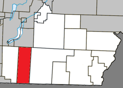 Location within Coaticook RCM | |
 Barnston-Ouest Location in southern Quebec | |
| Coordinates: 45°06′N 71°58′W / 45.100°N 71.967°WCoordinates: 45°06′N 71°58′W / 45.100°N 71.967°W[1] | |
| Country | Canada |
| Province | Quebec |
| Region | Estrie |
| RCM | Coaticook |
| Constituted | January 1, 1946 |
| Government | |
| • Mayor | Johnny Piszar |
| • Federal riding | Compton—Stanstead |
| • Prov. riding | Saint-François |
| Area | |
| • Total | 100.10 km2 (38.65 sq mi) |
| • Land | 100.85 km2 (38.94 sq mi) |
| There is an apparent contradiction between two authoritative sources | |
| Population | |
| • Total | 591 |
| • Density | 5.9/km2 (15/sq mi) |
| • Pop 2006-2011 | |
| • Dwellings | 282 |
| Time zone | UTC−5 (EST) |
| • Summer (DST) | UTC−4 (EDT) |
| Postal code(s) | J0B 1C0 |
| Area code(s) | 819 |
| Highways | |
| Website | www |

Barnston West (French: Barnston-Ouest) is a municipality within the Coaticook Regional County Municipality in Quebec, Canada, located on the Canada–United States border. It includes the hamlet of Ways Mills.
Demographics[]
Population[]
Population trend:[4]
| Census | Population | Change (%) |
|---|---|---|
| 2011 | 591 | |
| 2006 | 583 | |
| 2001 | 600 | |
| 1996 | 598 | |
| 1991 | 583 | N/A |
Language[]
Home language (2006)[5]
| Language | Population | Pct (%) |
|---|---|---|
| French only | 340 | 58.11% |
| English only | 245 | 41.88% |
References[]
- ^ Reference number 3554 of the Commission de toponymie du Québec (in French)
- ^ Jump up to: a b Geographic code 44045 in the official Répertoire des municipalités (in French)
- ^ Jump up to: a b "(Code 2444045) Census Profile". 2011 census. Statistics Canada. 2012.
- ^ Statistics Canada: 1996, 2001, 2006, 2011 census
- ^ 2006 Statistics Canada Community Profile: Barnston-Ouest, Quebec
External links[]
![]() Media related to Barnston-Ouest at Wikimedia Commons
Media related to Barnston-Ouest at Wikimedia Commons
| show Places adjacent to Barnston West, Quebec |
|---|
| show |
|---|
| Authority control |
|
|---|
This Quebec location article is a stub. You can help Wikipedia by . |
Categories:
- Municipalities in Quebec
- Incorporated places in Estrie
- Coaticook Regional County Municipality
- Quebec geography stubs