Batesville, Mississippi
This article needs additional citations for verification. (May 2010) |
Batesville, Mississippi | |
|---|---|
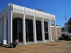 Panola County Courthouse in Batesville | |
 Location of Batesville, Mississippi | |
 Batesville Location in Mississippi | |
| Coordinates: 34°19′4″N 89°56′33″W / 34.31778°N 89.94250°WCoordinates: 34°19′4″N 89°56′33″W / 34.31778°N 89.94250°W | |
| Country | United States |
| State | Mississippi |
| County | Panola |
| Government | |
| • Type | Mayor-Counsel |
| • Mayor | Jerry Autrey |
| • Aldermen | show
List of Aldermen |
| Area | |
| • Total | 19.95 sq mi (51.67 km2) |
| • Land | 19.95 sq mi (51.67 km2) |
| • Water | 0.00 sq mi (0.00 km2) |
| Elevation | 233 ft (71 m) |
| Population | |
| • Total | 7,463 |
| • Estimate (2019)[4] | 7,218 |
| • Density | 361.79/sq mi (139.69/km2) |
| Time zone | UTC-6 (Central (CST)) |
| • Summer (DST) | UTC-5 (CDT) |
| ZIP code | 38606 |
| Area code(s) | 662 |
| FIPS code | 28-03620 |
| GNIS feature ID | 0666568 |
| Website | Official website |


Batesville is a city in Panola County, Mississippi, United States. The population was 7,463 at the 2010 census.
Batesville is one of two county seats which the legislature established for Panola County, related to a longstanding rivalry between towns on either side of the Tallahatchie River; the other is Sardis, located north of the river.
History[]
Batesville was founded in the 1850s following the construction of the Mississippi and Tennessee Railroad.[5]
Geography[]
According to the United States Census Bureau, the city has a total area of 11.1 square miles (29 km2), all land.
Demographics[]
| Historical population | |||
|---|---|---|---|
| Census | Pop. | %± | |
| 1870 | 227 | — | |
| 1880 | 442 | 94.7% | |
| 1890 | 705 | 59.5% | |
| 1900 | 556 | −21.1% | |
| 1910 | 774 | 39.2% | |
| 1920 | 1,050 | 35.7% | |
| 1930 | 1,062 | 1.1% | |
| 1940 | 1,815 | 70.9% | |
| 1950 | 2,463 | 35.7% | |
| 1960 | 3,284 | 33.3% | |
| 1970 | 3,796 | 15.6% | |
| 1980 | 5,162 | 36.0% | |
| 1990 | 6,403 | 24.0% | |
| 2000 | 7,113 | 11.1% | |
| 2010 | 7,463 | 4.9% | |
| 2019 (est.) | 7,218 | [4] | −3.3% |
| U.S. Decennial Census[6] | |||
As of the census[7] of 2000, there were 7,113 people, 2,577 households, and 1,821 families residing in the city. The population density was 638.2 people per square mile (246.3/km2). There were 2,791 housing units at an average density of 250.4 per square mile (96.6/km2). The racial makeup of the city was 56.43% White, 41.88% African American, 0.06% Native American, 0.38% Asian, 0.04% Pacific Islander, 0.82% from other races, and 0.39% from two or more races. Hispanic or Latino of any race were 1.60% of the population.
There were 2,577 households, out of which 35.7% had children under the age of 18 living with them, 44.7% were married couples living together, 21.5% had a female householder with no husband present, and 29.3% were non-families. 26.2% of all households were made up of individuals, and 12.6% had someone living alone who was 65 years of age or older. The average household size was 2.59 and the average family size was 3.14.
In the city, the population was spread out, with 28.9% under the age of 18, 11.6% from 18 to 24, 26.4% from 25 to 44, 18.6% from 45 to 64, and 14.4% who were 65 years of age or older. The median age was 33 years. For every 100 females, there were 85.9 males. For every 100 females age 18 and over, there were 78.4 males. The median income for a household in the city was $29,875, and the median income for a family was $38,849. Males had a median income of $30,998 versus $22,029 for females. The per capita income for the city was $15,814. About 21.9% of families and 28.7% of the population were below the poverty line, including 36.1% of those under age 18 and 27.0% of those age 65 or over.
Education[]
South Panola School District (SPSD) operates schools in Batesville and has its headquarters in Batesville.[8] Batesville Elementary School,[9] Batesville Intermediate School,[10] Batesville Middle School,[11] Batesville Junior High School,[12] and South Panola High School serve Batesville.[13]
A private academy founded in 1987, North Delta School, also serves Panola County and the surrounding area.[14]
Infrastructure[]
Transportation[]
This section does not cite any sources. (July 2020) |
Rail service is provided by Grenada Railway (formerly Illinois Central Railroad).
Amtrak's City of New Orleans used to provide passenger service, but the train was rerouted to the Delta region in 1995.
The short-lived Batesville Southwestern Railroad was established in Batesville.
Notable people[]
- Al Baker – former Major League Baseball player.
- Cliff Finch – governor of Mississippi from 1976 to 1980
- Joe C. Gardner – Mississippi state legislator
- Jermarcus Hardrick - current CFL player for the Winnipeg Blue Bombers
- John Jerry - NFL Offensive Lineman
- Peria Jerry – University of Mississippi and Atlanta Falcons defensive tackle
- Ronnie Musgrove – governor of Mississippi from 2000 to 2004, was born in Tocowa in 1956 and reared in Batesville.
- Jameson Rodgers - Country music singer-songwriter
- Dwayne Rudd – former NFL player for the Minnesota Vikings, Tampa Bay Buccaneers, Oakland Raiders, and Cleveland Browns.
- Deshea Townsend – Pittsburgh Steelers defensive back
- Sammy Vick – former Major League Baseball player
- Soulja Boy - rapper
References[]
- ^ "City Leadership". City of Batesville. Retrieved August 9, 2021.
- ^ "2019 U.S. Gazetteer Files". United States Census Bureau. Retrieved July 26, 2020.
- ^ "2010 City Population and Housing Occupancy Status". U.S. Census Bureau. Retrieved May 14, 2012.[dead link]
- ^ Jump up to: a b "Population and Housing Unit Estimates". United States Census Bureau. May 24, 2020. Retrieved May 27, 2020.
- ^ Kyle, John W. (1913). Reconstruction in Panola County. Publications of the Mississippi Historical Society. XIII. Mississippi Historical Society. p. 13.
- ^ "Census of Population and Housing". Census.gov. Retrieved June 4, 2015.
- ^ "U.S. Census website". United States Census Bureau. Retrieved 2008-01-31.
- ^ "SPSD Contact Information Archived July 23, 2011, at the Wayback Machine." South Panola School District. Retrieved on October 21, 2010.
- ^ "Batesville Elementary School Archived July 1, 2010, at the Wayback Machine." South Panola School District. Retrieved on October 21, 2010.
- ^ "Batesville Intermediate School Archived July 22, 2010, at the Wayback Machine." South Panola School District. Retrieved on October 21, 2010.
- ^ "Welcome to Batesville Middle School! Archived July 23, 2011, at the Wayback Machine." South Panola School District. Retrieved on October 21, 2010.
- ^ "Welcome to Batesville Jr. High! Archived August 29, 2010, at the Wayback Machine" South Panola School District. Retrieved on October 21, 2010.
- ^ "South Panola High School Archived 2010-05-01 at the Wayback Machine." South Panola School District. Retrieved on October 21, 2010.
- ^ North Delta School Archived December 2, 2011, at the Wayback Machine, official website
External links[]
| Wikimedia Commons has media related to Batesville, Mississippi. |
| show Municipalities and communities of Panola County, Mississippi, United States |
|---|

| show Authority control |
|---|
- Cities in Mississippi
- Cities in Panola County, Mississippi
- County seats in Mississippi