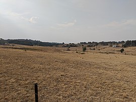
Baw Baw, New South Wales
| Baw Baw New South Wales | |||||||||||||||
|---|---|---|---|---|---|---|---|---|---|---|---|---|---|---|---|
 | |||||||||||||||
 Baw Baw Location in New South Wales | |||||||||||||||
| Coordinates | 34°42′32″S 149°38′0″E / 34.70889°S 149.63333°ECoordinates: 34°42′32″S 149°38′0″E / 34.70889°S 149.63333°E | ||||||||||||||
| Population | 260 (2016 census)[1] | ||||||||||||||
| Postcode(s) | 2580 | ||||||||||||||
| Location | |||||||||||||||
| LGA(s) | Goulburn Mulwaree Council | ||||||||||||||
| Region | Southern Tablelands | ||||||||||||||
| County | Argyle | ||||||||||||||
| Parish | Baw Baw | ||||||||||||||
| State electorate(s) | Goulburn | ||||||||||||||
| Federal division(s) | Hume | ||||||||||||||
| |||||||||||||||

Baw Baw is a locality in the Goulburn Mulwaree Council, New South Wales, Australia.[2][3] It lies about 7 km north of Goulburn and 95 km northeast of Canberra. At the 2016 census, it had a population of 260.[1]
Baw Baw had a state public school from November 1879 to May 1941, except in 1937. This was described as a "public school" until October 1929, when it became a "half-time school".[4]
References[]
- ^ a b Australian Bureau of Statistics (27 June 2017). "Baw Baw". 2016 Census QuickStats. Retrieved 17 May 2019.

- ^ "Baw Baw". Geographical Names Register (GNR) of NSW. Geographical Names Board of New South Wales. Retrieved 17 May 2019.
- ^ "Baw Baw". OpenStreetMap. Retrieved 5 March 2020.
- ^ "Baw Baw in the School history database search". New South Wales Department of Education. Retrieved 6 March 2020.
| Towns | |
|---|---|
| Localities and rural places | |
Main Article: Local government areas of New South Wales | |
This Southern Tablelands geography article is a stub. You can help Wikipedia by . |
Categories:
- Towns in New South Wales
- Localities in New South Wales
- Southern Tablelands
- Goulburn Mulwaree Council
- Southern Tablelands geography stubs