Beckemeyer, Illinois
Beckemeyer | |
|---|---|
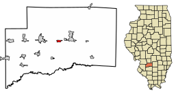 Location of Beckemeyer in Clinton County, Illinois. | |
 Location of Illinois in the United States | |
| Coordinates: 38°36′19″N 89°26′7″W / 38.60528°N 89.43528°WCoordinates: 38°36′19″N 89°26′7″W / 38.60528°N 89.43528°W | |
| Country | United States |
| State | Illinois |
| County | Clinton |
| Area | |
| • Total | 0.61 sq mi (1.59 km2) |
| • Land | 0.61 sq mi (1.59 km2) |
| • Water | 0.00 sq mi (0.00 km2) |
| Population (2010) | |
| • Total | 1,040 |
| • Estimate (2019)[2] | 1,008 |
| • Density | 1,644.37/sq mi (635.25/km2) |
| Time zone | UTC-6 (CST) |
| • Summer (DST) | UTC-5 (CDT) |
| ZIP Code(s) | 62219 |
| Area code(s) | 618 |
| FIPS code | 17-04533 |
| Wikimedia Commons | Beckemeyer, Illinois |
| Website | http://beckemeyeril.gov/ |

Beckemeyer is a village in Wade Township, Clinton County, Illinois, United States. The population was 1,040 as of the 2010 census.
History[]
Samuel B. Watkins was reported to be the first settler in the area, circa 1817. Beckemeyer began as a way station on the Ohio and Mississippi Railroad. It was organized and laid out in 1866 and originally named "Buxton" in honor of a railroad attorney.
A large coal seam underlying the village and surrounding area was mined starting in 1894, resulting in growth of Buxton. It was renamed "Beckemeyer" after an election held in 1905. The first school and bank were opened in 1906.[3][4]
On February 7, 1976 A train traveling at 56 miles per hour hit a camper truck belonging to Henry Lowe. The Tracks had no safety precautions at the time of the crash. The cab of the camper was severed from the rest of the camper and brought half a mile down the tracks. The crash killing a dozen people, including 11 children and injured four more, two of them seriously.[5]
Geography[]
Beckemeyer is located at 38°36′19″N 89°26′7″W / 38.60528°N 89.43528°W (38.605187, -89.435251).[6]
According to the 2010 census, Beckemeyer has a total area of 0.61 square miles (1.58 km2), all land.[7]
Demographics[]
| Historical population | |||
|---|---|---|---|
| Census | Pop. | %± | |
| 1910 | 764 | — | |
| 1920 | 1,153 | 50.9% | |
| 1930 | 850 | −26.3% | |
| 1940 | 900 | 5.9% | |
| 1950 | 1,045 | 16.1% | |
| 1960 | 1,056 | 1.1% | |
| 1970 | 1,069 | 1.2% | |
| 1980 | 1,119 | 4.7% | |
| 1990 | 1,070 | −4.4% | |
| 2000 | 1,043 | −2.5% | |
| 2010 | 1,040 | −0.3% | |
| 2019 (est.) | 1,008 | [2] | −3.1% |
| U.S. Decennial Census[8] | |||
As of the census[9] of 2000, there were 1,043 people, 405 households, and 281 families residing in the village. The population density was 2,122.0 people per square mile (821.8/km2). There were 424 housing units at an average density of 862.6 per square mile (334.1/km2). The racial makeup of the village was 98.47% White, 0.29% Native American, 0.77% Asian, 0.10% Pacific Islander, 0.10% from other races, and 0.29% from two or more races. Hispanic or Latino of any race were 1.34% of the population. As of the 2010 census, the village's population decreased by 0.3% with a total of 1,040 people.
There were 405 households, out of which 37.0% had children under the age of 18 living with them, 52.1% were married couples living together, 13.1% had a female householder with no husband present, and 30.4% were non-families. 26.7% of all households were made up of individuals, and 12.6% had someone living alone who was 65 years of age or older. The average household size was 2.58 and the average family size was 3.10.
In the village, the population was spread out, with 28.0% under the age of 18, 9.6% from 18 to 24, 29.2% from 25 to 44, 17.6% from 45 to 64, and 15.5% who were 65 years of age or older. The median age was 33 years. For every 100 females, there were 96.8 males. For every 100 females age 18 and over, there were 92.6 males.
The median income for a household in the village was $36,607, and the median income for a family was $39,400. Males had a median income of $31,534 versus $23,125 for females. The per capita income for the village was $89,039. About 5.9% of families and 8.2% of the population were below the poverty line, including 8.1% of those under age 18 and 7.0% of those age 65 or over.
Schools[]
Since Beckemeyer is a village, most residents' children go to neighboring towns, such as Breese or Carlyle, for their education. The village does have one elementary school, Breese/Becky District #12; the school houses grades 2 to 4, while older and younger students go to the elementary/middle school, District #12, in the town of Breese.[citation needed]
It is in the service area of Central Community High School, formed as a consolidation of the Breese and Aviston high schools in 1971.[10]
References[]
- ^ "2019 U.S. Gazetteer Files". United States Census Bureau. Retrieved July 14, 2020.
- ^ Jump up to: a b "Population and Housing Unit Estimates". United States Census Bureau. May 24, 2020. Retrieved May 27, 2020.
- ^ Village of Beckemeyer website
- ^ "1913 Clinton County Commercial History". Archived from the original on 2011-07-23. Retrieved 2010-11-10.
- ^ https://www.nytimes.com/1976/02/09/archives/11-children-killed-as-train-rams-camper.html
- ^ "US Gazetteer files: 2010, 2000, and 1990". United States Census Bureau. 2011-02-12. Retrieved 2011-04-23.
- ^ "G001 - Geographic Identifiers - 2010 Census Summary File 1". United States Census Bureau. Archived from the original on 2020-02-13. Retrieved 2015-08-02.
- ^ "Census of Population and Housing". Census.gov. Retrieved June 4, 2015.
- ^ "U.S. Census website". United States Census Bureau. Retrieved 2008-01-31.
- ^ "School / District / Community Profile" (PDF). Central Community High School. Archived from the original (PDF) on 2015-02-06. Retrieved 2020-04-05.
| show Municipalities and communities of Clinton County, Illinois, United States |
|---|
| show Authority control |
|---|
- Villages in Clinton County, Illinois
- Villages in Illinois
- Populated places established in 1866
- 1866 establishments in Illinois