Beinn Mhanach
| Beinn Mhanach | |
|---|---|
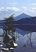
 The western approach to Beinn Mhanach | |
| Highest point | |
| Elevation | 953 m (3,127 ft)[1] |
| Prominence | 315 m (1,033 ft) |
| Listing | Munro, Marilyn |
| Naming | |
| English translation | Monks' hill |
| Language of name | Gaelic |
| Geography | |
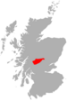
| Location | Perthshire, Scotland |
| Parent range | Bridge of Orchy Hills, Grampians |
| OS grid | NN373412 |
| Topo map | OS Landranger 50, OS Explorer 377 |
| Climbing | |
| Easiest route | By Auch or Achaladair farm |

Beinn Mhanach (Gaelic: 'Monk's hill')[2] is a mountain situated on the northern side of Loch Lyon and eight kilometres east of Bridge of Orchy, in the west highlands of Scotland.
Overview[]
From both the West Highland Line and the A82 road between Tyndrum and Bridge of Orchy the two rounded summits of Beinn Mhanach can be seen clearly 8 km away due north-east up the .[2]
Geography[]
Beinn Mhanach has two summits, the higher of which is 953 metres (3,127 ft). On the southern side the slopes are grassy but the more remote northern side is craggier.[2]
History[]
Beinn Mhanach derived its name from a monastery that once lay at its foot, and which was used by clan MacGregor when travelling between Glen Lyon and their burial ground in Glen Orchy.[3] No trace of the monastery remains today. The poet Duncan Ban MacIntyre, whose most well-known poem "Moladh Beinn Dòbhrain" celebrated nearby Beinn Dorain, lived for a number of years in a cottage, now a ruin and used as a sheep fank,[4] at Ais-an-t-Sidhean at the head of Auch Gleann.[2]
Ascents[]
There are two popular routes for Beinn Mhanach. One is from near Auch, with parking on the A82 near the private road, up Auch Gleann and past Ais-an-t-Sidhean. To reach the summit dome of the mountain the slopes to the north-east of Beinn a'Chuirn are traversed. The other route starts from Achallader farm at grid reference NN322442. This route is often taken when the nearby Beinn Achaladair and Beinn a' Chreachain are climbed.[2]
References[]
| Wikimedia Commons has media related to Beinn Mhanach. |
- ^ "walkhighlands Beinn Mhanach". walkhighlands.co.uk. 2013. Retrieved 21 October 2013.
- ^ a b c d e Donald Bennet and Rab Anderson (eds), The Munros: Scottish Mountaineering Club Hillwalkers' Guide, revised 3rd. ed., 2008, p. 45
- ^ Irvine Butterfield, The Magic of the Munros, David and Charles, 2000, p. 37
- ^ Cameron McNeish,"Sun shines on hidden gem peak", heraldscotland.com, 30 April 2006
- Marilyns of Scotland
- Munros
- Mountains and hills of the Southern Highlands
- Mountains and hills of Perth and Kinross