Bell Buckle, Tennessee
Bell Buckle, Tennessee | |
|---|---|
 Downtown Bell Buckle | |
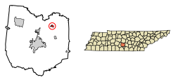 Location of Bell Buckle in Bedford County, Tennessee. | |
| Coordinates: 35°35′27″N 86°21′15″W / 35.59083°N 86.35417°W | |
| Country | United States |
| State | Tennessee |
| County | Bedford |
| Area | |
| • Total | 0.59 sq mi (1.54 km2) |
| • Land | 0.59 sq mi (1.54 km2) |
| • Water | 0.00 sq mi (0.00 km2) |
| Elevation | 856 ft (261 m) |
| Population (2010) | |
| • Total | 500 |
| • Estimate (2019)[4] | 543 |
| • Density | 912.61/sq mi (352.55/km2) |
| Time zone | UTC-6 (Central (CST)) |
| • Summer (DST) | UTC-5 (CDT) |
| ZIP code | 37020 |
| Area code(s) | 931 |
| FIPS code | 47-04460[2] |
| GNIS feature ID | 1276910[3] |
| Website | townofbellbuckle |

Bell Buckle is a town in Bedford County, Tennessee, United States. The population was 500 at the 2010 census.[5] The downtown area is listed on the National Register of Historic Places as the Bell Buckle Historic District.
Geography[]
Bell Buckle is located in northeastern Bedford County at 35°35′27″N 86°21′15″W / 35.59083°N 86.35417°W (35.590749, -86.354047).[6] Tennessee State Routes 82 and 269 cross at the town's center. TN 82 leads east 8 miles (13 km) to Beechgrove and Interstate 24, and west 5 miles (8 km) to U.S. Route 231 at a point 7 miles (11 km) north of Shelbyville, the county seat. TN 269 leads south 5 miles (8 km) to Wartrace and north 11 miles (18 km) to U.S. 231 near Christiana.
According to the United States Census Bureau, Bell Buckle has a total area of 0.58 square miles (1.5 km2), all land.[5]
Demographics[]
| Historical population | |||
|---|---|---|---|
| Census | Pop. | %± | |
| 1880 | 298 | — | |
| 1890 | 715 | 139.9% | |
| 1900 | 665 | −7.0% | |
| 1910 | 466 | −29.9% | |
| 1920 | 471 | 1.1% | |
| 1930 | 378 | −19.7% | |
| 1940 | 355 | −6.1% | |
| 1950 | 341 | −3.9% | |
| 1960 | 318 | −6.7% | |
| 1970 | 393 | 23.6% | |
| 1980 | 450 | 14.5% | |
| 1990 | 326 | −27.6% | |
| 2000 | 391 | 19.9% | |
| 2010 | 500 | 27.9% | |
| 2019 (est.) | 543 | [4] | 8.6% |
| Sources:[7][8] | |||
As of the census[2] of 2000, there were 391 people, 167 households, and 105 families residing in the town. The population density was 813.6 people per square mile (314.5/km2). There were 183 housing units at an average density of 380.8 per square mile (147.2/km2). The racial makeup of the town was 97.95% White and 2.05% African American.
There were 167 households, out of which 25.7% had children under the age of 18 living with them, 50.9% were married couples living together, 9.0% had a female householder with no husband present, and 37.1% were non-families. 35.3% of all households were made up of individuals, and 13.2% had someone living alone who was 65 years of age or older. The average household size was 2.24 and the average family size was 2.91.
In the town, the population was spread out, with 19.7% under the age of 18, 9.5% from 18 to 24, 26.1% from 25 to 44, 28.1% from 45 to 64, and 16.6% who were 65 years of age or older. The median age was 42 years. For every 100 females, there were 109.1 males. For every 100 females age 18 and over, there were 107.9 males.
The median income for a household in the town was $27,188, and the median income for a family was $40,000. Males had a median income of $30,417 versus $15,556 for females. The per capita income for the town was $16,235. About 8.2% of families and 15.6% of the population were below the poverty line, including 3.4% of those under age 18 and 18.3% of those age 65 or over.
2010 census[]
The 2010 census showed the population of Bell Buckle to have risen to 500 people, with a total population growth of 27.9%. The census documented 62.8% of the population as being 18 years of age or above, and 37.2% as under 18. The racial makeup of the town was 84.8% White, 8.2% Asian, 3.2% Hispanic, 2.8% African American and 1% from two or more races.
The 2010 census documented 164 housing units, 87.2% of which were occupied, and 12.8% were vacant.
History[]
The origin of the town's unusual name is not known. According to the local chamber of commerce, one story says that one of the first white men to travel through the area found a tree with carvings of a cowbell and a buckle, possibly carved by Indians to warn white settlers away, or possibly carved by surveyors to mark the area as good pasture. Another form of the legend holds that a bell and buckle were tied around a tree. In any case, the nearby creek was named Bell Buckle Creek, and the town later took the name of the creek.[9]
The Bell Buckle area was settled in the early 19th century. A bustling town grew up after the Nashville and Chattanooga Railroad came through the area in 1852. A railroad depot was built in 1853, and the town was incorporated in 1856. Bell Buckle had its period of greatest prosperity after about 1870, becoming the major stockyard between Nashville and Chattanooga and growing to a population of more than 1,000.[9]
In June 1940, US Army maneuvers centered on the area. A tank of General George S. Patton's Second Armored Division ran into the two-story town hall, bringing the building down.[10]
On January 11, 1975, on Hee Haw, Molly Bee saluted her home town of Bell Buckle, population 393.[11]
Sightseeing and tourism[]
Bell Buckle is noted for the many preserved and restored Victorian homes, shops, and churches located in and around downtown. Bell Buckle is a center for antiques, quilts, and various handmade crafts. The town hosts two yearly festivals: the RC Cola & Moon Pie festival[12] and the Webb School Arts & Crafts Fair. In addition to its more rustic business, Bell Buckle got its first financial advisory group, Anderson Asset Management, in 2013. The business is co-owned and operated by James and Julie Anderson, two local residents.[13]
A member of Tennessee Backroads, Bell Buckle has the distinction of being the smallest town in Tennessee to be a Tree City USA. Bell Buckle is the home of The Webb School (which relocated from Culleoka in 1886), a college preparatory boarding and day school which plays an integral part in the ambience of the town.
References[]
- ^ "2019 U.S. Gazetteer Files". United States Census Bureau. Retrieved July 30, 2020.
- ^ Jump up to: a b "U.S. Census website". United States Census Bureau. Retrieved 2008-01-31.
- ^ "US Board on Geographic Names". United States Geological Survey. 2007-10-25. Retrieved 2008-01-31.
- ^ Jump up to: a b "Population and Housing Unit Estimates". United States Census Bureau. May 24, 2020. Retrieved May 27, 2020.
- ^ Jump up to: a b "Geographic Identifiers: 2010 Demographic Profile Data (G001): Bell Buckle town, Tennessee". U.S. Census Bureau, American Factfinder. Archived from the original on February 12, 2020. Retrieved April 8, 2014.
- ^ "US Gazetteer files: 2010, 2000, and 1990". United States Census Bureau. 2011-02-12. Retrieved 2011-04-23.
- ^ "Census of Population and Housing: Decennial Censuses". United States Census Bureau. Retrieved 2012-03-04.
- ^ "Incorporated Places and Minor Civil Divisions Datasets: Subcounty Resident Population Estimates: April 1, 2010 to July 1, 2012". Population Estimates. U.S. Census Bureau. Archived from the original on 11 June 2013. Retrieved 11 December 2013.
- ^ Jump up to: a b Local History Archived January 13, 2008, at the Wayback Machine and Bell Buckle Past and Present Archived November 15, 2007, at the Wayback Machine on Bell Buckle Chamber of Commerce website (accessed December 19, 2007).
- ^ Dickson, Paul (7 July 2020). The Rise of the G.I. Army, 1940-1941: The Forgotten Story of How America Forged a Powerful Army Before Pearl Harbor (Kindle ed.). 2809: Atlantic Monthly Press. ISBN 978-0802147677.CS1 maint: location (link)
- ^ Hee Haw Season 6 Episode 18
- ^ "RC Cola and Moon Pie Festival". Bell Buckle Chamber of Commerce. Archived from the original on 2007-11-19. Retrieved 2007-11-21.
- ^ "Anderson Asset Management". Anderson Asset Management. Wells Fargo Advisors. 2015. Retrieved September 30, 2015.
External links[]
| Wikimedia Commons has media related to Bell Buckle, Tennessee. |
- Town of Bell Buckle official website
- Bell Buckle Chamber of Commerce
- Municipal Technical Advisory Service entry for Bell Buckle — information on local government, elections, and link to charter
- The Webb School
Coordinates: 35°35′27″N 86°21′15″W / 35.590749°N 86.354047°W
| show Municipalities and communities of Bedford County, Tennessee, United States |
|---|
| show Authority control |
|---|
- Towns in Bedford County, Tennessee
- Towns in Tennessee
- Populated places established in 1853
- 1853 establishments in Tennessee