Bell Glacier
From Wikipedia, the free encyclopedia
Glacier in Antarctica
| Bell Glacier | |
|---|---|
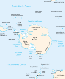 Map of Antarctica, with Wilkes Land slightly to the right | |
 Location of Bell Glacier in Antarctica | |
| Location | Wilkes Land |
| Coordinates |  66°42′00″S 124°54′00″E / 66.70000°S 124.90000°E / -66.70000; 124.90000 66°42′00″S 124°54′00″E / 66.70000°S 124.90000°E / -66.70000; 124.90000 |
| Thickness | unknown |
| Terminus | Maury Bay |
| Status | unknown |
Bell Glacier (66°42′S 124°54′E / 66.700°S 124.900°E / -66.700; 124.900Coordinates: WikiMiniAtlas66°42′S 124°54′E / 66.700°S 124.900°E / -66.700; 124.900) is a glacier draining northward into Maury Bay immediately eastward of Blair Glacier. It was mapped by (1955) from aerial photographs taken by U.S. Navy Operation Highjump (1946–47), and named by the Advisory Committee on Antarctic Names for , boatswain on the sloop Peacock during the United States Exploring Expedition (1838–42) under Lieutenant Charles Wilkes.
See also[]
- List of glaciers in the Antarctic
- Glaciology
References[]
 This article incorporates public domain material from the United States Geological Survey document: "Bell Glacier". (content from the Geographic Names Information System)
Portal: Geography
Glaciers | |||||||
|---|---|---|---|---|---|---|---|
| Types |
| ||||||
| Anatomy |
| ||||||
| Processes |
| ||||||
| Measurements |
| ||||||
| Volcanic relations | |||||||
| Landforms |
| ||||||
| |||||||
Glaciers in the Antarctic | |
|---|---|
|
Glaciers of Wilkes Land | |
|---|---|
|
This article about a glacier in Wilkes Land is a stub. You can help Wikipedia by . |
- v
- t
Retrieved from ""
Categories:
- Glaciers of Wilkes Land
- Wilkes Land geography stubs
- Antarctica glacier stubs
Hidden categories:
- Articles with short description
- Short description matches Wikidata
- Coordinates on Wikidata
- Wikipedia articles incorporating text from the USGS Geographic Names Information System
- All stub articles