Belmar, Nebraska
Belmar, Nebraska | |
|---|---|
 | |
 Belmar | |
| Coordinates: 41°17′56″N 101°55′00″W / 41.29889°N 101.91667°WCoordinates: 41°17′56″N 101°55′00″W / 41.29889°N 101.91667°W | |
| Country | United States |
| State | Nebraska |
| County | Keith |
| Area | |
| • Total | 4.58 sq mi (11.87 km2) |
| • Land | 4.58 sq mi (11.87 km2) |
| • Water | 0.0 sq mi (0.0 km2) |
| Elevation | 3,353 ft (1,022 m) |
| Population (2010) | |
| • Total | 216 |
| • Density | 47/sq mi (18.2/km2) |
| Time zone | UTC-7 (Mountain (MST)) |
| • Summer (DST) | UTC-6 (MDT) |
| ZIP code | 69147 |
| FIPS code | 31-04055 |
| GNIS feature ID | 835246 |


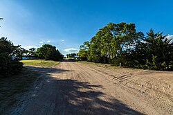
Belmar is an unincorporated community and census-designated place in Keith County, Nebraska, United States.[1] As of the 2010 census it had a population of 216.[2]
History[]
Belmar got its start following construction of the Union Pacific Railroad through the territory.[3] It was likely named for a railroad official.[4]
A post office was established at Belmar in 1910, and remained in operation until it was discontinued in 1941.[5]
Geography[]
Belmar is in northwestern Keith County, on the north side of Lake McConaughy, a reservoir on the North Platte River. Nebraska Highway 92 runs through the community, leading west 12 miles (19 km) to Lewellen and east 6 miles (10 km) to Lemoyne. Ogallala, the Keith county seat, is 24 miles (39 km) to the southeast via Highways 92 and 61.
According to the U.S. Census Bureau, the Belmar CDP has an area of 4.6 square miles (11.9 km2), all land.[2]
References[]
- ^ U.S. Geological Survey Geographic Names Information System: Belmar, Nebraska
- ^ a b "Geographic Identifiers: 2010 Census Summary File 1 (G001), Belmar CDP, Nebraska". American FactFinder. U.S. Census Bureau. Archived from the original on February 13, 2020. Retrieved April 10, 2019.
- ^ Burr, George L.; Buck, O. O. (1921). History of Hamilton and Clay Counties, Nebraska. S.J. Clarke Publishing Company. p. 123.
- ^ Fitzpatrick, Lillian L. (1960). Nebraska Place-Names. University of Nebraska Press. p. 84. ISBN 0-8032-5060-6. A 1925 edition is available for download at University of Nebraska—Lincoln Digital Commons.
- ^ "Keith County". Jim Forte Postal History. Archived from the original on 19 August 2014. Retrieved 18 August 2014.
Municipalities and communities of Keith County, Nebraska, United States | ||
|---|---|---|
| City | ||
| Villages | ||
| CDPs | ||
| Unincorporated communities | ||
| ||
This Keith County, Nebraska state location article is a stub. You can help Wikipedia by . |
- Census-designated places in Keith County, Nebraska
- Census-designated places in Nebraska
- South Central Nebraska geography stubs