Bemiss, Spokane
This article needs additional citations for verification. (November 2021) |
Bemiss | |
|---|---|
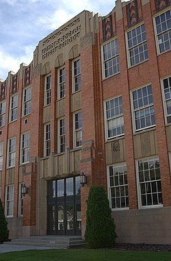 John R. Rogers High School in Bemiss | |
| Coordinates: 47°41′24.3″N 117°22′30.8″W / 47.690083°N 117.375222°WCoordinates: 47°41′24.3″N 117°22′30.8″W / 47.690083°N 117.375222°W | |
| Country | United States |
| State | Washington |
| County | Spokane |
| City | Spokane |
| Boroughs | list |
| Population (2017[1]) | |
| • Total | 8,633 |
| Demographics 2017 | |
| • White | 80.3% |
| • Black | 2.7% |
| • Hispanic | 7.9% |
| • Asian | 4.4% |
| • Native American | 3.4% |
| Time zone | UTC-8 (PST) |
| • Summer (DST) | UTC-7 (PDT) |
| ZIP Codes | 99207 |
| Area code(s) | 509 |

Bemiss is a neighborhood in Spokane, Washington.[2] It is located within City Council District 1, which covers the northeastern section of the city. The neighborhood is bounded by Wellesley Avenue to the north, Market Street to the east, Illinois Avenue and the Spokane River to the south, and Perry Street and Napa Street to the west. It is located to the southeast of the Hillyard neighborhood and is often grouped into greater Hillyard.[3]
The neighborhood is named for David Bemiss, an early settler in the area and superintendent of schools in Spokane.[4]
Geography[]

The intersection of Empire Avenue and Crestline Road, two arterials that meet near the center of the neighborhood, is 4.2 miles by road from Spokane City Hall in Downtown Spokane. Wellesley Avenue, a major arterial on the north side of town, is the neighborhood's northern border. Market and Haven Streets, also major arterials on the north side of town, delimit the eastern border. To the south the border is irregular, following North Foothills Drive to Napa Street, Illinois Avenue to Crestline Street, the Spokane River to Smith Street and then back along Illinois Avenue to Market Street. The western border runs down Perry Street to Euclid Avenue and Napa Street to Illinois Avenue.[5]
Demographics[]
As of 2017, the population of Bemiss was 8,633 in 3,263 households. 49.2% of those households are rented, compared to 45.3% of households citywide. 29.1% of Bemiss residents are age 19 or under and 11.6% are age 65 or older. The median household income is $34,565, below the citywide average of $44,768. 74.7% of students qualify for free or reduced lunch. 37.2% of residents have a high school diploma only and 8.7% have a bachelor's degree or higher. The unemployment rate is 10.3%.[1]
Of the residents, 85.8% were born in the United States. The top countries for the foreign born population are Ukraine, accounting for 54.4% of all foreign born residents, followed by Mexico at 9%, Belarus at 5.1% and Canada at 4.4%.
History[]
The adjacent neighborhood of Hillyard was once a separate city and the present day Bemiss neighborhood grew up as part of both Hillyard and Spokane. Hillyard was platted in 1892, incorporated in 1907. In 1907, the area northeast of Rich Avenue and Crestline Street, the northeastern corner of the current neighborhood, was incorporated into Hillyard. The rest of the neighborhood was incorporated into the City of Spokane that same year. Spokane annexed Hillyard in 1924.[4]
Rail trolleys and streetcars connected the neighborhood to downtown Spokane, to the southwest, and the rest of the Spokane area.
References[]
- ^ a b "Bemiss Neighborhood Snapshot" (PDF). spokanecity.org. City of Spokane. Retrieved 27 October 2021.
- ^ Tiernan, Colin. "Bemiss neighborhood fires displace four people on Saturday evening" (PDF). The Spokesman-Review. No. 18 July 2021. Retrieved 28 October 2021.
- ^ "Greater Hillyard". spokanecity.org. City of Spokane. Retrieved 28 October 2021.
- ^ a b "Bemiss Neighborhood Profile" (PDF). spokanecity.org. City of Spokane. Retrieved 28 October 2021.
- ^ "Bemiss Neighborhood Map" (PDF). spokanecity.org. City of Spokane. Retrieved 28 October 2021.
Places adjacent to Bemiss, Spokane | ||||||||||||||||
|---|---|---|---|---|---|---|---|---|---|---|---|---|---|---|---|---|
| ||||||||||||||||
- Neighborhoods in Spokane, Washington
- Geography of Spokane, Washington