Chief Garry Park, Spokane
Chief Garry Park | |
|---|---|
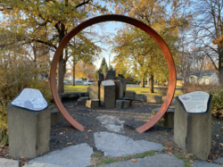 The Gathering Place monument to Spokane Garry in Chief Garry Park | |
| Coordinates: 47°41′24.3″N 117°22′30.8″W / 47.690083°N 117.375222°WCoordinates: 47°41′24.3″N 117°22′30.8″W / 47.690083°N 117.375222°W | |
| Country | United States |
| State | Washington |
| County | Spokane |
| City | Spokane |
| Population (2017 [1]) | |
| • Total | 6,075 |
| Demographics 2017 | |
| • White | 74.8% |
| • Black | 5.9% |
| • Latinx | 7.1% |
| • Asian | 6.2% |
| • Native American | 3.8% |
| Time zone | UTC-8 (PST) |
| • Summer (DST) | UTC-7 (PDT) |
| ZIP Codes | 99202 |
| Area code(s) | 509 |

Chief Garry Park is a neighborhood in Spokane, Washington.[2] It is located immediately south of the Spokane River. It is named for Spokane Garry and a park that has taken his name. The neighborhood was first established in 1912 but it wasn't until 1932 that it was officially named for Chief Garry.[3]
Geography[]

The neighborhood is bounded on the west and north by the Spokane River. The southern border runs along Trent Avenue to Havana Street, at which point it drops a few blocks to the south to follow railroad tracks east to Fancher Road. From Fancher, the boundary zig-zags to the northeast along the edge of Felts Field and delimits the municipal boundary of the City of Spokane where it meets the City of Spokane Valley.[1][4]
It is an elongated neighborhood that extends more than four miles from the Trent Avenue Bridge in the neighborhood's far southwestern corner to the city limits in the northeast. The bulk of the residential area of the neighborhood centers on Chief Garry Park itself on the west side. The Spokane Community College campus is located at the intersection of Greene and Mission and stretches north to the river. The northeastern half of the neighborhood is dominated by Felts Field.[4]
Pedestrian crossings of the Spokane River are available at Trent Avenue, Iron Bridge, Mission Avenue and Greene Street. The first three cross the river east-to-west into the Logan neighborhood, while the latter crosses south-to-north into the Minnehaha neighborhood. An exclave of the neighborhood exists at Upriver Park to the north of and across the river from Felts Field. The park is part of the City of Spokane, but surrounded on the north side of the river by unincorporated Spokane County.[5]
Demographics[]
The population of Chief Garry Park is 6,075. 55.7 of households in Chief Garry Park are rentals. 28.4% of people are 19 or younger and 8.3% of people are 65 or older. The median household income is $35,264. 30.3% of residents have nothing more than a high school diploma and 13.8% have at least a bachelor's degree.[6]
History[]
Chief Garry Park, the park itself, dates to 1912. In 1932 it was officially dedicated and named in honor of Spokane Garry.[3]
The neighborhood is one of Spokane's oldest. Lucias B. Nash, a U.S. District Court Judge, built a home for his family on Tilsey Place overlooking the Spokane River in 1886. The 24 room Queen Anne style home was designed by Nash's wife and was one of the first in Spokane with indoor plumbing.[5] Streetcar lines ran along Mission and Boone Avenues, connecting the neighborhood with Downtown Spokane to the west and the rest of the growing city. The Mission Avenue Bridge was built in 1909 and connected the neighborhood with the Logan Neighborhood and other areas on the north side of the river.[7]

Expansion into the Parkwater area on the east side of Chief Garry Park occurred between 1900 and 1930, first with the building of homes and then the development of an airport. Parkwater Aviation Field was established there in 1912 and designated as Spokane's official municipal airport in 1920. During the 1920s, Charles Lindbergh landed his famous Spirit of St. Louis at the airport. Since 1927 the airport has been known as Felts Field.[5] In the 1940s and 1950s, during the post-World War II housing boom in the United States, the area between Mission Avenue and the Spokane River was developed into a residential portion of the neighborhood. During those years the development was primarily single-family homes. Since 1970, however, denser multi-family housing has been built in the area, particularly on South Riverton Avenue, which runs along the river. Spokane Community College was established at the intersection of Mission Avenue and Greene Street in 1963 on the site of an existing technical and vocational school.[5]
In May 2020, construction began on the City Line (Spokane, Washington), a bus rapid transit route that will pass through the neighborhood connecting Spokane Community college on the east with Browne's Addition on the west via Gonzaga University and Downtown Spokane. The line will follow Mission Avenue through the neighborhood with stops at Napa Street, the west side of Chief Garry Park, the east side of Chief Garry Park, and its terminus at Spokane Community College.[8] Service is expected to begin in July 2023.[9]
References[]
- ^ a b "Chief Garry Neighborhood Snapshot" (PDF). spokanecity.org. City of Spokane. Retrieved 28 October 2021.
- ^ "Chief Garry Park Neighborhood Council". spokanecity.org. City of Spokane.
- ^ a b Rebstock, Tracy L. "Chief Garry Park". Retrieved 28 October 2021.
- ^ a b "Chief Garry Park Map" (PDF). spokanecity.org. City of Spokane. Retrieved 28 October 2021.
- ^ a b c d "Chief Garry Park Neighborhood Profile" (PDF). spokanecity.org. City of Spokane. Retrieved 28 October 2021.
- ^ "Chief Garry Park Neighborhood Snapshot" (PDF). spokanecity.org. City of Spokane. Retrieved 28 October 2021.
- ^ "Spokane River". bridgehunter.com. Bridgehunter.com: Historic Bridges of the United States. Retrieved 28 October 2021.
- ^ "City Line Spokane". citylinespokane.com. Spokane Transit Authority. Retrieved 28 October 2021.
- ^ Brown, Sydney (8 October 2021). "Spokane's city transit line will have to wait another year, slated to open July 2023". The Spokesman-Review. Retrieved 28 October 2021.
Places adjacent to Chief Garry Park, Spokane | ||||||||||||||||
|---|---|---|---|---|---|---|---|---|---|---|---|---|---|---|---|---|
| ||||||||||||||||
- Neighborhoods in Spokane, Washington
- Geography of Spokane, Washington