Bennington, Kansas
Bennington, Kansas | |
|---|---|
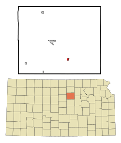 Location within Ottawa County and Kansas | |
 | |
| Coordinates: 39°1′59″N 97°35′35″W / 39.03306°N 97.59306°WCoordinates: 39°1′59″N 97°35′35″W / 39.03306°N 97.59306°W | |
| Country | United States |
| State | Kansas |
| County | Ottawa |
| Founded | 1870s |
| Platted | 1878 |
| Incorporated | 1885 |
| Named for | Bennington, Vermont |
| Government | |
| • Type | Mayor–Council |
| • Mayor | Ward Stockhamp[1][2] |
| Area | |
| • Total | 0.42 sq mi (1.09 km2) |
| • Land | 0.42 sq mi (1.09 km2) |
| • Water | 0.00 sq mi (0.00 km2) |
| Elevation | 1,220 ft (370 m) |
| Population | |
| • Total | 672 |
| • Estimate (2019)[5] | 612 |
| • Density | 1,457.14/sq mi (561.99/km2) |
| Time zone | UTC-6 (CST) |
| • Summer (DST) | UTC-5 (CDT) |
| ZIP code | 67422 [6] |
| Area code | 785, exchange 488 |
| FIPS code | 20-06075 [7] |
| GNIS ID | 0476467 [8] |
| Website | cityofbennington.com |

Bennington is a city in Ottawa County, Kansas, United States.[9] As of the 2010 census, the city population was 672.[10]
History[]
19th century[]
Bennington was platted in 1878 and grew to a population of over 200 within three years.[11] The city name comes from one of two sources. A paper written on the history of Bennington states that Bennington is an Indian name meaning "place of fine trees." The same article also states that co-city founder George R. Parker gave the town its name after Bennington, Vermont.[12] The Solomon Valley Railroad, a branch of the Kansas Pacific Railroad, reached Bennington in 1878.[11]
In 1879, the first school was located one half mile south of town. In 1918, a new school house was built. In 1938, an auditorium was added; in 1955 a shop was added; and in 1961 a new grade school building was annexed.[11]
Geography[]
Bennington is located at 39°1′59″N 97°35′35″W / 39.03306°N 97.59306°W (39.033174, -97.593030).[13] According to the United States Census Bureau, the city has a total area of 0.42 square miles (1.09 km2), all of it land.[14]
Climate[]
The climate in this area is characterized by hot, humid summers and generally mild to cool winters. According to the Köppen Climate Classification system, Bennington has a humid subtropical climate, abbreviated "Cfa" on climate maps.[15]
Demographics[]
| Historical population | |||
|---|---|---|---|
| Census | Pop. | %± | |
| 1890 | 390 | — | |
| 1900 | 389 | −0.3% | |
| 1910 | 386 | −0.8% | |
| 1920 | 371 | −3.9% | |
| 1930 | 374 | 0.8% | |
| 1940 | 369 | −1.3% | |
| 1950 | 325 | −11.9% | |
| 1960 | 535 | 64.6% | |
| 1970 | 561 | 4.9% | |
| 1980 | 579 | 3.2% | |
| 1990 | 568 | −1.9% | |
| 2000 | 623 | 9.7% | |
| 2010 | 672 | 7.9% | |
| 2019 (est.) | 612 | [5] | −8.9% |
| U.S. Decennial Census | |||
Bennington is part of the Salina Micropolitan Statistical Area.
2010 census[]
As of the census[4] of 2010, there were 672 people, 261 households, and 188 families residing in the city. The population density was 1,600.0 inhabitants per square mile (617.8/km2). There were 283 housing units at an average density of 673.8 per square mile (260.2/km2). The racial makeup of the city was 97.8% White, 0.3% African American, 0.9% Native American, and 1.0% from two or more races. Hispanic or Latino of any race were 1.9% of the population.
There were 261 households, of which 37.2% had children under the age of 18 living with them, 61.7% were married couples living together, 7.7% had a female householder with no husband present, 2.7% had a male householder with no wife present, and 28.0% were non-families. 25.7% of all households were made up of individuals, and 8.8% had someone living alone who was 65 years of age or older. The average household size was 2.57 and the average family size was 3.07.
The median age in the city was 37.4 years. 28.4% of residents were under the age of 18; 6.5% were between the ages of 18 and 24; 27.3% were from 25 to 44; 25% were from 45 to 64; and 12.9% were 65 years of age or older. The gender makeup of the city was 52.8% male and 47.2% female.
2000 census[]
As of the census[7] of 2000, there were 623 people, 245 households, and 182 families residing in the city. The population density was 1,474.4 people per square mile (572.7/km2). There were 266 housing units at an average density of 629.5 per square mile (244.5/km2). The racial makeup of the city was 97.75% White, 0.16% African American, 0.16% Native American, 0.16% Asian, 0.16% Pacific Islander, 0.32% from other races, and 1.28% from two or more races. Hispanic or Latino of any race were 0.96% of the population.
There were 245 households, out of which 37.6% had children under the age of 18 living with them, 60.8% were married couples living together, 9.8% had a female householder with no husband present, and 25.7% were non-families. 21.6% of all households were made up of individuals, and 10.2% had someone living alone who was 65 years of age or older. The average household size was 2.54 and the average family size was 2.96.
In the city, the population was spread out, with 31.0% under the age of 18, 3.9% from 18 to 24, 31.0% from 25 to 44, 22.2% from 45 to 64, and 12.0% who were 65 years of age or older. The median age was 35 years. For every 100 females, there were 95.9 males. For every 100 females age 18 and over, there were 93.7 males.
The median income for a household in the city was $37,303, and the median income for a family was $45,972. Males had a median income of $32,143 versus $21,429 for females. The per capita income for the city was $15,919. About 5.1% of families and 6.0% of the population were below the poverty line, including 5.8% of those under age 18 and 6.0% of those age 65 or over.
Government[]
The Bennington government consists of a mayor and five council members. The council meets the 2nd and 4th Monday of each month at 7 pm.[1][2]
- City Hall, 121 North Nelson Street.
- U.S. Post Office, 116 North Nelson Street.
Education[]
The community is served by Twin Valley USD 240 public school district.
- Bennington High School, 301 North Putnam Street.
- Bennington Junior High School, 301 North Putnam Street.
- Bennington Grade School, 223 North Putnam Street.
See also[]
- List of Nike missile locations
- List of tornadoes in the May 1995 tornado outbreak sequence
- List of tornadoes in the April 6–8, 2006 tornado outbreak
- List of tornadoes in the May 2007 Tornado Outbreak
- List of tornadoes in the tornado outbreak of May 26–31, 2013
References[]
- ^ Jump up to: a b Bennington - Directory of Public Officials Archived December 13, 2011, at the Wayback Machine
- ^ Jump up to: a b Bennington - Government Archived September 24, 2014, at the Wayback Machine
- ^ "2019 U.S. Gazetteer Files". United States Census Bureau. Retrieved July 24, 2020.
- ^ Jump up to: a b "U.S. Census website". United States Census Bureau. Retrieved 2012-07-06.
- ^ Jump up to: a b "Population and Housing Unit Estimates". United States Census Bureau. May 24, 2020. Retrieved May 27, 2020.
- ^ United States Postal Service (2012). "USPS - Look Up a ZIP Code". Retrieved 2012-02-15.
- ^ Jump up to: a b "U.S. Census website". United States Census Bureau. Retrieved 2008-01-31.
- ^ "US Board on Geographic Names". United States Geological Survey. 2007-10-25. Retrieved 2008-01-31.
- ^ "Geographic Names Information System". United States Geological Survey. Retrieved 2008-01-31.
- ^ "2010 City Population and Housing Occupancy Status". U.S. Census Bureau. Retrieved October 12, 2011.[dead link]
- ^ Jump up to: a b c History of Bennington Archived May 13, 2012, at the Wayback Machine
- ^ History of Bennington (continued) Archived May 14, 2012, at the Wayback Machine
- ^ "US Gazetteer files: 2010, 2000, and 1990". United States Census Bureau. 2011-02-12. Retrieved 2011-04-23.
- ^ "US Gazetteer files 2010". United States Census Bureau. Archived from the original on 2012-07-02. Retrieved 2012-07-06.
- ^ Climate Summary for Bennington, Kansas
Further reading[]
External links[]
- City of Bennington
- Bennington - Directory of Public Officials
- The Linger Longer and Dr Pepper Museum on YouTube, from Hatteberg's People on KAKE TV news
- Three Rivers Studio - Painting The Sunrise Every Day on YouTube, from Hatteberg's People on KAKE TV news
- Bennington City Map, KDOT
| hide Municipalities and communities of Ottawa County, Kansas, United States | ||
|---|---|---|
| Cities |  | |
| Unincorporated communities | ||
| Ghost towns | ||
| Footnotes | †This populated place is designated a Census-Designated Place (CDP) by the United States Census Bureau. | |
| ||
- Cities in Kansas
- Cities in Ottawa County, Kansas
- Salina, Kansas micropolitan area
- 1878 establishments in Kansas
- Populated places established in 1878