Beuvron (Loire)
| Beuvron | |
|---|---|
 | |
 | |
| Location | |
| Country | France |
| Physical characteristics | |
| Source | |
| • location | Sologne |
| • elevation | 160 m (520 ft) |
| Mouth | |
• location | Loire |
• coordinates | 47°29′35″N 1°14′29″E / 47.49306°N 1.24139°ECoordinates: 47°29′35″N 1°14′29″E / 47.49306°N 1.24139°E |
| Length | 115 km (71 mi) |
| Basin size | 1,440 km2 (560 sq mi) |
| Basin features | |
| Progression | Loire→ Atlantic Ocean |

The Beuvron (French pronunciation: [bøvʁɔ̃] (![]() listen); Latin: Bebronus) is a 115 km (71 mi) long river in Centre-Val de Loire, France, a left tributary of the river Loire.[1] Its source is near the village of Coullons, southwest of Gien. The Beuvron flows generally west through the following departments and towns:
listen); Latin: Bebronus) is a 115 km (71 mi) long river in Centre-Val de Loire, France, a left tributary of the river Loire.[1] Its source is near the village of Coullons, southwest of Gien. The Beuvron flows generally west through the following departments and towns:
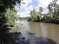
The Beuvron flows into the Loire at Candé-sur-Beuvron, near Chaumont-sur-Loire.
Tributaries[]
- Néant (in Vernou-en-Sologne)
- Cosson (in Candé-sur-Beuvron)
References[]
External links[]
Categories:
- Tributaries of the Loire
- Rivers of France
- Rivers of Centre-Val de Loire
- Rivers of Loiret
- Rivers of Loir-et-Cher
- Centre-Val de Loire geography stubs
- France river stubs