Bracieux
Bracieux | |
|---|---|
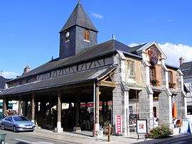 Covered market | |
 Coat of arms | |
show Location of Bracieux | |
 Bracieux | |
| Coordinates: 47°32′58″N 1°32′33″E / 47.5494°N 1.5425°ECoordinates: 47°32′58″N 1°32′33″E / 47.5494°N 1.5425°E | |
| Country | France |
| Region | Centre-Val de Loire |
| Department | Loir-et-Cher |
| Arrondissement | Blois |
| Canton | Chambord |
| Intercommunality | Grand Chambord |
| Government | |
| • Mayor (2020–2026) | Hélène Pailloux |
| Area 1 | 2.95 km2 (1.14 sq mi) |
| Population (Jan. 2018)[1] | 1,304 |
| • Density | 440/km2 (1,100/sq mi) |
| Time zone | UTC+01:00 (CET) |
| • Summer (DST) | UTC+02:00 (CEST) |
| INSEE/Postal code | 41025 /41250 |
| Elevation | 74–89 m (243–292 ft) (avg. 80 m or 260 ft) |
| 1 French Land Register data, which excludes lakes, ponds, glaciers > 1 km2 (0.386 sq mi or 247 acres) and river estuaries. | |


show This article may be expanded with text translated from the corresponding article in French. (December 2008) Click [show] for important translation instructions. |
Bracieux (pronounced [bʁasjø]) is a commune in the French department of Loir-et-Cher, region of Centre-Val de Loire.
It's located about 20 km (12.5 mi) from Blois, and about 10 km (6 mi) from Chambord.
Population[]
|
|
See also[]
- Communes of the Loir-et-Cher department
References[]
- ^ "Populations légales 2018". INSEE. 28 December 2020.
| Wikimedia Commons has media related to Bracieux. |
| show Communes of the Loir-et-Cher department |
|---|
| show Authority control |
|---|
This Loir-et-Cher geographical article is a stub. You can help Wikipedia by . |
Categories:
- Communes of Loir-et-Cher
- Loir-et-Cher geography stubs