Gièvres
Gièvres | |
|---|---|
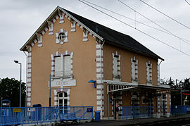 Railway station | |
 Coat of arms | |
show Location of Gièvres | |
 Gièvres | |
| Coordinates: 47°16′38″N 1°40′11″E / 47.2772°N 1.6697°ECoordinates: 47°16′38″N 1°40′11″E / 47.2772°N 1.6697°E | |
| Country | France |
| Region | Centre-Val de Loire |
| Department | Loir-et-Cher |
| Arrondissement | Romorantin-Lanthenay |
| Canton | Selles-sur-Cher |
| Intercommunality | Romorantinais et Monestois |
| Government | |
| • Mayor (2020–2026) | Françoise Gilot-Leclerc |
| Area 1 | 38.05 km2 (14.69 sq mi) |
| Population (Jan. 2018)[1] | 2,386 |
| • Density | 63/km2 (160/sq mi) |
| Time zone | UTC+01:00 (CET) |
| • Summer (DST) | UTC+02:00 (CEST) |
| INSEE/Postal code | 41097 /41130 |
| Elevation | 72–102 m (236–335 ft) |
| 1 French Land Register data, which excludes lakes, ponds, glaciers > 1 km2 (0.386 sq mi or 247 acres) and river estuaries. | |


Gièvres (French pronunciation: [ʒjɛvʁ]) is a commune in the Loir-et-Cher department of central France.
Population[]
|
|
See also[]
- Communes of the Loir-et-Cher department
References[]
- ^ "Populations légales 2018". INSEE. 28 December 2020.
| Wikimedia Commons has media related to Gièvres. |
| show Communes of the Loir-et-Cher department |
|---|
| show Authority control |
|---|
This Loir-et-Cher geographical article is a stub. You can help Wikipedia by . |
Categories:
- Communes of Loir-et-Cher
- Loir-et-Cher geography stubs