Boursay
Boursay | |
|---|---|
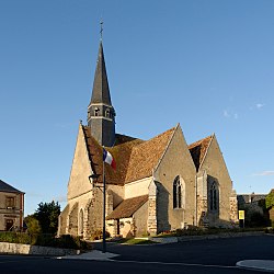 Church of Saint-Pierre | |
 Coat of arms | |
show Location of Boursay | |
 Boursay | |
| Coordinates: 48°01′11″N 0°58′12″E / 48.0197°N 0.97°ECoordinates: 48°01′11″N 0°58′12″E / 48.0197°N 0.97°E | |
| Country | France |
| Region | Centre-Val de Loire |
| Department | Loir-et-Cher |
| Arrondissement | Vendôme |
| Canton | Le Perche |
| Intercommunality | Collines du Perche |
| Government | |
| • Mayor (2020–2026) | Jean-Roger Bourdin[1] |
| Area 1 | 22.08 km2 (8.53 sq mi) |
| Population (Jan. 2018)[2] | 171 |
| • Density | 7.7/km2 (20/sq mi) |
| Time zone | UTC+01:00 (CET) |
| • Summer (DST) | UTC+02:00 (CEST) |
| INSEE/Postal code | 41024 /41270 |
| Elevation | 136–210 m (446–689 ft) (avg. 178 m or 584 ft) |
| 1 French Land Register data, which excludes lakes, ponds, glaciers > 1 km2 (0.386 sq mi or 247 acres) and river estuaries. | |


Boursay is a commune in the Loir-et-Cher department in central France.
Population[]
|
|
See also[]
- Communes of the Loir-et-Cher department
References[]
- ^ "Répertoire national des élus: les maires". data.gouv.fr, Plateforme ouverte des données publiques françaises (in French). 2 December 2020.
- ^ "Populations légales 2018". INSEE. 28 December 2020.
| Wikimedia Commons has media related to Boursay. |
| show Communes of the Loir-et-Cher department |
|---|
This Loir-et-Cher geographical article is a stub. You can help Wikipedia by . |
Categories:
- Communes of Loir-et-Cher
- Loir-et-Cher geography stubs