Theillay
Theillay | |
|---|---|
Commune | |
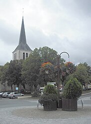 Church of Saint-Sulpice | |
 Coat of arms | |
show Location of Theillay | |
 Theillay | |
| Coordinates: 47°18′52″N 2°02′28″E / 47.3144°N 2.0411°ECoordinates: 47°18′52″N 2°02′28″E / 47.3144°N 2.0411°E | |
| Country | France |
| Region | Centre-Val de Loire |
| Department | Loir-et-Cher |
| Arrondissement | Romorantin-Lanthenay |
| Canton | Selles-sur-Cher |
| Intercommunality | Sologne des rivières |
| Government | |
| • Mayor (2020–2026) | Gérard Chopin[1] |
| Area 1 | 96.38 km2 (37.21 sq mi) |
| Population (Jan. 2018)[2] | 1,251 |
| • Density | 13/km2 (34/sq mi) |
| Time zone | UTC+01:00 (CET) |
| • Summer (DST) | UTC+02:00 (CEST) |
| INSEE/Postal code | 41256 /41300 |
| Elevation | 96–168 m (315–551 ft) |
| 1 French Land Register data, which excludes lakes, ponds, glaciers > 1 km2 (0.386 sq mi or 247 acres) and river estuaries. | |


Theillay is a commune of the Loir-et-Cher department in central France.
Geography[]
The Rère flows west through the northern part of the commune.
Population[]
|
|
See also[]
- Communes of the Loir-et-Cher department
References[]
- ^ "Répertoire national des élus: les maires". data.gouv.fr, Plateforme ouverte des données publiques françaises (in French). 2 December 2020.
- ^ "Populations légales 2018". INSEE. 28 December 2020.
| Wikimedia Commons has media related to Theillay. |
| show Communes of the Loir-et-Cher department |
|---|
This Loir-et-Cher geographical article is a stub. You can help Wikipedia by . |
Categories:
- Communes of Loir-et-Cher
- Loir-et-Cher geography stubs