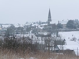
Morée
Morée | |
|---|---|
 | |
 Coat of arms | |
show Location of Morée | |
 Morée | |
| Coordinates: 47°54′13″N 1°14′07″E / 47.9036°N 1.2353°ECoordinates: 47°54′13″N 1°14′07″E / 47.9036°N 1.2353°E | |
| Country | France |
| Region | Centre-Val de Loire |
| Department | Loir-et-Cher |
| Arrondissement | Vendôme |
| Canton | Le Perche |
| Intercommunality | Perche et Haut Vendômois |
| Government | |
| • Mayor (2020–2026) | Alain Bourgeois |
| Area 1 | 25.83 km2 (9.97 sq mi) |
| Population (Jan. 2018)[1] | 1,082 |
| • Density | 42/km2 (110/sq mi) |
| Time zone | UTC+01:00 (CET) |
| • Summer (DST) | UTC+02:00 (CEST) |
| INSEE/Postal code | 41154 /41160 |
| Elevation | 86–152 m (282–499 ft) (avg. 96 m or 315 ft) |
| 1 French Land Register data, which excludes lakes, ponds, glaciers > 1 km2 (0.386 sq mi or 247 acres) and river estuaries. | |


Morée (French pronunciation: [mɔʁe]) is a commune in the Loir-et-Cher department of central France.
Population[]
|
|
See also[]
- Communes of the Loir-et-Cher department
References[]
- ^ "Populations légales 2018". INSEE. 28 December 2020.
| Wikimedia Commons has media related to Morée (Loir-et-Cher). |
| show Communes of the Loir-et-Cher department |
|---|
| show Authority control |
|---|
This Loir-et-Cher geographical article is a stub. You can help Wikipedia by . |
Categories:
- Communes of Loir-et-Cher
- Loir-et-Cher geography stubs