Saint-Hilaire-la-Gravelle
Saint-Hilaire-la-Gravelle | |
|---|---|
Commune | |
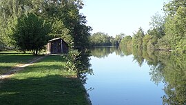 The Loir | |
 Coat of arms | |
show Location of Saint-Hilaire-la-Gravelle | |
 Saint-Hilaire-la-Gravelle | |
| Coordinates: 47°55′31″N 1°12′27″E / 47.9253°N 1.2075°ECoordinates: 47°55′31″N 1°12′27″E / 47.9253°N 1.2075°E | |
| Country | France |
| Region | Centre-Val de Loire |
| Department | Loir-et-Cher |
| Arrondissement | Vendôme |
| Canton | Le Perche |
| Intercommunality | Perche et Haut Vendômois |
| Government | |
| • Mayor (2014–2020) | Dominique Maroye-Patignier |
| Area 1 | 17.57 km2 (6.78 sq mi) |
| Population (Jan. 2018)[1] | 701 |
| • Density | 40/km2 (100/sq mi) |
| Time zone | UTC+01:00 (CET) |
| • Summer (DST) | UTC+02:00 (CEST) |
| INSEE/Postal code | 41214 /41160 |
| Elevation | 87–172 m (285–564 ft) (avg. 92 m or 302 ft) |
| 1 French Land Register data, which excludes lakes, ponds, glaciers > 1 km2 (0.386 sq mi or 247 acres) and river estuaries. | |


Saint-Hilaire-la-Gravelle is a commune in the Loir-et-Cher department of central France.
Population[]
|
|
See also[]
- Communes of the Loir-et-Cher department
References[]
- ^ "Populations légales 2018". INSEE. 28 December 2020.
| Wikimedia Commons has media related to Saint-Hilaire-la-Gravelle. |
| show Communes of the Loir-et-Cher department |
|---|
This Loir-et-Cher geographical article is a stub. You can help Wikipedia by . |
Categories:
- Communes of Loir-et-Cher
- Loir-et-Cher geography stubs