Villeny
Villeny | |
|---|---|
Commune | |
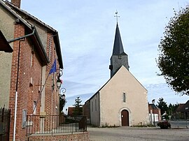 Town hall and church | |
show Location of Villeny | |
 Villeny | |
| Coordinates: 47°37′25″N 1°45′20″E / 47.6236°N 1.7556°ECoordinates: 47°37′25″N 1°45′20″E / 47.6236°N 1.7556°E | |
| Country | France |
| Region | Centre-Val de Loire |
| Department | Loir-et-Cher |
| Arrondissement | Romorantin-Lanthenay |
| Canton | Chambord |
| Intercommunality | Sologne des étangs |
| Government | |
| • Mayor (2014–2020) | Alain Blanche |
| Area 1 | 33.98 km2 (13.12 sq mi) |
| Population (Jan. 2018)[1] | 489 |
| • Density | 14/km2 (37/sq mi) |
| Time zone | UTC+01:00 (CET) |
| • Summer (DST) | UTC+02:00 (CEST) |
| INSEE/Postal code | 41285 /41220 |
| Elevation | 93–136 m (305–446 ft) (avg. 130 m or 430 ft) |
| 1 French Land Register data, which excludes lakes, ponds, glaciers > 1 km2 (0.386 sq mi or 247 acres) and river estuaries. | |


Villeny is a commune in the Loir-et-Cher department in central France.
Population[]
| Year | Pop. | ±% |
|---|---|---|
| 1793 | 311 | — |
| 1806 | 381 | +22.5% |
| 1821 | 423 | +11.0% |
| 1831 | 411 | −2.8% |
| 1841 | 426 | +3.6% |
| 1851 | 444 | +4.2% |
| 1861 | 460 | +3.6% |
| 1872 | 563 | +22.4% |
| 1881 | 614 | +9.1% |
| 1891 | 580 | −5.5% |
| 1901 | 742 | +27.9% |
| 1911 | 733 | −1.2% |
| 1921 | 669 | −8.7% |
| 1931 | 625 | −6.6% |
| 1946 | 570 | −8.8% |
| 1954 | 526 | −7.7% |
| 1962 | 488 | −7.2% |
| 1968 | 461 | −5.5% |
| 1975 | 381 | −17.4% |
| 1982 | 336 | −11.8% |
| 1990 | 324 | −3.6% |
| 1999 | 334 | +3.1% |
| 2004 | 337 | +0.9% |
| 2015 | 493 | +46.3% |
See also[]
- Communes of the Loir-et-Cher department
References[]
- ^ "Populations légales 2018". INSEE. 28 December 2020.
| Wikimedia Commons has media related to Villeny. |
| show Communes of the Loir-et-Cher department |
|---|
| show Authority control |
|---|
This Loir-et-Cher geographical article is a stub. You can help Wikipedia by . |
Categories:
- Communes of Loir-et-Cher
- Loir-et-Cher geography stubs