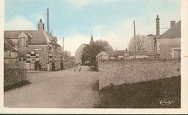
Lancôme, Loir-et-Cher
Lancôme | |
|---|---|
 | |
show Location of Lancôme | |
 Lancôme | |
| Coordinates: 47°38′59″N 1°07′27″E / 47.6497°N 1.1242°ECoordinates: 47°38′59″N 1°07′27″E / 47.6497°N 1.1242°E | |
| Country | France |
| Region | Centre-Val de Loire |
| Department | Loir-et-Cher |
| Arrondissement | Blois |
| Canton | Onzain |
| Intercommunality | CA Blois Agglopolys |
| Government | |
| • Mayor (2020–2026) | Philippe Bourgueil[1] |
| Area 1 | 9.89 km2 (3.82 sq mi) |
| Population (Jan. 2018)[2] | 123 |
| • Density | 12/km2 (32/sq mi) |
| Time zone | UTC+01:00 (CET) |
| • Summer (DST) | UTC+02:00 (CEST) |
| INSEE/Postal code | 41108 /41190 |
| Elevation | 105–129 m (344–423 ft) (avg. 118 m or 387 ft) |
| 1 French Land Register data, which excludes lakes, ponds, glaciers > 1 km2 (0.386 sq mi or 247 acres) and river estuaries. | |


Lancôme (French pronunciation: [lɑ̃kom]) is a commune in the Loir-et-Cher department of central France.
Population[]
|
|
See also[]
- Communes of the Loir-et-Cher department
References[]
- ^ "Répertoire national des élus: les maires". data.gouv.fr, Plateforme ouverte des données publiques françaises (in French). 2 December 2020.
- ^ "Populations légales 2018". INSEE. 28 December 2020.
| Wikimedia Commons has media related to Lancôme (Loir-et-Cher). |
| show Communes of the Loir-et-Cher department |
|---|
This Loir-et-Cher geographical article is a stub. You can help Wikipedia by . |
Categories:
- Communes of Loir-et-Cher
- Loir-et-Cher geography stubs