Villebarou
Villebarou | |
|---|---|
Commune | |
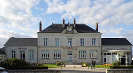 Town hall | |
show Location of Villebarou | |
 Villebarou | |
| Coordinates: 47°37′24″N 1°19′27″E / 47.6233°N 1.3242°ECoordinates: 47°37′24″N 1°19′27″E / 47.6233°N 1.3242°E | |
| Country | France |
| Region | Centre-Val de Loire |
| Department | Loir-et-Cher |
| Arrondissement | Blois |
| Canton | Blois-2 |
| Intercommunality | CA Blois Agglopolys |
| Government | |
| • Mayor (2020–2026) | Philippe Masson |
| Area 1 | 9.11 km2 (3.52 sq mi) |
| Population (Jan. 2018)[1] | 2,462 |
| • Density | 270/km2 (700/sq mi) |
| Time zone | UTC+01:00 (CET) |
| • Summer (DST) | UTC+02:00 (CEST) |
| INSEE/Postal code | 41276 /41000 |
| Elevation | 108–121 m (354–397 ft) (avg. 120 m or 390 ft) |
| 1 French Land Register data, which excludes lakes, ponds, glaciers > 1 km2 (0.386 sq mi or 247 acres) and river estuaries. | |


Villebarou (pronounced [vilˈbaʁu]) is a commune in the Loir-et-Cher department, Centre-Val de Loire, France. It is located 3.8 km (2.4 mi) from Blois.
Population[]
|
|
See also[]
- Communes of the Loir-et-Cher department
References[]
- ^ "Populations légales 2018". INSEE. 28 December 2020.
| Wikimedia Commons has media related to Villebarou (Loir-et-Cher). |
| show Communes of the Loir-et-Cher department |
|---|
This Loir-et-Cher geographical article is a stub. You can help Wikipedia by . |
Categories:
- Communes of Loir-et-Cher
- Loir-et-Cher geography stubs