Bezirk Halle
Bezirk Halle | |
|---|---|
District | |
 Coat of arms | |
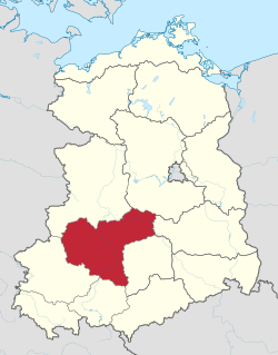 Location of Bezirk Halle within the German Democratic Republic | |
| Coordinates: 51°30′N 12°0′E / 51.500°N 12.000°E | |
| Country | German Democratic Republic |
| Subdivisions | 20 Kreise and 3 Stadtkreise |
| Formed | 1952 |
| Dissolved | 1990 |
| Seat | Halle |
| Area | |
| • Total | 8,771 km2 (3,387 sq mi) |
| Population (1989)[1] | |
| • Total | 1,776,500 |
| • Density | 200/km2 (520/sq mi) |
| Vehicle registration | K, V |

The Bezirk Halle was a district (Bezirk) of East Germany. The administrative seat and the main town was Halle.
History[]
The district was established, with the other 13, on 25 July 1952, substituting the old German states. After 3 October 1990 it was disestablished as a consequence of the German reunification, becoming again part of the state of Saxony-Anhalt except Artern kreis, which became part of Thuringia.
Geography[]
Position[]
The Bezirk Halle bordered with the Bezirke of Magdeburg, Potsdam, Cottbus, Leipzig, Gera and Erfurt.
Subdivision[]
The Bezirk was divided into 23 Kreise: 3 urban districts (Stadtkreise) and 20 rural districts (Landkreise):
- Urban districts : Dessau; Halle; Halle-Neustadt.[2]
- Rural districts : Artern; ; ; ; ; ; ; ; ; ; ; ; ; ; ; ; ; ; ; .
See also[]
References[]
External links[]
![]() Media related to Halle District (GDR) at Wikimedia Commons
Media related to Halle District (GDR) at Wikimedia Commons

| Authority control |
|---|
Categories:
- Bezirk Halle
- Districts of East Germany
- Former states and territories of Saxony-Anhalt
- 1952 establishments in East Germany
- 1990 disestablishments in Germany
- States and territories established in 1952