Bigelow, Missouri
Bigelow, Missouri | |
|---|---|
 | |
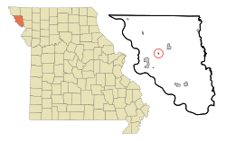 Location of Bigelow, Missouri | |
| Coordinates: 40°6′37″N 95°17′25″W / 40.11028°N 95.29028°WCoordinates: 40°6′37″N 95°17′25″W / 40.11028°N 95.29028°W | |
| Country | United States |
| State | Missouri |
| County | Holt |
| Area | |
| • Total | 0.10 sq mi (0.25 km2) |
| • Land | 0.10 sq mi (0.25 km2) |
| • Water | 0.00 sq mi (0.00 km2) |
| Elevation | 860 ft (262 m) |
| Population (2020) | |
| • Total | 5 |
| • Estimate (2019)[2] | 24 |
| • Density | 250.00/sq mi (96.71/km2) |
| Time zone | UTC-6 (Central (CST)) |
| • Summer (DST) | UTC-5 (CDT) |
| ZIP code | 64437 |
| Area code(s) | 660 |
| FIPS code | 29-05464[3] |
| GNIS feature ID | 0730058[4] |

Bigelow is a village in Holt County, Missouri, United States. The population was 5 at the 2020 census.[5]
History[]
A post office called Bigelow was established in 1869, and remained in operation until 1992.[6] The village was named after a railroad promoter.[7]
Geography[]
Bigelow is located at 40°6′37″N 95°17′25″W / 40.11028°N 95.29028°W (40.110204, -95.290252).[8]
According to the United States Census Bureau, the village has a total area of 0.09 square miles (0.23 km2), all land.[9]
Demographics[]
| Historical population | |||
|---|---|---|---|
| Census | Pop. | %± | |
| 1880 | 190 | — | |
| 1900 | 195 | — | |
| 1910 | 156 | −20.0% | |
| 1920 | 161 | 3.2% | |
| 1930 | 138 | −14.3% | |
| 1940 | 143 | 3.6% | |
| 1950 | 132 | −7.7% | |
| 1960 | 100 | −24.2% | |
| 1970 | 84 | −16.0% | |
| 1980 | 67 | −20.2% | |
| 1990 | 32 | −52.2% | |
| 2000 | 38 | 18.8% | |
| 2010 | 27 | −28.9% | |
| 2019 (est.) | 24 | [2] | −11.1% |
| U.S. Decennial Census[10] | |||
2010 census[]
As of the census[11] of 2010, there were 27 people, 12 households, and 6 families residing in the village. The population density was 300.0 inhabitants per square mile (115.8/km2). There were 22 housing units at an average density of 244.4 per square mile (94.4/km2). The racial makeup of the village was 100.0% White.
There were 12 households, of which 25.0% had children under the age of 18 living with them, 33.3% were married couples living together, 16.7% had a female householder with no husband present, and 50.0% were non-families. 41.7% of all households were made up of individuals, and 16.6% had someone living alone who was 65 years of age or older. The average household size was 2.25 and the average family size was 3.17.
The median age in the village was 33.8 years. 29.6% of residents were under the age of 18; 7.4% were between the ages of 18 and 24; 22.2% were from 25 to 44; 11.1% were from 45 to 64; and 29.6% were 65 years of age or older. The gender makeup of the village was 51.9% male and 48.1% female.
2000 census[]
As of the census[3] of 2000, there were 38 people, 16 households, and 12 families residing in the village. The population density was 415.9 people per square mile (163.0/km2). There were 26 housing units at an average density of 284.6 per square mile (111.5/km2). The racial makeup of the village was 100.00% White.
There were 16 households, out of which 18.8% had children under the age of 18 living with them, 50.0% were married couples living together, 25.0% had a female householder with no husband present, and 25.0% were non-families. 25.0% of all households were made up of individuals, and 12.5% had someone living alone who was 65 years of age or older. The average household size was 2.38 and the average family size was 2.83.
In the village, the population was spread out, with 28.9% under the age of 18, 2.6% from 18 to 24, 10.5% from 25 to 44, 18.4% from 45 to 64, and 39.5% who were 65 years of age or older. The median age was 60 years. For every 100 females, there were 123.5 males. For every 100 females age 18 and over, there were 80.0 males.
The median income for a household in the village was $23,750, and the median income for a family was $26,250. Males had a median income of $26,250 versus $10,000 for females. The per capita income for the village was $13,067. There were 12.5% of families and 31.0% of the population living below the poverty line, including 100.0% of under eighteens and none of those over 64.
References[]
- ^ "2019 U.S. Gazetteer Files". United States Census Bureau. Retrieved July 26, 2020.
- ^ a b "Population and Housing Unit Estimates". United States Census Bureau. May 24, 2020. Retrieved May 27, 2020.
- ^ a b "U.S. Census website". United States Census Bureau. Retrieved 2008-01-31.
- ^ "US Board on Geographic Names". United States Geological Survey. 2007-10-25. Retrieved 2008-01-31.
- ^ "Explore Census Data". data.census.gov. Retrieved 2021-12-16.
- ^ "Post Offices". Jim Forte Postal History. Retrieved 8 October 2016.
- ^ "Holt County Place Names, 1928–1945 (archived)". The State Historical Society of Missouri. Archived from the original on 24 June 2016. Retrieved 8 October 2016.CS1 maint: bot: original URL status unknown (link)
- ^ "US Gazetteer files: 2010, 2000, and 1990". United States Census Bureau. 2011-02-12. Retrieved 2011-04-23.
- ^ "US Gazetteer files 2010". United States Census Bureau. Archived from the original on January 12, 2012. Retrieved 2012-07-08.
- ^ "Census of Population and Housing". Census.gov. Retrieved June 4, 2015.
- ^ "U.S. Census website". United States Census Bureau. Retrieved 2012-07-08.
Municipalities and communities of Holt County, Missouri, United States | ||
|---|---|---|
| Cities |  | |
| Villages | ||
| Townships | ||
| Unincorporated communities | ||
| Ghost towns | ||
| ||
- Villages in Holt County, Missouri
- Villages in Missouri