Bismark, Germany
This article needs additional citations for verification. (March 2013) |
Bismark | |
|---|---|
 Protestant church in Bismark | |
 Coat of arms | |
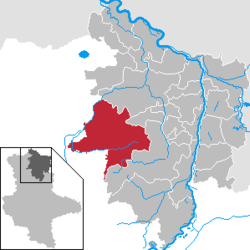
show Location of Bismark within Stendal district | |
 Bismark | |
| Coordinates: 52°40′0″N 11°33′0″E / 52.66667°N 11.55000°ECoordinates: 52°40′0″N 11°33′0″E / 52.66667°N 11.55000°E | |
| Country | Germany |
| State | Saxony-Anhalt |
| District | Stendal |
| Government | |
| • Mayor (2016–23) | Annegret Schwarz[1] |
| Area | |
| • Total | 289.43 km2 (111.75 sq mi) |
| Elevation | 55 m (180 ft) |
| Population (2020-12-31)[2] | |
| • Total | 8,094 |
| • Density | 28/km2 (72/sq mi) |
| Time zone | UTC+01:00 (CET) |
| • Summer (DST) | UTC+02:00 (CEST) |
| Postal codes | 39576, 39579, 39599, 39606, 39624, 39629 |
| Dialling codes | 039080, 039083, 039089, 039320, 039324, 039325, 039328 |
| Vehicle registration | SDL |
| Website | www.stadt-bismark.de |


Bismark is a town in the Stendal district, in the historic Altmark region, which is located in the northern part of the state of Saxony-Anhalt, Germany. It is situated approximately 22 km (14 mi) west of Stendal in north-eastern Germany.
In the early 12th century, the area then under the rule of Albert the Bear was settled with peasants migrating from the Low Countries. The town's name is derived from the nearby river Biese (after Dutch: bies meaning rush plants); though it may also refer to the bishop's march, a possession of the Havelberg bishops mentioned in a 1209 deed issued by the Ascanian margrave Albert II. With the Altmark, Bismark was part of the Margraviate of Brandenburg until it was adjudicated to the Prussian Province of Saxony after the 1815 Congress of Vienna.
One Herbordus of Bismarck was mentioned holding the office of a Schultheiß in Stendal about 1270. His descendant Otto von Bismarck received the honorary citizenship of Bismark in 1895.
Since an administrative reform that became effective on 1 January 2010, the town of Bismark has comprised the former municipalities of Badingen, Berkau, Büste, Dobberkau, Garlipp, Grassau, Hohenwulsch, Holzhausen, Käthen, Kläden, Könnigde, Kremkau, Meßdorf, Querstedt, Schäplitz, Schernikau, Schorstedt and Steinfeld.[3]
References[]
- ^ Bürgermeisterwahlen in den Gemeinden, Endgültige Ergebnisse, Statistisches Landesamt Sachsen-Anhalt, accessed 8 July 2021.
- ^ "Bevölkerung der Gemeinden – Stand: 31. Dezember 2020" (PDF). Statistisches Landesamt Sachsen-Anhalt (in German). June 2021.
- ^ Gebietsänderungen vom 01.01. bis 31.12.2010, Statistisches Bundesamt
| Wikimedia Commons has media related to Bismark (Altmark). |
| show Authority control |
|---|
This Stendal district location article is a stub. You can help Wikipedia by . |
- Towns in Saxony-Anhalt
- Stendal (district)
- Province of Saxony
- Stendal district geography stubs