Biwer
Biwer
Biwer | |
|---|---|
Commune | |
 | |
 Coat of arms | |
 Map of Luxembourg with Biwer highlighted in orange, and the canton in dark red | |
| Coordinates: 49°42′25″N 6°22′20″E / 49.7069°N 6.3722°ECoordinates: 49°42′25″N 6°22′20″E / 49.7069°N 6.3722°E | |
| Country | |
| Canton | Grevenmacher |
| Area | |
| • Total | 23.08 km2 (8.91 sq mi) |
| Area rank | 42nd of 102 |
| Highest elevation | 332 m (1,089 ft) |
| • Rank | 91st of 102 |
| Lowest elevation | 210 m (690 ft) |
| • Rank | 30th of 102 |
| Population (2018) | |
| • Total | 1,817 |
| • Rank | 81st of 102 |
| • Density | 79/km2 (200/sq mi) |
| • Density rank | 74th of 102 |
| Time zone | UTC+1 (CET) |
| • Summer (DST) | UTC+2 (CEST) |
| LU0001102 | |
| Website | biwer.lu |

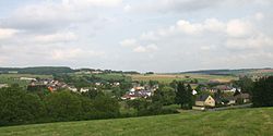
Biwer is a commune and small town in eastern Luxembourg. It is part of the canton of Grevenmacher. As of January 2018, the commune has a population of 1,817 inhabitants.
As of June 2018, the town of Biwer, which lies in the east of the commune, has a population of 1,403 inhabitants.[1] Other localities within the commune include, Boudler, Brouch, Hagelsdorf, Wecker, and Weydig.[1]
References[]
- ^ Jump up to: a b "La commune se présente". Administration Communale de la commune de Biwer (in French). Retrieved 2 July 2018.
External links[]
 Media related to Biwer at Wikimedia Commons
| show Places adjacent to Biwer |
|---|

| Authority control |
|---|
This Luxembourg location article is a stub. You can help Wikipedia by . |
Categories:
- Biwer
- Communes in Grevenmacher (canton)
- Towns in Luxembourg
- Luxembourg geography stubs