Black Head (St Austell), Cornwall
| Black Head | |
|---|---|
 | |
 | |
| Location | St Austell Bay, Cornwall |
| OS grid | SX 039 480 |
| Coordinates | 50°17′57″N 4°45′16″W / 50.29917°N 4.75444°WCoordinates: 50°17′57″N 4°45′16″W / 50.29917°N 4.75444°W |
| Operator | National Trust |
| Designation | Scheduled monument |

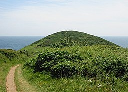
Black Head is a headland at the western end of St Austell Bay, in Cornwall, England. It is owned by the National Trust.[1]
Description[]
It is the site of an Iron Age promontory fort. There are two parallel ramparts, up to 5.2 metres (17 ft) high, with ditches of depth 2.1 metres (6 ft 11 in); slight remains are visible of a further rampart beyond. The fort is a scheduled monument. There are also the remains of a rifle range, built in the 1880s and modified in later years.[2]
A memorial stone for the Cornish writer A. L. Rowse is situated on Black Head. In retirement he lived in the nearby hamlet of Trenarren. The stone includes the inscription "This was the land of my content".[3]
References[]
| Wikimedia Commons has media related to Black Head, St Austell Bay. |
- ^ "Opening times at The Dodman" National Trust. Retrieved 11 October 2020.
- ^ Historic England. "Promontory fort at Black Head (1004391)". National Heritage List for England. Retrieved 10 October 2020.
- ^ "Walk - Black Head & Castle Gotha" South West Coast Path. Retrieved 10 October 2020.
Cornwall Portal | |
| Unitary authorities |
|
| Major settlements |
|
| Rivers | |
| Topics |
|
Categories:
- Hill forts in Cornwall
- Headlands of Cornwall
- Iron Age sites in Cornwall
- Scheduled monuments in Cornwall
- National Trust properties in Cornwall