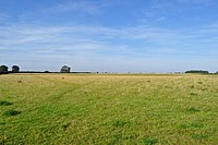
Bloodgate Hill Iron Age Fort

The Bloodgate Hill Iron Age Fort is an Iron Age hill fort in Norfolk, England, situated on a hill above the village of South Creake in the north of the county. The meaning of the name Bloodgate is unknown, but is taken from the road that runs from the fort to the village.

The circular fort has a diameter of 210 metres, making it the largest of the hill forts known in Norfolk. Much of the visible remains disappeared in 1827–8, when the ramparts were levelled during agricultural improvements. The land continued to be ploughed until 2003, when the land was acquired by the . The site is now preserved and accessible. However little excavation has yet been undertaken.
References[]
- Norfolk Archaeological Trust (2005). Bloodgate Hill Iron Age Hillfort. Retrieved October 21, 2005.
External links[]
- Map sources for Bloodgate Hill Iron Age Fort
Images of Bloodgate Hill [1]
Coordinates: 52°53′00″N 0°44′42″E / 52.88340°N 0.74504°E
- King's Lynn and West Norfolk
- Hill forts in Norfolk
- Archaeological sites in Norfolk
- Norfolk building and structure stubs
