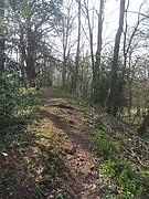
Wychbury Ring
| Wychbury Ring | |
|---|---|
 Location within West Midlands county | |
| General information | |
| Type | Hill fort |
| Town or city | Hagley |
| Country | England |
| Coordinates | 52°26′00″N 2°07′09″W / 52.43322°N 2.11909°WCoordinates: 52°26′00″N 2°07′09″W / 52.43322°N 2.11909°W |
| Construction started | Iron Age |
| Technical details | |
| Size | 7.5 acres (3.0 ha) |
Wychbury Ring is an Iron Age hill fort located on Wychbury Hill, near Hagley, Stourbridge, on the border of West Midlands and Worcestershire in the English Midlands.
Description[]
The fort measures 250 m (820 ft) from east to west and 150 m (490 ft) from north to south, covering an area of 7.25 acres (2.93 ha). It has two sets of ramparts and ditches. The inner rampart is between 16 m (52 ft) and 20 m (66 ft) wide, rising up to 2.6 m (8 ft 6 in) in height, with the surrounding inner ditch 10 m (33 ft) wide and up to 1.7 m (5 ft 7 in) deep. The outer rampart is 10 m (33 ft) wide and up to 3 m (9.8 ft) in height, with the outer ditch being 10 m (33 ft) wide and up to 1.2 m (3 ft 11 in) deep. There are fortified entrances at the east and south west.[1]
Small bronze rings, including an Iron Age terret, were found in the fort in 1884, and Roman coins and masonry have been found nearby, suggesting a possible site of a later Roman Villa. Investigations in 1924 reported a 5.5-acre (22,000 m2) annexe to the south and a nearby Iron Age field system, but no trace of either remain.[1]
Images[]

Eastern end

Southern rampart
References[]
- ^ a b Historic England. "Wychbury Ring (118705)". Research records (formerly PastScape). Retrieved 2009-08-14.
External links[]
- Structures on the Heritage at Risk register
- Hill forts in the West Midlands (county)
- Hill forts in Worcestershire
- Iron Age sites in England


