Bladel
Bladel | |
|---|---|
Municipality | |
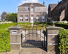
 Townhall in Bladel | |
 Flag Coat of arms | |
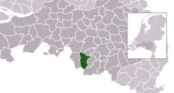 Location in North Brabant | |
| Coordinates: 51°22′N 5°13′E / 51.367°N 5.217°ECoordinates: 51°22′N 5°13′E / 51.367°N 5.217°E | |
| Country | Netherlands |
| Province | North Brabant |
| Government | |
| • Body | Municipal council |
| • Mayor | Remco Bosma (VVD) |
| Area | |
| • Total | 75.62 km2 (29.20 sq mi) |
| • Land | 75.33 km2 (29.09 sq mi) |
| • Water | 0.29 km2 (0.11 sq mi) |
| Elevation | 32 m (105 ft) |
| Population (January 2019)[3] | |
| • Total | 20,175 |
| • Density | 268/km2 (690/sq mi) |
| Time zone | UTC+1 (CET) |
| • Summer (DST) | UTC+2 (CEST) |
| Postcode | 5527–5534 |
| Area code | 0497 |
| Website | www |

Bladel (Dutch pronunciation: [ˈblaːdəl] (![]() listen)) is a municipality and a town in the southern Netherlands.
listen)) is a municipality and a town in the southern Netherlands.
Population centres[]
- Bladel
- Casteren
- Hapert
- Hoogeloon
- Netersel
Topography[]
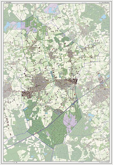
Dutch Topographic map of the municipality of Bladel, 2013.
Notable residents[]

Roy Beerens, 2008
- Jan Renier Snieders (1812 in Bladel – 1888) a Flemish writer
- August Snieders (1825 in Bladel – 1904) a Flemish journalist and writer
- Corky de Graauw (born 1951 in Bladel) a former Dutch ice hockey player, competed at the 1980 Winter Olympics
- Alain van Katwijk (born 1979 in Bladel) a former Dutch cyclist
- Roy Beerens (born 1987 in Bladel) a Dutch professional footballer with 320 club caps
Gallery[]

Tower former church
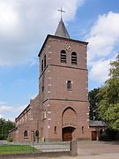
Antonius van Padua en Brigidakerk Netersel

Overzicht - Hapert
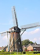
Hapertse molen
Pastorie bij de Sint-Willibrordkerk in Casteren

Overzicht kapel gezien vanaf de andere kant van het water - Hoogeloon


References[]
- ^ "Kerncijfers wijken en buurten 2020" [Key figures for neighbourhoods 2020]. StatLine (in Dutch). CBS. 24 July 2020. Retrieved 19 September 2020.
- ^ "Postcodetool for 5531BC". Actueel Hoogtebestand Nederland (in Dutch). Het Waterschapshuis. Retrieved 1 May 2014.
- ^ "Bevolkingsontwikkeling; regio per maand" [Population growth; regions per month]. CBS Statline (in Dutch). CBS. 1 January 2019. Retrieved 1 January 2019.
External links[]
 Media related to Bladel at Wikimedia Commons
- Official website
| show Places adjacent to Bladel |
|---|
| show Municipalities of North Brabant |
|---|

| Authority control |
|
|---|
This North Brabant location article is a stub. You can help Wikipedia by . |
Categories:
- Bladel
- Municipalities of North Brabant
- Populated places in North Brabant
- North Brabant geography stubs