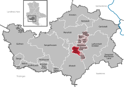
Blankenheim, Saxony-Anhalt
Blankenheim | |
|---|---|
 Coat of arms | |
show Location of Blankenheim within Mansfeld-Südharz district | |
 Blankenheim | |
| Coordinates: 51°30′27″N 11°25′51″E / 51.50750°N 11.43083°ECoordinates: 51°30′27″N 11°25′51″E / 51.50750°N 11.43083°E | |
| Country | Germany |
| State | Saxony-Anhalt |
| District | Mansfeld-Südharz |
| Municipal assoc. | Mansfelder Grund-Helbra |
| Government | |
| • Mayor (2020–27) | André Strobach[1] (FDP) |
| Area | |
| • Total | 14.85 km2 (5.73 sq mi) |
| Elevation | 280 m (920 ft) |
| Population (2020-12-31)[2] | |
| • Total | 1,141 |
| • Density | 77/km2 (200/sq mi) |
| Time zone | UTC+01:00 (CET) |
| • Summer (DST) | UTC+02:00 (CEST) |
| Postal codes | 06528 |
| Dialling codes | 034659 |
| Vehicle registration | MSH, EIL, HET, ML, SGH |
Blankenheim is a municipality in the Mansfeld-Südharz district, Saxony-Anhalt, Germany.
History[]

Klosterrode monastery

St. Lamberti Chapel in Blankenheim
The earliest known documented mention of Blankenheim dates from 1181. The development of the place was closely connected to the history of the Premonstratenian monastery Rode in the modern-day Klosterrode.
References[]
- ^ Bürgermeisterwahlen in den Gemeinden, Endgültige Ergebnisse, Statistisches Landesamt Sachsen-Anhalt, accessed 8 July 2021.
- ^ "Bevölkerung der Gemeinden – Stand: 31. Dezember 2020" (PDF). Statistisches Landesamt Sachsen-Anhalt (in German). June 2021.
Categories:
- Municipalities in Saxony-Anhalt
- Mansfeld-Südharz
- Province of Saxony
- Bezirk Halle
- Mansfeld-Südharz geography stubs


