Blue Line (St. Louis MetroLink)
| Blue Line | |
|---|---|
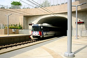 Blue Line train entering Forsyth station. | |
| Overview | |
| Locale | Greater St. Louis |
| Termini | Shrewsbury-Lansdowne I-44 (west) Fairview Heights (east) |
| Stations | 24 |
| Service | |
| Type | Light rail |
| System | St. Louis MetroLink |
| Operator(s) | Metro |
| History | |
| Opened | August 26, 2006 |
| Technical | |
| Line length | 24-mile (39 km) |
| Track gauge | 4 ft 8+1⁄2 in (1,435 mm) |
| Electrification | Overhead lines, 750 V DC |
| Highest elevation | elevated, at-grade, and underground |
The Blue Line, of the St. Louis MetroLink, is a light rail service - operating between 24 stations in Greater St. Louis. It is the newest line in the system.
Route description[]
The Blue Line branch starts in Shrewsbury just west of River des Peres. It crosses over Interstate 44 and the continues north to the next two stations, located in Maplewood; one at the Sunnen Industrial Complex, the other over at Manchester Road. The line then continues further north to the Brentwood I-64 station, located in Brentwood just south of Interstate 64. It then proceeds in a tunnel just underneath Interstate 64, continuing to the Richmond Heights station in Richmond Heights. This station serves the popular St. Louis Galleria shopping center. The line then proceeds on a sharp turn east to Clayton Central station in the median of in Clayton where it serves the Central Business District of St. Louis County. It heads further east into a tunnel opening where there is a station underneath Forsyth Boulevard and Big Bend Boulevard in University City where it serves Washington University . After crossing the St. Louis City/County boundary, the branch makes its last stop right under in St. Louis. The Blue Line now joins with the Red Line at Forest Park–DeBaliviere station as the Shared Alignment. The Blue Line terminates at Fairview Heights station in Fairview Heights.
History prior to MetroLink[]
Much of the southern half of the Blue Line follows a former TRRA/Rock Island railroad right of way that ran from BNSF's junction with the Cuba and River Subdivisions (known as Southeastern junction) to what is now I-170 Business Center in St. John. The current stretch of line from Forest Park to Clayton stations was known as the Forsyth branch until Rock Island abandoned it in 1931. The Terminal Railroad Association of St. Louis (TRRA) used the portion from Clayton station onward, as well as the rest of the portion from St. John to Clayton until 1987 when the portion from Big Bend to Olive Boulevard was severed to the lack of customers on that stretch. This was known as TRRA's Central Belt. The rest of the track was removed in 2002 just prior to construction on the Blue Line. All that remains of the original Central Belt is the portion north from Rock Island Junction, near Overland, MO (where the Central Belt crossed the junction between TRRA's West Belt and the Missouri Central (now Central Midland) Railway, to just a fifth of a mile past Page Avenue where around 10 industries still use TRRA.
Future extensions[]
The Blue Line is part of the . These following extensions will include up to 46-mile (74 km) of track, but in order to plan, design, and construct these separate extensions, they will need anticipated local and federal funding.
Daniel Boone Corridor[]
- Daniel Boone Corridor - Clayton/Shrewsbury to Maryland Heights/Westport
- According to the East-West Gateway Council of Government, it has been identified as the next priority. The Daniel Boone Corridor will extend from the Shrewsbury I-44 Branch (Blue Line) to West St. Louis County, initially terminating near Westport Plaza in Maryland Heights. The 8–10-mile (13–16 km) extension will add up to six stations between Clayton and Maryland Heights in the I-170-Page Corridor serving Ladue, Olivette, and Overland. A recent study shows the alignment might branch off northwest to St. Charles County.
- Phase II - Westport to Chesterfield
- This 12-mile (19 km) extension might become a Phase II of the Daniel Boone Corridor. The alignment crosses west over the Interstate-270/255 Ring in Maryland Heights. It will run along with the Page Ave Extension in North County until it crosses off near Creve Coeur County Park. It then will head westward to the Spirit of St. Louis Airport in the Chesterfield Valley. This alignment has not been given serious consideration because of its perceived low ridership potential.
MetroNorth Corridor[]
- MetroNorth Corridor - Clayton to Florissant
- This 12-mile (19 km) extension will cut off from the Daniel Boone Corridor just north of Clayton in Olivette and Overland to continue north along I-170 to Florissant, Ferguson, Hazelwood, and Berkeley in North County. Most of the line will use the old Rock Island Railroad right-of-way, right alongside I-170. It will continue 3 miles out of the I-170/I-270 interchange in Hazelwood.
MetroSouth Corridor[]
- MetroSouth Corridor - Shrewsbury I-64 to Butler Hill I-55
- This 12-mile (19 km) extension will begin from the Shrewsbury-Landsdowne/I-44 station, following Watson Road in Shrewsbury. The corridor follows a use right-of-way further south to Mehlville, Oakville, Affton, and Butler Hill in South County. The alignment will serve along with the Grant Bike Trail. This extension was deferred in 2005 due to lack of funding.
Station list[]
From Shrewsbury−Lansdowne I-44 to Fairview Heights (west to east)
| Station | Red Line (shared) |
City/town served | County | Opening date |
|---|---|---|---|---|
| Shrewsbury–Lansdowne I-44 | Shrewsbury | St. Louis County | August 26, 2006[1] | |
| Sunnen | Maplewood | |||
| Maplewood–Manchester | ||||
| Brentwood I-64 | Brentwood | |||
| Richmond Heights | Richmond Heights | |||
| Clayton | Clayton | |||
| Forsyth | ||||
| University City–Big Bend | University City | |||
| Skinker | St. Louis | St. Louis independent city | ||
| Forest Park–DeBaliviere | July 31, 1993[2] | |||
| Central West End | ||||
| Cortex | July 31, 2018[3] | |||
| Grand | July 31, 1993[2] | |||
| Union Station | ||||
| Civic Center | ||||
| Central West End | ||||
| Stadium | ||||
| 8th & Pine | ||||
| Convention Center | ||||
| Laclede's Landing | ||||
| East Riverfront | East St. Louis | St. Clair County | May 14, 1994[4] | |
| 5th & Missouri | July 31, 1993[2] | |||
| Emerson Park | May 5, 2001[5] | |||
| Jackie Joyner-Kersee Center | ||||
| Washington Park | ||||
| Fairview Heights | Fairview Heights |
See also[]
- List of St. Louis MetroLink stations
- Red Line (St. Louis MetroLink)
Route map:
| ( • help)
|
References[]
- ^ "Next Stop: Shrewsbury". The St. Louis Post-Dispatch. August 20, 2006. p. C2. Retrieved April 15, 2021 – via Newspapers.com.

- ^ a b c Lindecke, Fred W. (August 1, 1993). "Area Riders Throng to Try MetroLink". The St. Louis Post-Dispatch. pp. 1A, 6A. Retrieved April 15, 2021 – via Newspapers.com.
- ^ "Metro Marks Opening of Cortex Station". The St. Louis Post-Dispatch. August 1, 2018. p. A12. Retrieved April 15, 2021 – via Newspapers.com.
- ^ Goodrich, Robert (April 27, 1994). "E. St. Louis Starring in MetroLink". The St. Louis Post-Dispatch. p. B1. Retrieved April 15, 2021 – via Newspapers.com.
- ^ Leiser, Ken (April 30, 2001). "MetroLink Extension Opens This Weekend With Parking to Spare". The St. Louis Post-Dispatch. p. A9. Retrieved April 15, 2021 – via Newspapers.com.
| Lines | ||
|---|---|---|
| Infrastructure | ||
| Rolling Stock |
| |
| Rail yards | ||
| Connections |
| |
| Connecting services | ||
| Proposed expansions | ||
| Operators | ||
Italic denote lines or services which are proposed and planned. | ||
- Blue Line (St. Louis MetroLink)
- Metro Transit (St. Louis)
- MetroLink (St. Louis)
- Light rail in Missouri
- Light rail in Illinois
- Proposed railway lines in Missouri