Blue River (Colorado)
This article needs additional citations for verification. (January 2011) |
| Blue River (Colorado) | |
|---|---|
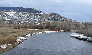 The Blue River near Kremmling, Colorado | |
 Map of the Blue River drainage basin | |
| Location | |
| Country | United States |
| State | Colorado |
| Physical characteristics | |
| Source | Tenmile Range |
| • location | Near Blue River, Summit County |
| • coordinates | 39°23′27″N 106°01′12″W / 39.39083°N 106.02000°W[1] |
| • elevation | 12,800 ft (3,900 m) |
| Mouth | Colorado River |
• location | Kremmling, Grand County |
• coordinates | 40°02′33″N 106°23′48″W / 40.04250°N 106.39667°WCoordinates: 40°02′33″N 106°23′48″W / 40.04250°N 106.39667°W[1] |
• elevation | 7,342 ft (2,238 m) |
| Length | 65 mi (105 km) |
| Basin size | 680 sq mi (1,800 km2)[2] |
| Discharge | |
| • location | 0.3 mi (0.48 km) below Green Mountain Dam[3] |
| • average | 447 cu ft/s (12.7 m3/s)[4] |
| • minimum | 0 cu ft/s (0 m3/s) |
| • maximum | 4,040 cu ft/s (114 m3/s) |
| Basin features | |
| Tributaries | |
| • right | Snake River |

The Blue River is a tributary of the Colorado River, approximately 65 miles (105 km) long,[5] in the U.S. state of Colorado.
It rises in southern Summit County, on the western side of the continental divide in the Ten Mile Range, near Quandary Peak. It flows north past Blue River and Breckenridge, then through the Dillon Reservoir near Dillon. The west portal for the "Roberts Tunnel" is at the base of Dillon Reservoir. The Roberts Tunnel is a trans-basin diversion, built by Denver Water in 1962, that diverts water under the Continental Divide from the Colorado River basin into the South Platte River Basin. The east portal is approximately one mile upstream of Grants, Colorado.[6]
North of Dillon the river flows north-northwest along the eastern slope of the Gore Range and joins the Colorado River at Kremmling.
The Green Mountain Dam, 13 miles (21 km) upstream from Kremmling, forms the Green Mountain Reservoir, providing hydroelectric power and diversionary water for irrigation, as part of the Colorado-Big Thompson Project. The dam is a project of the United States Bureau of Reclamation.
History[]
This section is empty. You can help by . (December 2012) |
See also[]
References[]
- ^ a b "Blue River". Geographic Names Information System. United States Geological Survey. Retrieved 2011-01-26.
- ^ "Blue River Watershed Fast Facts". Blue River Watershed Group. Archived from the original on 2011-08-10. Retrieved 2013-07-16.
- ^ "USGS Gage #09057500 on the Blue River below Green Mountain Reservoir, Colorado" (PDF). National Water Information System. U.S. Geological Survey. 1943–2012. Retrieved 2013-07-16.
- ^ "USGS Gage #09057500 on the Blue River below Green Mountain Reservoir, Colorado" (PDF). National Water Information System. U.S. Geological Survey. 1943–2012. Retrieved 2013-07-16.
- ^ U.S. Geological Survey. National Hydrography Dataset high-resolution flowline data. The National Map Archived 2012-03-29 at the Wayback Machine, accessed March 18, 2011
- ^ Park County Local History Archives. Roberts Tunnel. [1]. Photo 1439, accessed June 13, 2018.
External links[]


This article related to a river in Colorado is a stub. You can help Wikipedia by . |
- Rivers of Colorado
- Rivers of Summit County, Colorado
- Tributaries of the Colorado River in Colorado
- Colorado river stubs