Bluffdale, Utah
Bluffdale, Utah | |
|---|---|
City | |
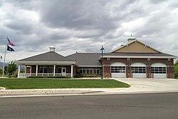 Bluffdale Fire Station in 2013 | |
|
| |
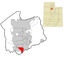 Location in Salt Lake County and the state of Utah. | |
 Location of Utah in the United States | |
| Coordinates: 40°28′24″N 111°56′40″W / 40.47333°N 111.94444°WCoordinates: 40°28′24″N 111°56′40″W / 40.47333°N 111.94444°W | |
| Country | United States |
| State | Utah |
| County | Salt Lake, Utah |
| Founded | 1886 |
| Incorporated | October 13, 1978 |
| Named for | Bluffs (high cliffs) and dales (valleys) along the Jordan River |
| Government | |
| • Mayor | Derk Timothy |
| • City Manager | Mark Reid |
| Area | |
| • Total | 11.14 sq mi (28.86 km2) |
| • Land | 11.14 sq mi (28.85 km2) |
| • Water | 0.00 sq mi (0.01 km2) |
| Elevation | 4,436 ft (1,352 m) |
| Population | |
| • Total | 7,598 |
| • Estimate (2019)[5] | 16,358 |
| • Density | 1,468.53/sq mi (567.01/km2) |
| Time zone | UTC-7 (MST) |
| • Summer (DST) | UTC-6 (MDT) |
| ZIP code | 84065 |
| Area code(s) | 385, 801 |
| FIPS code | 49-06810 [3] |
| GNIS feature ID | 1425844 [4] |
| Website | bluffdale.com |

Bluffdale is a city in Salt Lake and Utah counties in the U.S. state of Utah, located about 20 miles (32 km) south of Salt Lake City. As of the 2010 census, the city population was 7,598.[2] As of the 2018 census,[6] the city population is 14,699.
From 2011 to 2013, the National Security Agency's (NSA) data storage center, the Utah Data Center, was constructed at Camp Williams in Bluffdale. It is approximately 1 million square feet in size.[7][8] Bluffdale is also home to the Granite Point data center.
History[]
Bluffdale, named for its geography of bluffs and dales, was first settled in 1848–1849 when the area was originally part of West Jordan. On July 29, 1858, Orrin Porter Rockwell paid five- hundred dollars to Evan M. Green for sixteen acres of land near to the Crystal Hot Lakes (adjacent to the present Utah State Prison). This land included Hot Springs Hotel and Brewery with dining facilities, stable, brewery, and pony express station. As the community expanded, the Bluffdale area became part of South Jordan, then Riverton. In 1883 the Bluffdale School Precinct was formed from parts of Herriman, South Jordan and Draper. On August 1, 1886, the Bluffdale Ward of The Church of Jesus Christ of Latter-day Saints was organized with Lewis H. Mousley as Bishop. For a short time the town was called Mousley. There are seven irrigation canals that originate at the Jordan Narrows in the Bluffdale area and serve the Salt Lake Valley. One of the earliest was the Utah and Salt Lake Canal started in 1862. Some of the early buildings included an adobe church, built in 1887–1888, a tithing house, and a three-room schoolhouse constructed in 1893. The city incorporated in 1978. [9]
Geography[]
Bluffdale has an area of 10.22 square miles (26.47km2) and an average elevation of 4,436 feet (1,352 m) above sea level. Bluffdale is predominately located in Salt Lake County, though a portion of the city is located in Utah County. Bluffdale shares city borders with Herriman to the west, Riverton to the north, Draper to the east, and Lehi to the south.
Bluffdale is surrounded by wide open spaces with dramatic views of the Wasatch and Oquirrh Mountain Ranges. The Salt Lake Valley floor is the ancient lakebed of Lake Bonneville which existed at the end of the last Ice Age. Several Lake Bonneville shorelines can be distinctly seen on the foothills or benches of nearby mountains. The Jordan River flows through the city and is a drainage of Utah Lake that empties into the Great Salt Lake.
Climate[]
The climate of Bluffdale is semi-arid. Under the Köppen climate classification, Bluffdale has a hot-summer humid continental climate (Dfa) with hot summers and cold, snowy winters.
| Bluffdale, Utah | ||||||||||||||||||||||||||||||||||||||||||||||||
|---|---|---|---|---|---|---|---|---|---|---|---|---|---|---|---|---|---|---|---|---|---|---|---|---|---|---|---|---|---|---|---|---|---|---|---|---|---|---|---|---|---|---|---|---|---|---|---|---|
| Climate chart (explanation) | ||||||||||||||||||||||||||||||||||||||||||||||||
| ||||||||||||||||||||||||||||||||||||||||||||||||
| ||||||||||||||||||||||||||||||||||||||||||||||||
Parks[]
The largest park in Bluffdale is , part of the Salt Lake County Parks system. At 40 acres, the park caters to the recreational needs of the region by providing a splash pad, a 25-foot tall watchtower, pickle ball and basketball courts, bouldering wall, zip lines, and other amenities.
City Parks[]
Bluffdale has a system of 13 parks. Some of the most notable are:
- Bluffdale City Main Park (22.37 acres) is the city's largest park and features 2 pavilions, 16 picnic tables, a trail, and sports fields.
- Vintage Park (6.37 acres) is one of the city's newest parks and features pavilions and picnic tables, pickle ball and tennis courts, and a splash pad.
- Independence Park (5.73 acres) features a splash pad, pavilion, and a variety of play equipment.
- Parry Farms Park (5.63 acres)
- Phillip Gates Memorial Park (4.54 acres)
- Mount Jordan Park (3.69 acres)
Trails[]
The City hosts a variety of beautiful and well-maintained trails weaving through and around the city. A significant portion of the Jordan River Parkway Trail, a 40-mile trail crossing three counties, goes through Bluffdale. The City's trail system includes cycling, pedestrian, and equestrian routes.
Demographics[]

| Historical population | |||
|---|---|---|---|
| Census | Pop. | %± | |
| 1980 | 1,300 | — | |
| 1990 | 2,152 | 65.5% | |
| 2000 | 4,700 | 118.4% | |
| 2010 | 7,598 | 61.7% | |
| 2019 (est.) | 16,358 | [5] | 115.3% |
| U.S. Decennial Census[10] | |||
Bluffdale is part of the Salt Lake City, Utah Metropolitan Statistical Area.
As of the census[3] of 2010, there were 7,598 people, 1,966 households, and 1,719 families residing in the city. The population density was 743.5 people per square mile. There were 2,059 housing units at an average density of 201.5 per square mile. The racial makeup of the city was 95.8% White, 0.4% African American, 0.3% Native American, 0.4% Asian, 0.3% Pacific Islander, 1.1% from other races, and 1.8% from two or more races. Hispanic or Latino of any race were 4.4% of the population.
There were 1,966 households, out of which 57.8% had children under the age of 18 living with them, 74.7% were married couples living together, 8.7% had a female householder with no husband present, and 12.6% were non-families. Of all households 9.8% were made up of individuals, and 14.0% had someone living alone who was 65 years of age or older. The average household size was 3.86 and the average family size was 4.15.
In the city, the population was spread out, with 38.2% under the age of 18, 9.7% from 18 to 24, 25.1% from 25 to 44, 21.6% from 45 to 64, and 5.3% who were 65 years of age or older. The median age was 26 years. For every 100 females, there were 100.2 males.
The average household income in the city was US$67,392, and the average family income was US$78,180.
Government[]
Bluffdale is part of Utah's 4th congressional district represented by Democrat Ben McAdams (2018).
City Administration[]
| Official | Position | Term End |
|---|---|---|
| Derk Timothy | Mayor | 2022 |
| Wendy Aston | City Council | 2022 |
| Traci Crocket | City Council | 2022 |
| Dave Kallas | City Council | 2024 |
| Mark Hales | City Council | 2024 |
| Jeff Gaston | City Council | 2024 |
Economy[]
Camp Williams is located in Bluffdale.
Utah Data Center[]

The Utah Data Center, also known as the Intelligence Community Comprehensive National Cybersecurity Initiative Data Center,[11] is a data storage facility for the United States Intelligence Community that is designed to be a primary storage resource capable of storing data on the scale of yottabytes (1 yottabyte = 1 trillion terabytes, or 1 quadrillion gigabytes).[12][13] Its purpose – as the name implies – is to support the Comprehensive National Cybersecurity Initiative (CNCI), including storing details of people's mobile phone and internet use, though its precise mission is secret.[14] The National Security Agency (NSA), which will lead operations at the facility, is the executive agent for the Director of National Intelligence.[15] It is located at Camp Williams.
The planned structure is 1 million or 1.5 million square feet[13][16][17] and cost $1.5 billion[18][19][20] when it was completed in May 2014.[12][13] One report suggested that it also cost another $2 billion for hardware, software, and maintenance.[13] The facility is estimated to have a power demand of 65 megawatts, costing about $40 million per year.[12][13]
Education[]
Schools[]
Bluffdale is in the Jordan School District. Within the city, there are five traditional public and four charter public schools. Bluffdale Elementary offers a Portuguese Dual Immersion program, while South Hills Middle School has been designated as a "School to Watch" by the National Forum to Accelerate Middle-Grades Reform.
Traditional Public
- Bluffdale Elementary School
- Mountain Point Elementary School
- South Hills Middle School
- Hidden Valley Middle School
- Riverton High School
Charter Public
- North Star Academy (K-9)
- Summit Academy (Independence)
- Summit Academy (14400 South)
- Summit High School
Transportation[]
Roads[]
Bluffdale lies at the convergence of one major and two minor freeways: I-15, which runs north-to-south to the east of the city; Bangerter Highway, which runs east-to-west between Bluffdale and Riverton; and Mountain View Corridor, which runs north-to-south to the west of the City. Porter Rockwell Boulevard is a five-phase road project that will serve as an I-15 and Mountain View Corridor connection, the only east-to-west connection in county.
Public transportation[]
Bluffdale has no public transportation system. The commuter rail system, FrontRunner, passes Bluffdale but does not have a stop there.
Air transportation[]
Salt Lake City International Airport is approximately 28 miles (45 km) north of Bluffdale.
See also[]
- List of cities and towns in Utah
- Apostolic United Brethren – headquarters of this sect is in Bluffdale
- Utah State Prison located nearby
References[]
- ^ "2019 U.S. Gazetteer Files". United States Census Bureau. Retrieved August 7, 2020.
- ^ Jump up to: a b "2010 City Population and Housing Occupancy Status". U.S. Census Bureau. Retrieved March 29, 2012.[dead link]
- ^ Jump up to: a b "U.S. Census website". United States Census Bureau. Retrieved 2008-01-31.
- ^ "US Board on Geographic Names". United States Geological Survey. 2007-10-25. Retrieved 2008-01-31.
- ^ Jump up to: a b "Population and Housing Unit Estimates". United States Census Bureau. May 24, 2020. Retrieved May 27, 2020.
- ^ "U.S. Census Bureau QuickFacts: Bluffdale city, Utah". www.census.gov. Retrieved 2019-03-07.
- ^ Bamford, James (March 15, 2012). "The NSA Is Building the Country's Biggest Spy Center (Watch What You Say)". Wired.
- ^ Government is tracking all U.S. phone calls; LA Times; June 6, 2013.
- ^ "Archived copy". Archived from the original on 2013-06-16. Retrieved 2013-05-17.CS1 maint: archived copy as title (link)
- ^ U.S. Decennial Census
- ^ "NSA Utah Data Center". Facilities Magazine. 14 September 2011. Retrieved 24 April 2013.
- ^ Jump up to: a b c Bamford, James (15 March 2012). "The NSA Is Building the Country's Biggest Spy Center (Watch What You Say)". Wired Magazine. Retrieved 5 April 2012.
- ^ Jump up to: a b c d e Kenyon, Henry (Jan 7, 2011). "New NSA data center breaks ground on construction – Defense Systems". Defense Systems. Retrieved 11 August 2011.
- ^ (6 June 2011). "Utah's $1.5 billion cyber-security center under way". Deseret News. Retrieved 29 March 2013.
- ^ "U.S. agency denies data center to monitor citizens' emails". Reuters. 15 April 2013. Retrieved 16 April 2013.
- ^ "NSA to store yottabytes in Utah data centre". CNET Networks. Archived from the original on 17 March 2012. Retrieved 11 August 2011.
- ^ Bamford, James. "Who's in Big Brother's Database? by James Bamford". The New York Review of Books. Retrieved 11 August 2011.
- ^ LaPlante, Matthew D. (July 2, 2009). "New NSA center unveiled in budget documents". Salt Lake Tribune. MediaNews Group. Retrieved 2009-07-05.
- ^ LaPlante, Matthew D. (July 2, 2009). "Spies like us: NSA to build huge facility in Utah". Salt Lake Tribune. MediaNews Group. Retrieved 2009-07-05.
- ^ Fidel, Steve. "Utah's $1.5 billion cyber-security center under way". Deseret News. Retrieved 6 January 2011.
External links[]
| Wikimedia Commons has media related to Bluffdale, Utah. |
| show Places adjacent to Bluffdale, Utah |
|---|
| show Municipalities and communities of Salt Lake County, Utah, United States |
|---|

| show Municipalities and communities of Utah County, Utah, United States |
|---|


| show Authority control |
|---|
- Cities in Salt Lake County, Utah
- Cities in Utah County, Utah
- Salt Lake City metropolitan area
- Populated places established in 1886
- Cities in Utah
- 1886 establishments in Utah Territory
- Provo–Orem metropolitan area