Blunsdon
| Blunsdon | |
|---|---|
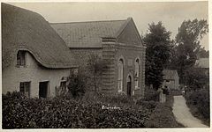 Chapel Hill, Blunsdon ca.1920 | |
 Blunsdon Location within Wiltshire | |
| Population | 12,414 (parish, 2011)[1] |
| OS grid reference | SU154902 |
| Civil parish |
|
| Unitary authority |
|
| Ceremonial county | |
| Region | |
| Country | England |
| Sovereign state | United Kingdom |
| Post town | Swindon |
| Postcode district | SN25, SN26 |
| Dialling code | 01793 |
| Police | Wiltshire |
| Fire | Dorset and Wiltshire |
| Ambulance | South Western |
| UK Parliament | |
| Website | Parish Council |
Blunsdon is a civil parish in the Borough of Swindon, England, about 4 miles (6 km) north of the centre of Swindon, with the A419 forming its southern boundary. Its main settlement is the village of Broad Blunsdon, with Lower Blunsdon nearby; the hamlet of Broadbush is now contiguous with Broad Blunsdon.
Blunsdon is the eastern half of the former Blunsdon St Andrew civil parish. In April 2017 the parish was divided, with the western half becoming parish.
History[]
Blunsdon dates from Roman times: it was discovered that a Roman travellers’ resting place existed on the site of the present-day Cold Harbour public house. The main A419 road follow the course of a Roman road known as Ermin Street that linked the historic Roman towns of Gloucester (Glevum) and Silchester (Calleva Atrebatum), via Cirencester (Corinium). In 1086 it appears in the Domesday Book as Bluntesdone.
Sport[]
Blunsdon's Abbey Stadium is the home of Swindon Greyhounds, broadcast world-wide three times per week and a stalwart of off course betting shops in the U.K. all the year round, plus speedway team the Swindon Robins. The Robins compete in the Elite League, with matches regularly televised live on Sky Sports. However, this was briefly under threat in 2006 due to plans by developers to demolish the stadium and replace it with houses with a proposal to build a smaller greyhound racing stadium elsewhere, but these were modified to a propose a new stadium on the existing site for both sports.
These plans were at first recommended for refusal by the Council Officers for various reasons, the developers agreed to take the plans away for adjustment and in May 2008 planning inspectors approved the new plans, which included 450 houses and office space.[2]
The village has a football team, Blunsdon FC, which has youth development squads as well as a senior men's side playing in the Wiltshire League.
Local government[]
Blunsdon parish covers Broad Blunsdon and the area west of the A419. In the southeast, the boundary with St Andrews leaves the A419 and follows the A4311 Cricklade Road, so that the Groundwell industrial estate is in Blunsdon parish.
Until April 2017, the whole area was the civil parish of Blunsdon St Andrew.[3][4] The parish lies within the Borough of Swindon.
Village shop[]
After the last privately owned shop in the village closed in 2002, a village public meeting convened and agreed to open a new community shop, which was opened in 2003.[5] Located in the car park of the village hall, the shop was originally based inside a secondhand site office cabin, but in 2009 this was replaced by a brand new structure. Run mainly by volunteers, in 2010 the shop won third place for 'Best Village Shop' at the Wiltshire Life Magazine Awards [6]
Transport[]
The Swindon and Cricklade Railway has rebuilt Blunsdon railway station, just outside the parish boundary.
A419 bypass[]
A bypass was built between the autumn of 2006 and spring 2009. This has reunited Broad Blunsdon village with the portion that was southwest of the former A419.
References[]
| Wikimedia Commons has media related to Blunsdon. |
- ^ "Wiltshire Community History - Census". Wiltshire Council. Archived from the original on 4 March 2016. Retrieved 24 October 2015.
- ^ "New Swindon speedway stadium moves ahead". Gazette & Herald. 12 May 2008. Retrieved 28 May 2008.
- ^ "Community governance review - next steps". www.swindon.gov.uk. Swindon Borough Council. March 2017. Archived from the original on 22 February 2017. Retrieved 13 April 2017.
- ^ "The Swindon Borough (Reorganisation of Community Governance) No. 1 Order 2017" (PDF). Local Government Boundary Commission for England. 19 January 2017. p. 4. Archived from the original (PDF) on 6 April 2017. Retrieved 13 April 2017.
- ^ "Archived copy". Archived from the original on 29 April 2012. Retrieved 16 March 2013.
{{cite web}}: CS1 maint: archived copy as title (link) - ^ "Archived copy" (PDF). Archived from the original (PDF) on 11 June 2014. Retrieved 16 March 2013.
{{cite web}}: CS1 maint: archived copy as title (link)
- Civil parishes in Wiltshire
- Borough of Swindon