Boleboř
Boleboř | |
|---|---|
Municipality | |
 | |
 Flag  Coat of arms | |
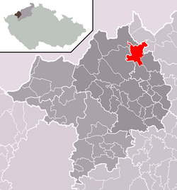 Location in Chomutov District | |
 Boleboř Location in the Czech Republic | |
| Coordinates: 50°32′15″N 13°24′51″E / 50.53750°N 13.41417°ECoordinates: 50°32′15″N 13°24′51″E / 50.53750°N 13.41417°E | |
| Country | |
| Region | Ústí nad Labem |
| District | Chomutov |
| Area | |
| • Total | 20.05 km2 (7.74 sq mi) |
| Elevation | 620 m (2,030 ft) |
| Population (2006) | |
| • Total | 209 |
| • Density | 10/km2 (27/sq mi) |
| Postal code | 431 21 |
| Website | http://www.bolebor.cz |

Boleboř (German: Göttersdorf) is a village and municipality (obec) in Chomutov District in the Ústí nad Labem Region of the Czech Republic.
The municipality covers an area of 20.05 square kilometres (7.74 sq mi), and has a population of 209 (as at 28 August 2006).
Boleboř lies approximately 8 kilometres (5 mi) north of Chomutov, 47 km (29 mi) west of Ústí nad Labem, and 88 km (55 mi) north-west of Prague.
Gallery[]

Protected homestead

Cemetery


References[]
| Wikimedia Commons has media related to Boleboř. |
| Authority control: National libraries |
|---|
This Ústí nad Labem Region location article is a stub. You can help Wikipedia by . |
Categories:
- Villages in Chomutov District
- Villages in the Ore Mountains
- Ústí nad Labem Region geography stubs