Boni station
This article does not cite any sources. (February 2021) |
Boni | |||||||||||
|---|---|---|---|---|---|---|---|---|---|---|---|
 | |||||||||||
| Location | Epifanio de los Santos Avenue cor. Boni Avenue and Pioneer Street, Barangka Ilaya & Malamig Mandaluyong, Metro Manila | ||||||||||
| Owned by | Metro Rail Transit Corporation | ||||||||||
| Operated by | Department of Transportation | ||||||||||
| Line(s) | Line 3 | ||||||||||
| Platforms | Island platform | ||||||||||
| Tracks | 2 | ||||||||||
| Connections | Jeepneys, buses, taxis, and tricycles | ||||||||||
| Construction | |||||||||||
| Structure type | At-grade | ||||||||||
| Parking | Yes (SM Light Residences & Pioneer Woodlands Condominium) | ||||||||||
| Disabled access | Concourse: Northeast entrance Platforms: All platforms | ||||||||||
| Other information | |||||||||||
| Station code | BA | ||||||||||
| History | |||||||||||
| Opened | December 15, 1999 | ||||||||||
| Services | |||||||||||
| |||||||||||
| Location | |||||||||||
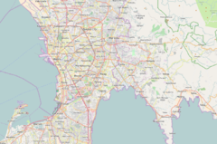 Boni Location within Metro Manila | |||||||||||
Boni station, also called Boni Avenue station, is a station on the Manila Metro Rail Transit System Line 3. It is the eighth station for trains headed to Taft Avenue and the sixth station for trains headed to North Avenue. It has several restaurants and shops that surround the station, including a public market located across the train station.
Nearby landmarks[]
The station serves Mandaluyong and the new Pioneer District. Its nearest landmarks include Forum Robinsons, Go Hotel, and Robinsons Cybergate; Victor Potenciano Medical Center; GA Twin Towers; SM Light Residences; TV5 Media Center (inside Reliance Street); Pioneer Woodlands; and Paragon Plaza Building. It is also located near the national headquarters of the Philippine Red Cross, former headquarters of Globe Telecom on Pioneer Street and Rizal Technological University on Boni Avenue.
Transportation links[]
Jeepneys, buses, taxis, and tricycles are available outside the station, particularly at EDSA and as well as Pioneer and Pinatubo streets. A major jeepney terminal is located in the area, at Metromart Market, and jeepneys leaving from the terminal head for western Mandaluyong, Pasig, and Manila (Stop and Shop in the vicinity of Santa Mesa). A major tricycle terminal is also found nearby, serving destinations in Mandaluyong. Its proximity to Rizal Technological University and other colleges in the area makes the station a popular stop for students.
See also[]
- List of rail transit stations in Metro Manila
- Manila Metro Rail Transit System Line 3
| Wikimedia Commons has media related to Boni station. |
Coordinates: 14°34′25.55″N 121°02′53.4″E / 14.5737639°N 121.048167°E
- Manila Metro Rail Transit System stations
- Railway stations opened in 1999
- Buildings and structures in Mandaluyong
- 1999 establishments in the Philippines