Booneville, Arkansas
Booneville, Arkansas | |
|---|---|
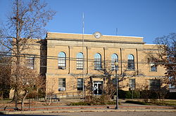 Logan County Courthouse, Southern District in downtown Booneville | |
 Location of Booneville in Logan County, Arkansas. | |
| Coordinates: 35°8′23″N 93°55′17″W / 35.13972°N 93.92139°WCoordinates: 35°8′23″N 93°55′17″W / 35.13972°N 93.92139°W | |
| Country | United States |
| State | Arkansas |
| County | Logan |
| Established | 1828 |
| Incorporated | 1878, 1899 |
| Area | |
| • Total | 3.99 sq mi (10.32 km2) |
| • Land | 3.97 sq mi (10.28 km2) |
| • Water | 0.02 sq mi (0.05 km2) |
| Elevation | 502 ft (153 m) |
| Population (2010) | |
| • Total | 3,990 |
| • Estimate (2019)[1] | 3,785 |
| • Density | 953.88/sq mi (368.31/km2) |
| Time zone | UTC−06:00 (Central (CST)) |
| • Summer (DST) | UTC−05:00 (CDT) |
| ZIP Code | 72927 |
| Area code(s) | 479 |
| FIPS code | 05-07720 |
| GNIS feature ID | 0062143 |

Booneville is a city in Logan County, Arkansas, United States and the county seat of its southern district.[3] Located in the Arkansas River Valley between the Ouachita and Ozark Mountains, the city is one of the oldest in western Arkansas. The city's economy was first based upon the railroad and Arkansas State Tuberculosis Sanatorium. It has developed a diverse economy of small businesses and light industry. Booneville's population was 3,990 at the 2010 census.
Booneville supports a community center, a senior-citizens center, a community hospital, a municipal airport, and new school facilities. Hunting, fishing, camping, hiking, and other outdoors activities are readily available in nearby national forests and state parks.
History[]

Naming[]
The city was founded in 1828 when Walter Cauthron, an early explorer of the Arkansas Territory, built a log cabin and store along the Petit Jean River. By some accounts, he intended to name the community as "Bonneville" for friend Benjamin Bonneville, but the spelling and name were later changed. Another theory is that the name was to honor Daniel Boone, a friend of the Logan family for whom the county is named.[4]
State Tuberculosis Sanatorium[]

The Arkansas State Tuberculosis Sanatorium was established in 1909 about 3 miles (5 km) south of Booneville. It became the center of treatment for any resident of Arkansas suffering from tuberculosis. By the time the facility was closed in 1973, it had treated over 70,000 patients.
The main hospital was completed in 1941. It was named the Nyberg Building after , a former sanatorium patient and Arkansas state legislator, who sponsored the bill funding the hospital's construction. In its day, the facility became known worldwide as one of the most successful and modern hospitals for the treatment of tuberculosis.
The sanatorium complex was self-sustaining. It included dormitories, staff entertainment buildings, a chapel, laundry, dairy, water-treatment plant, independent telephone system, and even a fire department. At the height of its use, the complex employed nearly 300 staff members. At one point, the total population of the center was greater than that of Booneville, in the valley below.
With the introduction of more effective drug therapy, the patient population began to decline. Eventually, the sanatorium was closed in 1973. The campus is now used as the Booneville Human Development Center. This is a state-run residential program for adults with mild and moderate intellectual and other developmental disabilities.
2008 explosion of meat-packing plant[]
On March 23, 2008, Easter Sunday, a series of explosions destroyed the Cargill Meat Solutions plant. Employing about 800 people, it was the town's largest employer. The plant exploded when 88,000 pounds of anhydrous ammonia reacted with 100,000 pounds of carbon dioxide, ignited by sparks from a welder. At least 1,000 of Booneville's roughly 4,000 residents had to be evacuated, and nearly 800 people were suddenly unemployed.
Because of the disaster and loss of jobs, the town's population drastically declined. The community suffered what many people began calling the "small-town recession". On May 2, 2008, Cargill announced that the plant would not be rebuilt.[5]
Geography[]
Booneville is located at 35°8′23″N 93°55′17″W / 35.13972°N 93.92139°W (35.139650, -93.921272).[6] According to the United States Census Bureau, the city has a total area of 4.1 square miles (11 km2), all land.
Booneville is near Blue Mountain Lake, a lake popular for fishing, boating, and swimming. Five United States Army Corps of Engineers recreation areas are available for public lake access. At the east end of the lake, the Blue Mountain Wildlife Demonstration Area is a world-class bird-dog field area. This area also hosts visitors interested in hiking, birding, and mountain bike riding.
Climate[]
| hideClimate data for Booneville, Arkansas (1991–2020 normals, extremes 1915–present) | |||||||||||||
|---|---|---|---|---|---|---|---|---|---|---|---|---|---|
| Month | Jan | Feb | Mar | Apr | May | Jun | Jul | Aug | Sep | Oct | Nov | Dec | Year |
| Record high °F (°C) | 84 (29) |
87 (31) |
94 (34) |
96 (36) |
99 (37) |
111 (44) |
114 (46) |
118 (48) |
112 (44) |
100 (38) |
89 (32) |
83 (28) |
118 (48) |
| Average high °F (°C) | 50.0 (10.0) |
55.2 (12.9) |
63.5 (17.5) |
72.5 (22.5) |
79.5 (26.4) |
87.2 (30.7) |
92.1 (33.4) |
91.9 (33.3) |
84.8 (29.3) |
74.5 (23.6) |
62.2 (16.8) |
52.4 (11.3) |
72.1 (22.3) |
| Daily mean °F (°C) | 39.0 (3.9) |
43.1 (6.2) |
51.0 (10.6) |
59.8 (15.4) |
68.6 (20.3) |
76.6 (24.8) |
81.0 (27.2) |
80.1 (26.7) |
73.0 (22.8) |
62.0 (16.7) |
50.2 (10.1) |
41.5 (5.3) |
60.5 (15.8) |
| Average low °F (°C) | 28.0 (−2.2) |
31.1 (−0.5) |
38.5 (3.6) |
47.2 (8.4) |
57.7 (14.3) |
65.9 (18.8) |
69.9 (21.1) |
68.4 (20.2) |
61.3 (16.3) |
49.5 (9.7) |
38.1 (3.4) |
30.7 (−0.7) |
48.9 (9.4) |
| Record low °F (°C) | −18 (−28) |
−6 (−21) |
5 (−15) |
22 (−6) |
30 (−1) |
45 (7) |
49 (9) |
41 (5) |
32 (0) |
18 (−8) |
8 (−13) |
−9 (−23) |
−18 (−28) |
| Average precipitation inches (mm) | 3.75 (95) |
3.20 (81) |
4.78 (121) |
5.04 (128) |
5.82 (148) |
4.24 (108) |
3.56 (90) |
3.49 (89) |
4.39 (112) |
4.40 (112) |
4.62 (117) |
4.35 (110) |
51.64 (1,312) |
| Average precipitation days (≥ 0.01 in) | 7.6 | 7.6 | 9.5 | 8.7 | 10.4 | 8.0 | 8.1 | 7.0 | 7.2 | 7.9 | 8.0 | 7.9 | 97.9 |
| Source: NOAA[7][8] | |||||||||||||
Demographics[]
| Historical population | |||
|---|---|---|---|
| Census | Pop. | %± | |
| 1880 | 275 | — | |
| 1890 | 496 | 80.4% | |
| 1900 | 988 | 99.2% | |
| 1910 | 1,631 | 65.1% | |
| 1920 | 2,199 | 34.8% | |
| 1930 | 2,099 | −4.5% | |
| 1940 | 2,324 | 10.7% | |
| 1950 | 2,433 | 4.7% | |
| 1960 | 2,690 | 10.6% | |
| 1970 | 3,239 | 20.4% | |
| 1980 | 3,718 | 14.8% | |
| 1990 | 3,804 | 2.3% | |
| 2000 | 4,117 | 8.2% | |
| 2010 | 3,990 | −3.1% | |
| 2019 (est.) | 3,785 | [1] | −5.1% |
| U.S. Decennial Census[9] 2014 Estimate[10] | |||
As of the census[11] of 2000, 4,117 people, 1,619 households, and 1,109 families were residing in the city. The population density was 1,010.0 people per square mile (389.6/km2). The 1,863 housing units averaged 457.0 per square mile (176.3/km2). The racial makeup of the city was 96.62% White, 0.05% African American, 1.12% Native American, 0.27% Asian, 0.05% Pacific Islander, 0.17% from other races, and 1.72% from two or more races. About 0.87% of the population was Hispanic or Latino of any race.
Of the 1,619 households, 34.8% had children under the age of 18 living with them, 51.3% were married couples living together, 13.3% had a female householder with no husband present, and 31.5% were not families. About 28.5% of all households were made up of individuals, and 16.2% had someone living alone who was 65 years of age or older. The average household size was 2.48, and the average family size was 3.01.
In the city, the population was distributed as 28.0% under the age of 18, 8.1% from 18 to 24, 26.4% from 25 to 44, 20.0% from 45 to 64, and 17.5% who were 65 years of age or older. The median age was 36 years. For every 100 females, there were 88.9 males. For every 100 females age 18 and over, there were 82.1 males.
The median income for a household in the city was $26,627, and for a family was $31,012. Males had a median income of $25,238 versus $20,092 for females. The per capita income for the city was $13,076. About 13.1% of families and 18.4% of the population were below the poverty line, including 22.0% of those under age 18 and 23.9% of those age 65 or over.
Education[]

From its early days, Booneville has supported education. In 1874, as a response to needs for higher learning in western Arkansas, the Fort Smith District of the Methodist Episcopal Church, South, authorized the establishment of the Fort Smith District High School in Booneville, 40 miles to the west. Local church members donated the land, building materials, and labor. The school, located on South College Street, was to be supported by student tuition fees. Students came from towns all over western Arkansas to board with Booneville families and attend a school that offered an advanced curriculum, including Latin, German, advanced mathematics, literature, and music. The school functioned until the early 1900s.
After the school closed, a group of residents and business leaders formed the Booneville Education Association and acquired 9 acres (36,000 m2) of land in the northwest part of town. The new school was called the Booneville Co-Educational Institute and also offered a more advanced curriculum than the public school around. Graduates were admitted as sophomores at the University of Arkansas at Fayetteville. In 1920, state funds were made available for the support of public high schools and the school's property was transferred to the Booneville School District. The building continued to be used as the city's high school until a new building was built in 1929. The old Co-Educational Institute building was used as the Booneville elementary school for several decades after that.[12]
Infrastructure[]
Transportation[]

The city is located at the intersection of Highway 23 (commonly known as the "Pig Trail") and Highway 10. Both routes are designated as Arkansas Scenic Byways near Booneville. also runs north and south from the city.
Rights-of-way for downtown city streets dedicated during the original town plat are wider than in most communities.
Water/wastewater[]
The city of Booneville owns the Booneville Water Department, which treats and distributes potable water from Lake Booneville to the residents and commercial users of the city in accordance with Arkansas Department of Health regulations.[13]
The Booneville Water Department also collects and treats wastewater in accordance with a Clean Water Act National Pollutant Discharge Elimination System permit issued and administrated by the Arkansas Department of Environmental Quality.[14] Treated effluent is discharged to Booneville Creek, ultimately draining to the Arkansas River.[14]
Notable people[]
- Dizzy and Daffy Dean, Major League Baseball (MLB) players and brothers, were born in the small community of Lucas, 14 miles (23 km) west of Booneville.
- Kimberly Foster, television and movie actor, is best known for her role as Michelle Stevens in the later seasons of the primetime soap opera Dallas.
- Elizabeth Ward Gracen was Miss America 1982 and an actress on Highlander: The Series.
- Tom Greenway was a character actor in numerous TV series of 1950s and '60s such as Gunsmoke, Bonanza, Dragnet, and Perry Mason.
- John P. McConnell was chief of staff of the United States Air Force from February 1, 1965, to July 31, 1969.
- Floyd Speer, pitcher for the Chicago White Sox, played MLB from April 25, 1943, to May 3, 1944. He is buried in the Carolan Community Cemetery.
- Aaron Lee Ward, former Baseball player and member of the New York Yankees first World Series championship team 1923
- Paul X. Williams, a federal judge for the Western District of Arkansas, was appointed by President Lyndon B. Johnson.
- Alex Taylor, a YouTube creator,[15] automotive-performance and drag-racing enthusiast[16]
See also[]
 United States portal
References[]
- ^ Jump up to: a b "Population and Housing Unit Estimates". United States Census Bureau. May 24, 2020. Retrieved May 27, 2020.
- ^ "2019 U.S. Gazetteer Files". United States Census Bureau. Retrieved June 30, 2020.
- ^ "Find a County". National Association of Counties. Archived from the original on 2011-05-31. Retrieved 2011-06-07.
- ^ Curry, Patricia L. (October 24, 2011). "Booneville (Logan County)". Encyclopedia of Arkansas History and Culture. Butler Center for Arkansas Studies at the Central Arkansas Library System. Retrieved March 14, 2015.
- ^ Cargill Meat Solutions: Cargill will not rebuild in Booneville, Ark.
- ^ "US Gazetteer files: 2010, 2000, and 1990". United States Census Bureau. 2011-02-12. Retrieved 2011-04-23.
- ^ "NowData – NOAA Online Weather Data". National Oceanic and Atmospheric Administration. Retrieved June 20, 2021.
- ^ "Station: Booneville 3 SSE, AR". U.S. Climate Normals 2020: U.S. Monthly Climate Normals (1991-2020). National Oceanic and Atmospheric Administration. Retrieved June 20, 2021.
- ^ "Census of Population and Housing". Census.gov. Retrieved June 4, 2015.
- ^ "Annual Estimates of the Resident Population for Incorporated Places: April 1, 2010 to July 1, 2014". Archived from the original on May 22, 2015. Retrieved June 4, 2015.
- ^ "U.S. Census website". United States Census Bureau. Retrieved 2008-01-31.
- ^ Booneville Democrat, Special Edition, June 30, 1999, Pg. 13
- ^ "Booneville Water Department" (PDF). Annual Drinking Water Quality Report. ADH. 2013. Retrieved March 14, 2015.[permanent dead link]
- ^ Jump up to: a b "Authorization to Discharge Wastewater Under the National Pollutant Discharge Elimination System and the Arkansas Water and Air Pollution Control Act". NPDES Permit AR-0021571. ADEQ. April 23, 2013. Missing or empty
|url=(help) - ^ "YouTube: Riding With Alex Taylor". 2021. Retrieved March 17, 2021.
- ^ "Alex Taylor Racing". 2021. Retrieved March 17, 2021.
External links[]
- Arkansas State Tuberculosis Sanatorium Historic Site
- Booneville Democrat -- Local Weekly Newspaper (On-Line Version)
- "Every Day Was Tuesday" The Arkansas TB Sanatorium
| show Municipalities and communities of Logan County, Arkansas, United States |
|---|

| show Authority control |
|---|
- Booneville, Arkansas
- Cities in Arkansas
- Cities in Logan County, Arkansas
- County seats in Arkansas
- Populated places established in 1878
- Populated places established in 1899
- 1828 establishments in Arkansas Territory